STS044-79-59
| NASA Photo ID | STS044-79-59 |
| Focal Length | 100mm |
| Date taken | 1991.11.26 |
| Time taken | 07:29:05 GMT |
Resolutions offered for this image:
5700 x 6000 pixels 500 x 526 pixels 640 x 480 pixels 4580 x 4511 pixels
5700 x 6000 pixels 500 x 526 pixels 640 x 480 pixels 4580 x 4511 pixels


Cloud masks available for this image:
Spacecraft nadir point: 10.8° S, 44.2° E
Photo center point: 12.0° S, 40.5° E
Photo center point by machine learning:
Photo center point: 12.0° S, 40.5° E
Photo center point by machine learning:
Nadir to Photo Center: West
Spacecraft Altitude: 196 nautical miles (363km)
Country or Geographic Name: | MOZAMBIQUE |
Features: | PORTO AMELIA |
| Features Found Using Machine Learning: | |
Cloud Cover Percentage: | 40 (26-50)% |
Sun Elevation Angle: | 70° |
Sun Azimuth: | 174° |
Camera: | Hasselblad |
Focal Length: | 100mm |
Camera Tilt: | 50 degrees |
Format: | VELVI: Fuji, natural color positive, Velvia 50, CS 135-36, ASA 32, standard base |
Film Exposure: | Normal |
| Additional Information | |
| Width | Height | Annotated | Cropped | Purpose | Links |
|---|---|---|---|---|---|
| 5700 pixels | 6000 pixels | No | No | Download Image | |
| 500 pixels | 526 pixels | No | No | Download Image | |
| 640 pixels | 480 pixels | No | No | Download Image | |
| 4580 pixels | 4511 pixels | ReefBase pilot | Download Image |
Download Packaged File
Download a Google Earth KML for this Image
View photo footprint information
Download a GeoTIFF for this photo
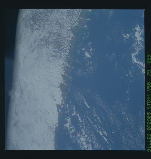
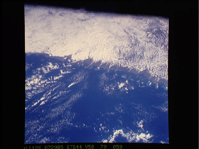
Image Caption: This rare depiction of the physical interactions of air land and sea in cloud formation was seen over Mozambique (12.0S, 40.5E). Moist low air, heated as it moves over land, rises and forms clouds. Even the coastal islands have enough heat to initiate the process. Once begun, the circulation is dynamic and the descending motion suppresses cloud formation on either side of the cloud stream. As clouds move inland, they rise to follow the land upslope.
