STS043-84-31
| NASA Photo ID | STS043-84-31 |
| Focal Length | 250mm |
| Date taken | 1991.08.07 |
| Time taken | 12:57:42 GMT |
Resolutions offered for this image:
5320 x 5266 pixels 640 x 633 pixels 4396 x 4600 pixels 500 x 523 pixels 640 x 480 pixels
5320 x 5266 pixels 640 x 633 pixels 4396 x 4600 pixels 500 x 523 pixels 640 x 480 pixels


Cloud masks available for this image:
Spacecraft nadir point: 28.3° N, 79.3° W
Photo center point: 28.5° N, 80.5° W
Photo center point by machine learning:
Photo center point: 28.5° N, 80.5° W
Photo center point by machine learning:
Nadir to Photo Center: West
Spacecraft Altitude: 177 nautical miles (328km)
Country or Geographic Name: | USA-FLORIDA |
Features: | CAPE CANAVERAL |
| Features Found Using Machine Learning: | |
Cloud Cover Percentage: | 5 (1-10)% |
Sun Elevation Angle: | 28° |
Sun Azimuth: | 85° |
Camera: | Hasselblad |
Focal Length: | 250mm |
Camera Tilt: | 22 degrees |
Format: | 5017: Kodak, natural color positive, Ektachrome, X Professional, ASA 64, standard base |
Film Exposure: | Normal |
| Additional Information | |
| Width | Height | Annotated | Cropped | Purpose | Links |
|---|---|---|---|---|---|
| 5320 pixels | 5266 pixels | No | No | Earth From Space collection | Download Image |
| 640 pixels | 633 pixels | No | No | Earth From Space collection | Download Image |
| 4396 pixels | 4600 pixels | No | No | Download Image | |
| 500 pixels | 523 pixels | No | No | Download Image | |
| 640 pixels | 480 pixels | No | No | Download Image |
Download Packaged File
Download a Google Earth KML for this Image
View photo footprint information
Download a GeoTIFF for this photo
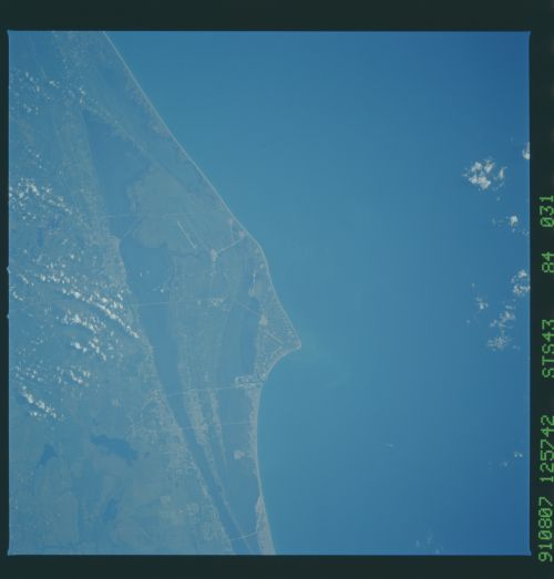
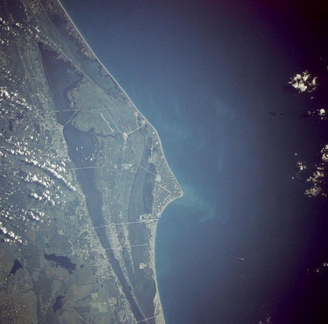
Image Caption: STS043-084-031 Cape Canaveral, Florida, U.S.A. August 1991
Cape Canaveral, Florida, and the NASA John F. Kennedy Space Center are shown is this near-vertical photograph. Numerous launch pads line the Atlantic Ocean coast near the center of the photograph. To the north of the multiple launch pads, the Space Shuttle landing runway, the Shuttle Assembly Area, and Shuttle Launch Pads A and B are visible. To the south of the multiple launch pads are Port Canaveral and the city of Cocoa Beach, Florida. To the west of the space complex, five causeways span the Indian and Banana Rivers. Interstate Highway 95 is the main artery traversing south to north just west of the Florida cities of Cocoa and Titusville.
Cape Canaveral, Florida, and the NASA John F. Kennedy Space Center are shown is this near-vertical photograph. Numerous launch pads line the Atlantic Ocean coast near the center of the photograph. To the north of the multiple launch pads, the Space Shuttle landing runway, the Shuttle Assembly Area, and Shuttle Launch Pads A and B are visible. To the south of the multiple launch pads are Port Canaveral and the city of Cocoa Beach, Florida. To the west of the space complex, five causeways span the Indian and Banana Rivers. Interstate Highway 95 is the main artery traversing south to north just west of the Florida cities of Cocoa and Titusville.
