STS043-84-27
| NASA Photo ID | STS043-84-27 |
| Focal Length | 250mm |
| Date taken | 1991.08.07 |
| Time taken | 12:57:28 GMT |
Resolutions offered for this image:
794 x 799 pixels 5285 x 5285 pixels 639 x 639 pixels 4396 x 4600 pixels 500 x 523 pixels 640 x 480 pixels 2590 x 2526 pixels
794 x 799 pixels 5285 x 5285 pixels 639 x 639 pixels 4396 x 4600 pixels 500 x 523 pixels 640 x 480 pixels 2590 x 2526 pixels

Cloud masks available for this image:
Spacecraft nadir point: 28.3° N, 80.3° W
Photo center point: 28.5° N, 81.0° W
Photo center point by machine learning:
Photo center point: 28.5° N, 81.0° W
Photo center point by machine learning:
Nadir to Photo Center: West
Spacecraft Altitude: 177 nautical miles (328km)
Country or Geographic Name: | USA-FLORIDA |
Features: | ORLANDO |
| Features Found Using Machine Learning: | |
Cloud Cover Percentage: | 10 (1-10)% |
Sun Elevation Angle: | 27° |
Sun Azimuth: | 85° |
Camera: | Hasselblad |
Focal Length: | 250mm |
Camera Tilt: | 14 degrees |
Format: | 5017: Kodak, natural color positive, Ektachrome, X Professional, ASA 64, standard base |
Film Exposure: | Normal |
| Additional Information | |
| Width | Height | Annotated | Cropped | Purpose | Links |
|---|---|---|---|---|---|
| 794 pixels | 799 pixels | No | No | Cities collection | Download Image |
| 5285 pixels | 5285 pixels | No | No | Earth From Space collection | Download Image |
| 639 pixels | 639 pixels | No | No | Earth From Space collection | Download Image |
| 4396 pixels | 4600 pixels | No | No | Download Image | |
| 500 pixels | 523 pixels | No | No | Download Image | |
| 640 pixels | 480 pixels | No | No | Download Image | |
| 2590 pixels | 2526 pixels | No | No | Download Image |
Download Packaged File
Download a Google Earth KML for this Image
View photo footprint information
Download a GeoTIFF for this photo
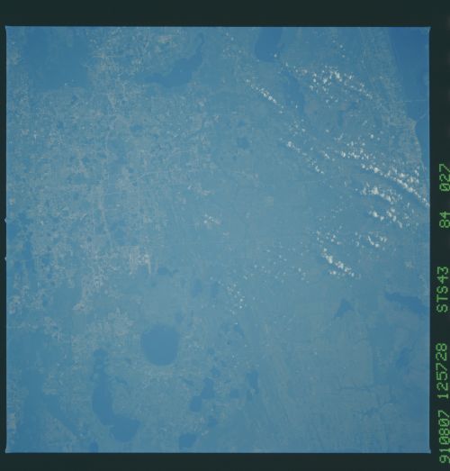
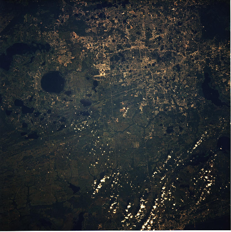
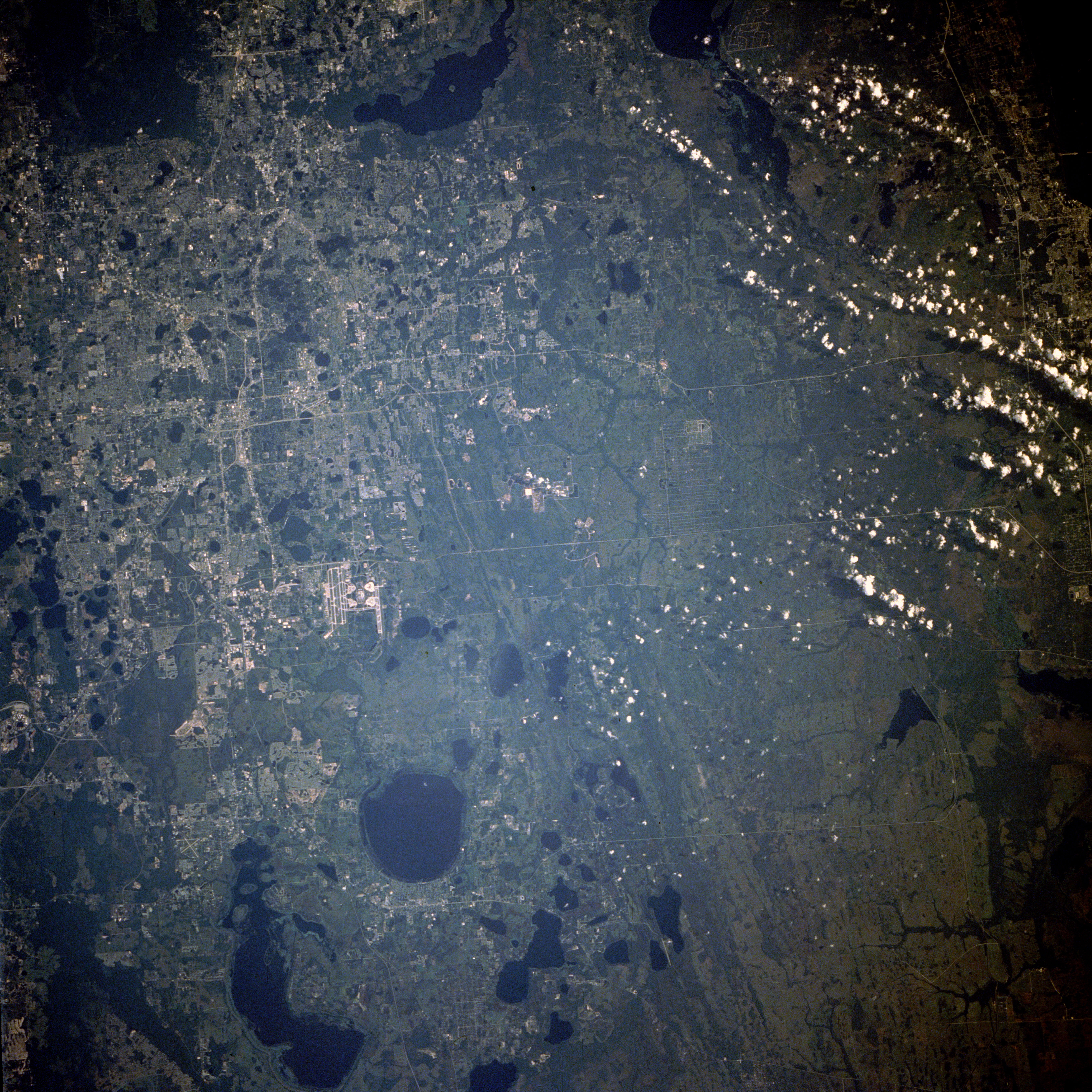
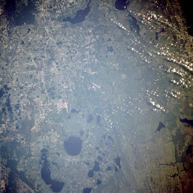
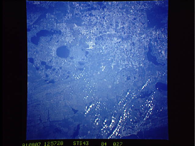
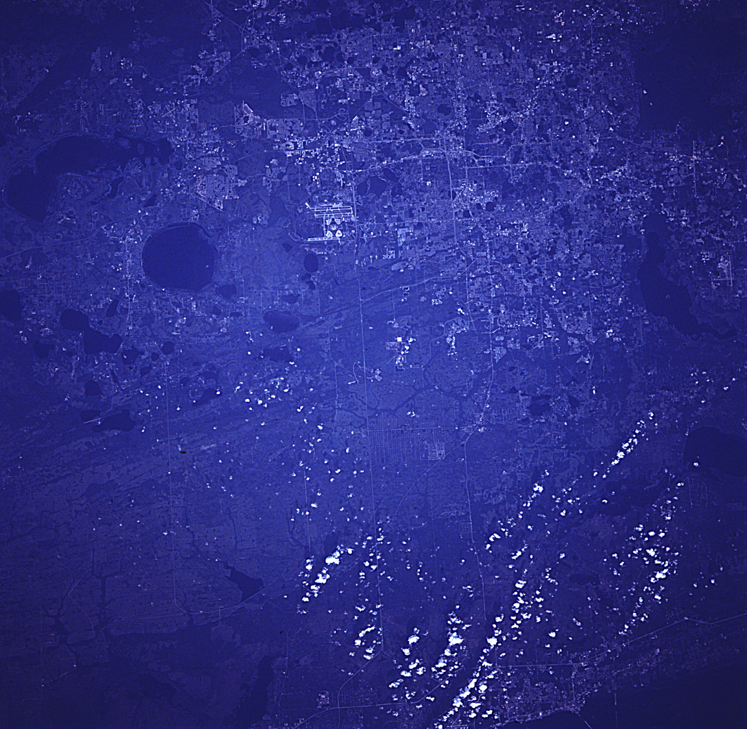
Image Caption: STS043-084-027 Orlando, Florida, U.S.A. August 1991
Orlando, with an estimated population of 200 000, is spread across the northwestern quadrant of this near-vertical photograph of east-central Florida. Numerous lakes--among them, East Lake Tohopekaliga, the circular feature south of the large airport, and elongated Lake Tohopekaliga to the southwest--were formed as chemical weathering eroded the underlying limestone rocks, causing sinkholes to develop. All of central Florida is characterized by this karst topography. The north-south-oriented streaks east of East Lake Tohopekaliga are ancient beach terraces that resulted from the gradual uplift of the Florida peninsula. Two parallel highways, State Highway 50 (northern) and State Highway 528 (also known as Bee Line Expressway), connect the Orlando area with the east coast of Florida. Barely discernible on the western edge of the photograph is the Disney World complex, almost equidistant between Orlando and Kissimmee, the city at the north end of Lake Tohopekaliga.
Orlando, with an estimated population of 200 000, is spread across the northwestern quadrant of this near-vertical photograph of east-central Florida. Numerous lakes--among them, East Lake Tohopekaliga, the circular feature south of the large airport, and elongated Lake Tohopekaliga to the southwest--were formed as chemical weathering eroded the underlying limestone rocks, causing sinkholes to develop. All of central Florida is characterized by this karst topography. The north-south-oriented streaks east of East Lake Tohopekaliga are ancient beach terraces that resulted from the gradual uplift of the Florida peninsula. Two parallel highways, State Highway 50 (northern) and State Highway 528 (also known as Bee Line Expressway), connect the Orlando area with the east coast of Florida. Barely discernible on the western edge of the photograph is the Disney World complex, almost equidistant between Orlando and Kissimmee, the city at the north end of Lake Tohopekaliga.
