STS043-79-97

| NASA Photo ID | STS043-79-97 |
| Focal Length | 250mm |
| Date taken | 1991.08.06 |
| Time taken | 08:11:37 GMT |
Resolutions offered for this image:
5266 x 5266 pixels 639 x 639 pixels 4396 x 4600 pixels 500 x 523 pixels 640 x 480 pixels
5266 x 5266 pixels 639 x 639 pixels 4396 x 4600 pixels 500 x 523 pixels 640 x 480 pixels

Cloud masks available for this image:
Spacecraft nadir point: 28.3° N, 14.8° W
Photo center point: 28.5° N, 16.5° W
Photo center point by machine learning:
Photo center point: 28.5° N, 16.5° W
Photo center point by machine learning:
Nadir to Photo Center: West
Spacecraft Altitude: 177 nautical miles (328km)
Camera: | Hasselblad |
Focal Length: | 250mm |
Camera Tilt: | 30 degrees |
Format: | 5017: Kodak, natural color positive, Ektachrome, X Professional, ASA 64, standard base |
Film Exposure: | Normal |
| Additional Information | |
| Width | Height | Annotated | Cropped | Purpose | Links |
|---|---|---|---|---|---|
| 5266 pixels | 5266 pixels | No | No | Earth From Space collection | Download Image |
| 639 pixels | 639 pixels | No | No | Earth From Space collection | Download Image |
| 4396 pixels | 4600 pixels | No | No | Download Image | |
| 500 pixels | 523 pixels | No | No | Download Image | |
| 640 pixels | 480 pixels | No | No | Download Image |
Download Packaged File
Download a Google Earth KML for this Image
View photo footprint information
Download a GeoTIFF for this photo
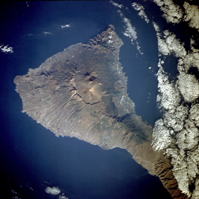
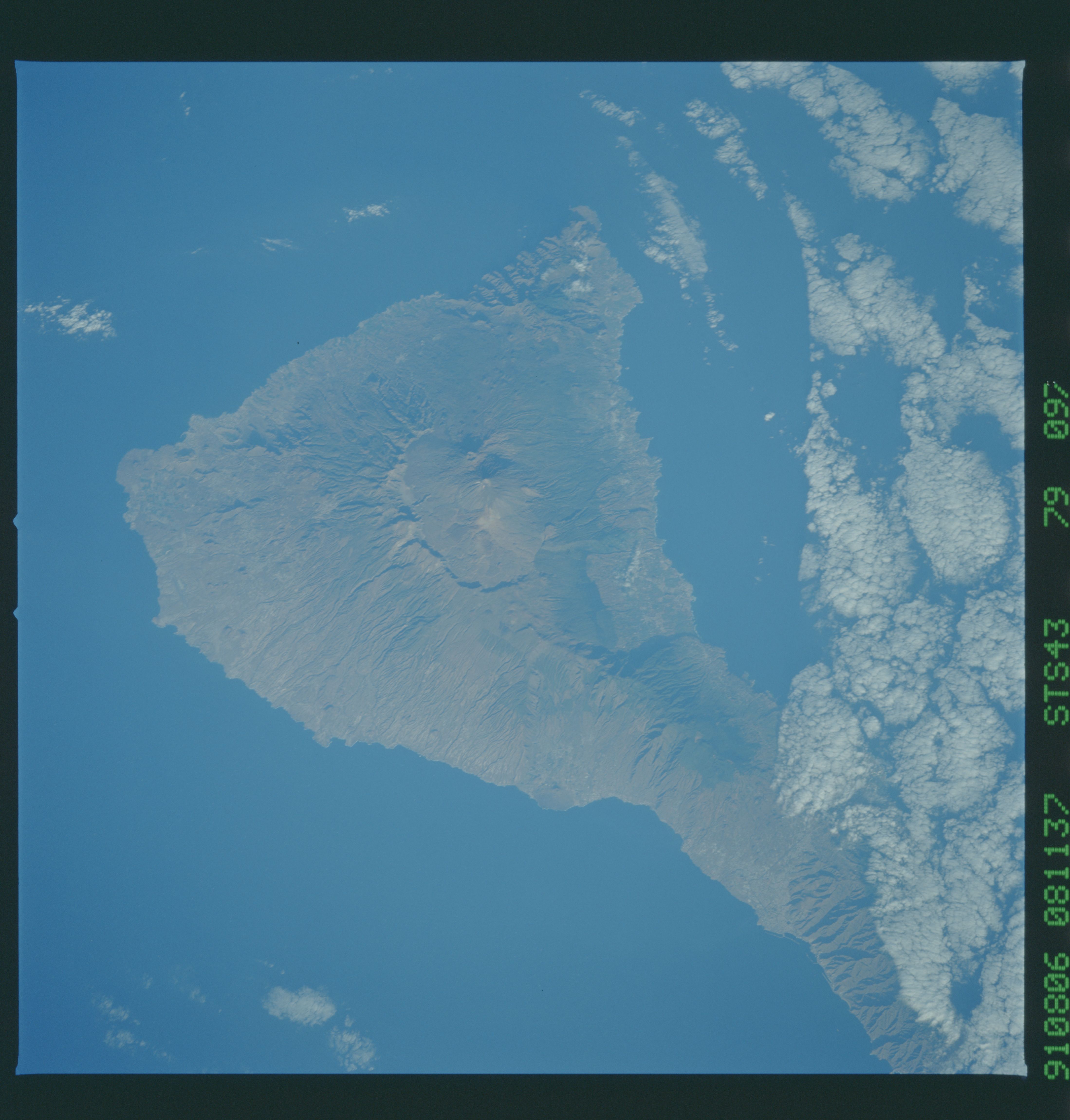
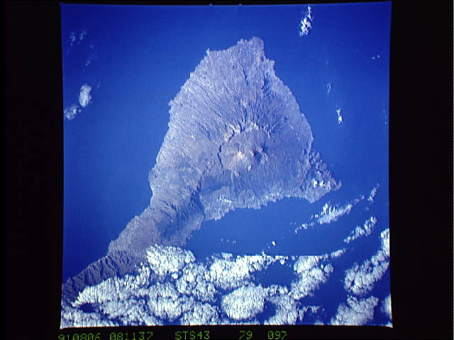
Image Caption: STS043-79-97 Tenerife Island, Canary Islands August 1991
Tenerife Island, the largest in the Canary Island archipelago, is approximately 50 miles (80 kilometers) long and 32 miles (54 kilometers) at its widest point. With Pico de Teide, its volcanic peak, rising 12 198 feet (3718 meters) above the sea, Tenerife has the distinction of having the highest elevation in the Atlantic Ocean. This near-vertical photograph of the entire island, except for the northeastern tip, showcases the prominent caldera, which measures approximately 10 miles (16 kilometers) by 7 miles (11 kilometers). Within the large caldera, young volcanic cones and small craters rise from the older volcano that was probably destroyed by a gigantic explosion millions of years ago. The classic radial erosion drainage pattern is obvious around the old volcanic cone. The island, with its precipitous coastline, has a mild and pleasant climate; however, it is subject to severe drought and occasional tornadoes. The fertile soils produce a variety of crops--date palms, grapes, fruits, sugarcane, grains, and cotton.
Tenarife Island is one of the most volcanically active of the Canary Island archipelago, Atlantic Ocean, just off the NW coast of Africa, (28.5N, 16.5W). The old central caldera, nearly filled in by successive volcanic activity culminating in two stratocones. From those two peaks, a line of smaller cinder cones extend to the point of the island. Extensive gullies dissect the west side of the island and some forests still remain on the east side.
