STS043-608-45
| NASA Photo ID | STS043-608-45 |
| Focal Length | 250mm |
| Date taken | 1991.08.__ |
| Time taken | GMT |
Resolutions offered for this image:
3961 x 4033 pixels 628 x 639 pixels 4396 x 4600 pixels 500 x 523 pixels 640 x 480 pixels 5222 x 5241 pixels 640 x 640 pixels
3961 x 4033 pixels 628 x 639 pixels 4396 x 4600 pixels 500 x 523 pixels 640 x 480 pixels 5222 x 5241 pixels 640 x 640 pixels

Cloud masks available for this image:
Spacecraft nadir point:
Photo center point: 26.5° N, 128.0° E
Photo center point by machine learning:
Photo center point: 26.5° N, 128.0° E
Photo center point by machine learning:
Nadir to Photo Center:
Spacecraft Altitude: nautical miles (0km)
Camera: | Rolleiflex |
Focal Length: | 250mm |
Camera Tilt: | Low Oblique |
Format: | 5017: Kodak, natural color positive, Ektachrome, X Professional, ASA 64, standard base |
Film Exposure: | Normal |
| Additional Information | |
| Width | Height | Annotated | Cropped | Purpose | Links |
|---|---|---|---|---|---|
| 3961 pixels | 4033 pixels | No | No | Earth From Space collection | Download Image |
| 628 pixels | 639 pixels | No | No | Earth From Space collection | Download Image |
| 4396 pixels | 4600 pixels | No | No | Download Image | |
| 500 pixels | 523 pixels | No | No | Download Image | |
| 640 pixels | 480 pixels | No | No | Download Image | |
| 5222 pixels | 5241 pixels | Reef RS | Download Image | ||
| 640 pixels | 640 pixels | ReefBase pilot | Download Image |
Download Packaged File
Download a Google Earth KML for this Image
View photo footprint information
Download a GeoTIFF for this photo
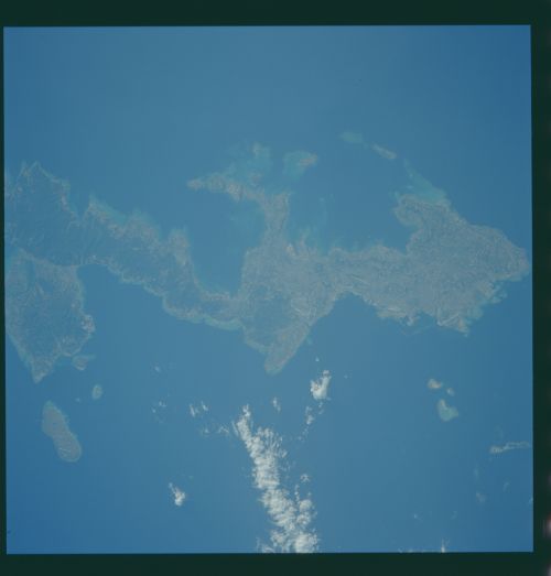
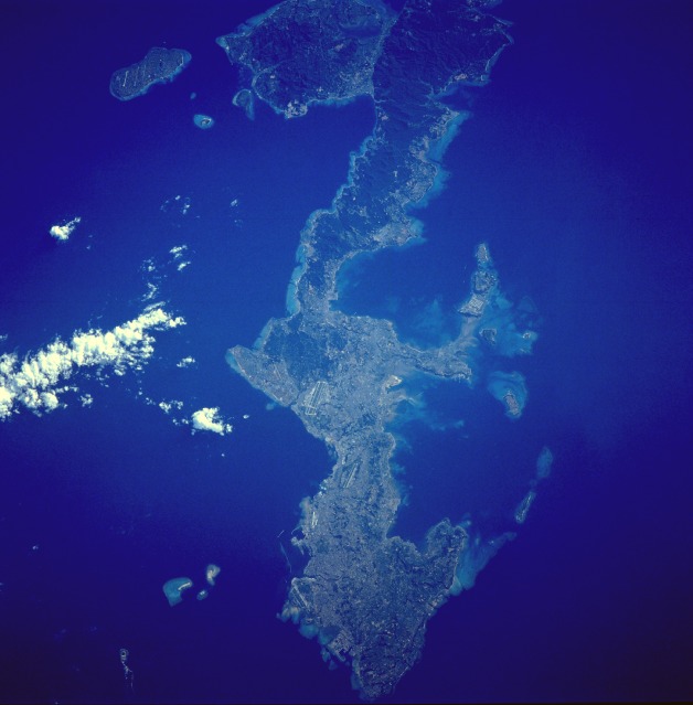
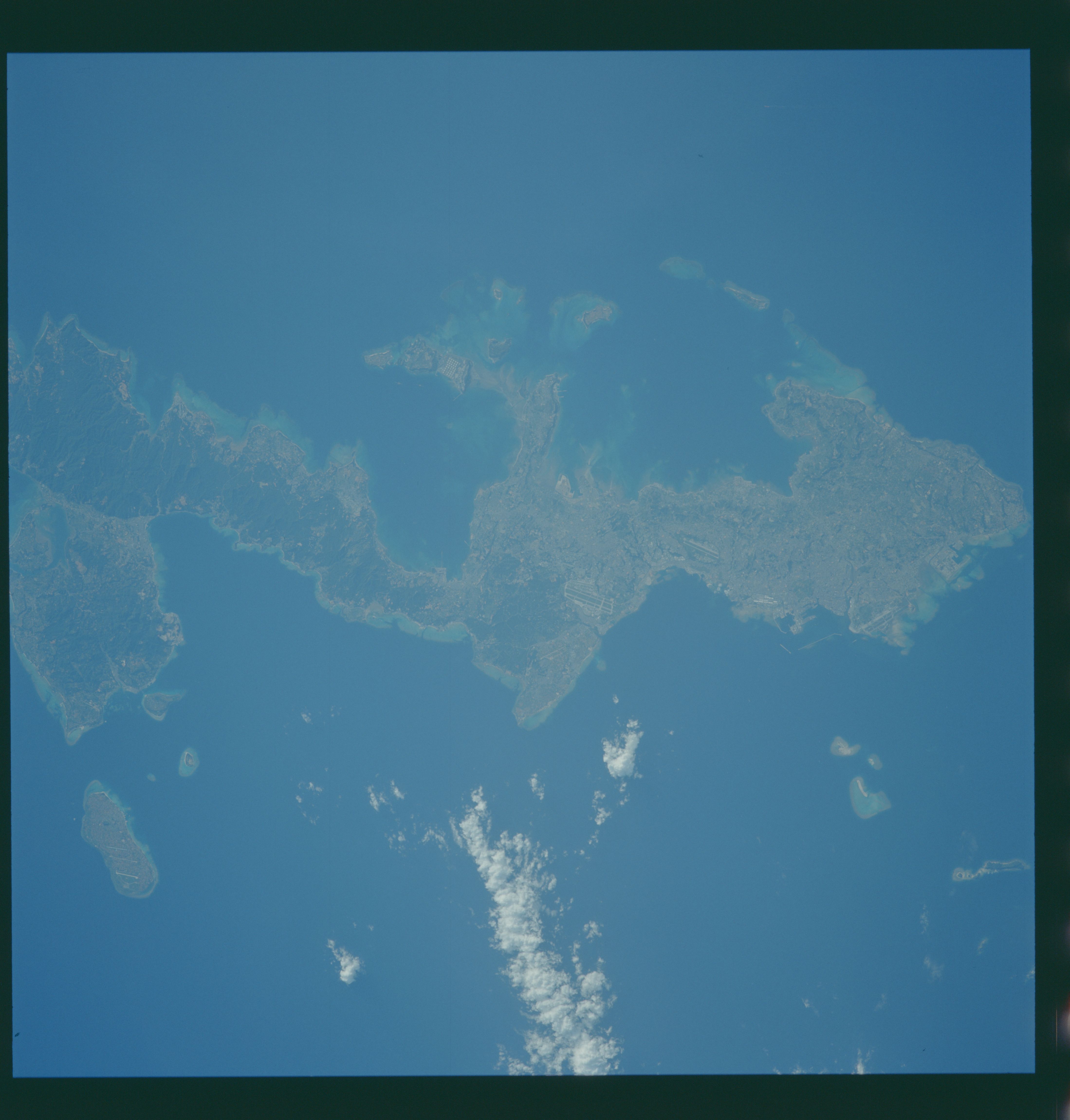
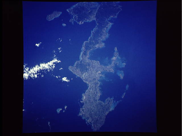
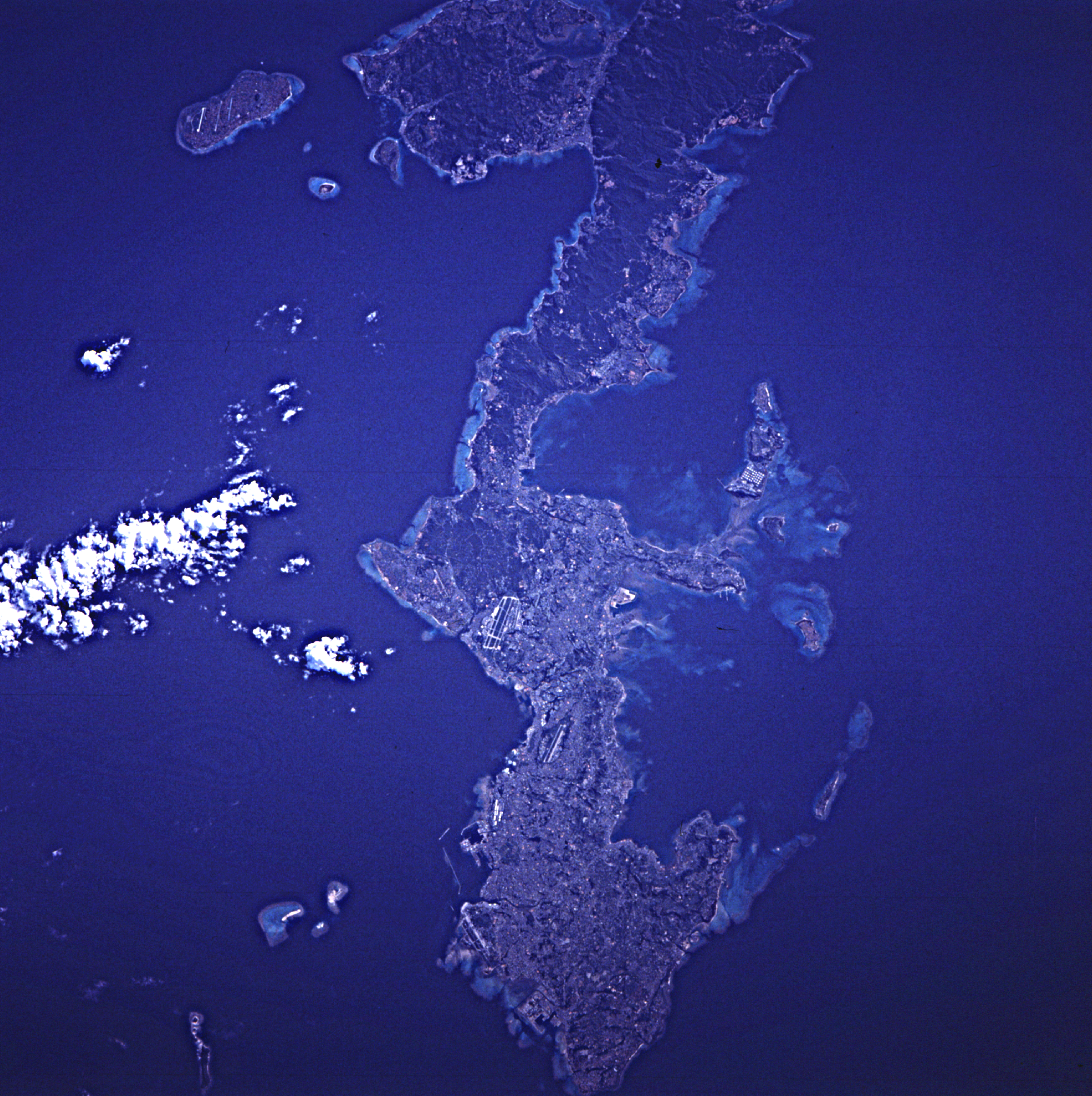
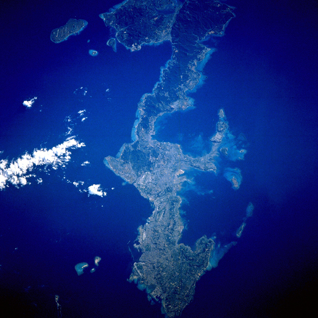
Image Caption: STS043-608-45 Okinawa, Ryukyu Islands August 1991
Okinawa, the largest of the Ryukyu Islands Archipelago, is visible in this near-vertical photograph. The long, narrow, irregular-shaped island of Okinawa, which is volcanic in origin, covers 454 square miles (1176 square kilometers). The southern half of the island is surrounded by coral formations; the northern half is mountainous, rising to 1657 feet (505 meters) above sea level, and is covered with dense vegetation (darker green). Most of the population and the agricultural areas, which produce sugarcane, sweet potatoes, and rice, exist in the southern half of the island. Fishing is also an important industry. The large U.S. military airfield at Kadena is discernible near the center of the photograph. Okinawa was the site of one of the bloodiest campaigns of World War II (March through June 1945). Under United States control since August 1945, the island was returned to Japanese control in May 1972. Negotiations in April 1996 called for some U.S. military installations to be closed and the land returned to the people of Okinawa; however, numerous U.S. military installations remain scattered throughout the island.
The southern half of the island of Okinawa, Japan (26.5N, 128.0E) can be seen in this nearly cloud free view. Okinawa is part of the Ryuku Islands which extend from Taiwan northeastward to Kyushu, southernmost of the Japanese Home Islands. The large military base at Kadena, with large runways, is visible near the center of the scene. Kadena is one of several emergency landing sites around the world for the space shuttle.
