STS042-92-68
| NASA Photo ID | STS042-92-68 |
| Focal Length | 250mm |
| Date taken | 1992.01.24 |
| Time taken | 04:39:17 GMT |
Cloud masks available for this image:
Spacecraft nadir point: 27.8° N, 64.4° E
Photo center point: 23.0° N, 68.0° E
Photo center point by machine learning:
Photo center point: 23.0° N, 68.0° E
Photo center point by machine learning:
Nadir to Photo Center: Southeast
Spacecraft Altitude: 164 nautical miles (304km)
Country or Geographic Name: | INDIA |
Features: | INDUS R. DELTA |
| Features Found Using Machine Learning: | |
Cloud Cover Percentage: | 40 (26-50)% |
Sun Elevation Angle: | 23° |
Sun Azimuth: | 129° |
Camera: | Hasselblad |
Focal Length: | 250mm |
Camera Tilt: | Low Oblique |
Format: | 2443: Kodak Aerochrome 2443, color IR, thin base, EA-5 process thru June 1999, E-6 process afterward |
Film Exposure: | Normal |
| Additional Information | |
| Width | Height | Annotated | Cropped | Purpose | Links |
|---|---|---|---|---|---|
| 5700 pixels | 6000 pixels | No | No | Download Image | |
| 500 pixels | 526 pixels | No | No | Download Image | |
| 640 pixels | 480 pixels | No | No | Download Image |
Download Packaged File
Download a Google Earth KML for this Image
View photo footprint information
Download a GeoTIFF for this photo
Image Caption:
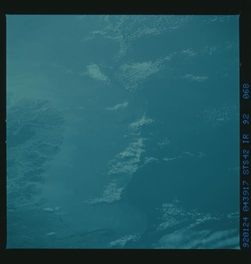
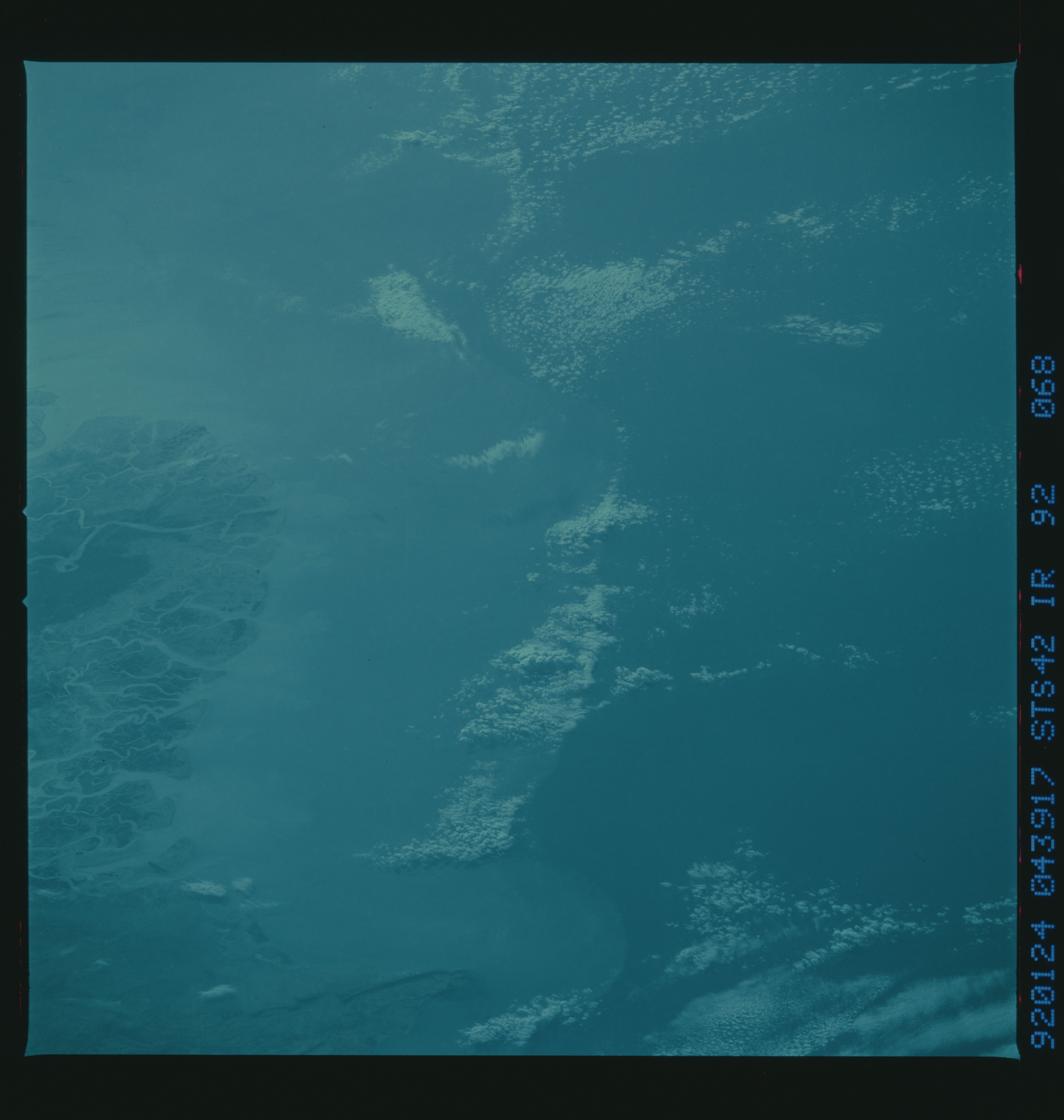
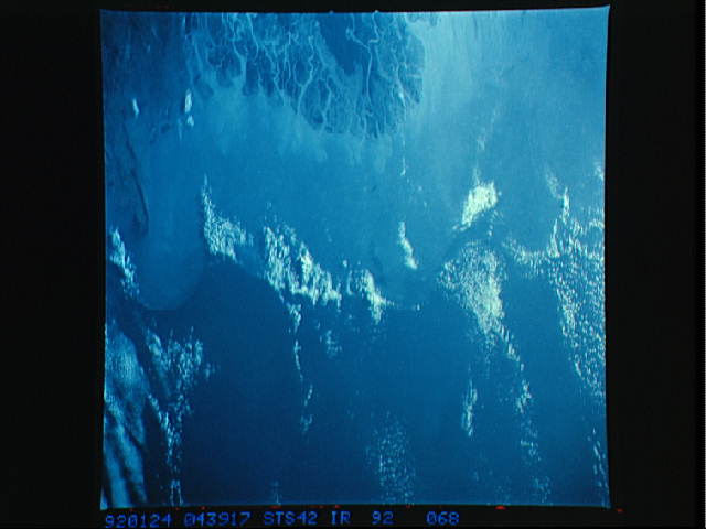
STS042-92-068 (CIR) Indus River Delta (24.0! N, 68.0! E)
This oblique view of coastal water turbidity adjacent to
the Indus River Delta and surrounding wetlands was photographed
on 24 January at 04:39 GMT using a Hasselblad camera equipped
with color infrared transparency film and a 250 mm lens.JJThe
view is identical to STS042-81-003, photographed with natural
color film. Much of the atmospheric haze appears to have been
eliminated, resulting in greater discrimination between land and
water. Variability in water tone, indicating changes in suspend-
ed sediment concentration, is more evident than in the natural
color photograph. Variations in water color, on the other hand,
are suppressed in comparison with the natural color photograph,
since blue light is filtered out.
