STS042-75-67
| NASA Photo ID | STS042-75-67 |
| Focal Length | 100mm |
| Date taken | 1992.01.26 |
| Time taken | 14:03:13 GMT |

Cloud masks available for this image:
Spacecraft nadir point: 47.8° N, 64.5° W
Photo center point: 48.0° N, 65.5° W
Photo center point by machine learning:
Photo center point: 48.0° N, 65.5° W
Photo center point by machine learning:
Nadir to Photo Center: West
Spacecraft Altitude: 160 nautical miles (296km)
Country or Geographic Name: | CANADA-NB |
Features: | NEPISIGUIT BAY, BATHURST |
| Features Found Using Machine Learning: | |
Cloud Cover Percentage: | 20 (11-25)% |
Sun Elevation Angle: | 16° |
Sun Azimuth: | 144° |
Camera: | Hasselblad |
Focal Length: | 100mm |
Camera Tilt: | 21 degrees |
Format: | 5017: Kodak, natural color positive, Ektachrome, X Professional, ASA 64, standard base |
Film Exposure: | Normal |
| Additional Information | |
| Width | Height | Annotated | Cropped | Purpose | Links |
|---|---|---|---|---|---|
| 5700 pixels | 6000 pixels | No | No | Download Image | |
| 500 pixels | 526 pixels | No | No | Download Image | |
| 640 pixels | 480 pixels | No | No | Download Image |
Download Packaged File
Download a Google Earth KML for this Image
View photo footprint information
Download a GeoTIFF for this photo
Image Caption:
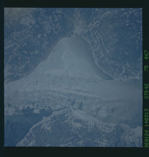
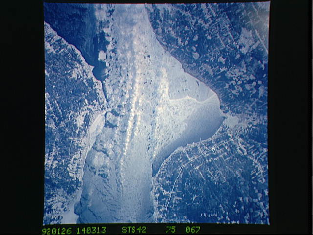
STS042-75-067: Baie des Chaleurs This image was acquired
from STS-42 on 26 January 1992 at 14:03:13JGMT. Bathurst, New
Brunswick, is at the center of the right side of the image. The
upper part of Chaleur Bay (lower part of the image) is ice-
covered with a few breaks, while towards the open ocean (upper
left of the image) the water is relatively free of ice. Of
meteorological interest, note the cloud streets, roughly parallel
to the shores, near the center of the bay. The ice cover on the
bay is obviously warmer than the adjacent land. Heating of the
air over the warmer ice initiates vertical motions that form the
cloud streets downwind. Also note the streets that develop
downwind of the points where the ice separates from the shore.
This development occurs as a result of differential heating
across the ice/water interface.
