STS041-90-12
| NASA Photo ID | STS041-90-12 |
| Focal Length | 250mm |
| Date taken | 1990.10.09 |
| Time taken | 07:46:45 GMT |
Cloud masks available for this image:
Spacecraft nadir point: 21.0° N, 3.3° E
Photo center point: 21.5° N, 2.5° E
Photo center point by machine learning:
Photo center point: 21.5° N, 2.5° E
Photo center point by machine learning:
Nadir to Photo Center: Northwest
Spacecraft Altitude: 162 nautical miles (300km)
Country or Geographic Name: | ALGERIA |
Features: | SAHARA |
| Features Found Using Machine Learning: | |
Cloud Cover Percentage: | 0 (no clouds present) |
Sun Elevation Angle: | 27° |
Sun Azimuth: | 109° |
Camera: | Hasselblad |
Focal Length: | 250mm |
Camera Tilt: | 19 degrees |
Format: | 2443: Kodak Aerochrome 2443, color IR, thin base, EA-5 process thru June 1999, E-6 process afterward |
Film Exposure: | Over Exposed |
| Additional Information | |
| Width | Height | Annotated | Cropped | Purpose | Links |
|---|---|---|---|---|---|
| 5614 pixels | 6000 pixels | No | No | Download Image | |
| 500 pixels | 534 pixels | No | No | Download Image |
Download Packaged File
Download a Google Earth KML for this Image
View photo footprint information
Download a GeoTIFF for this photo
Image Caption:
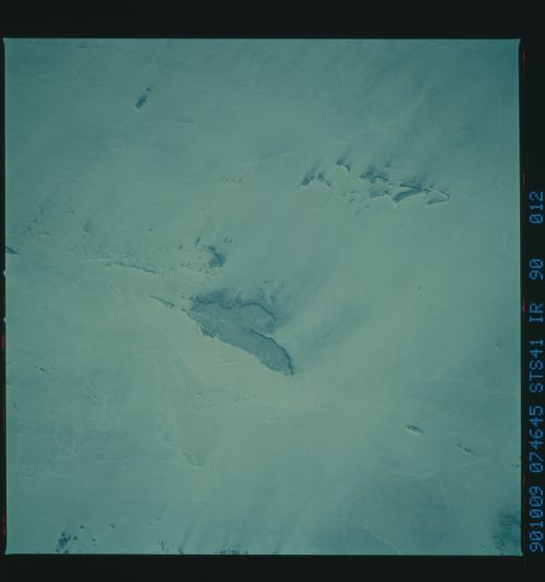
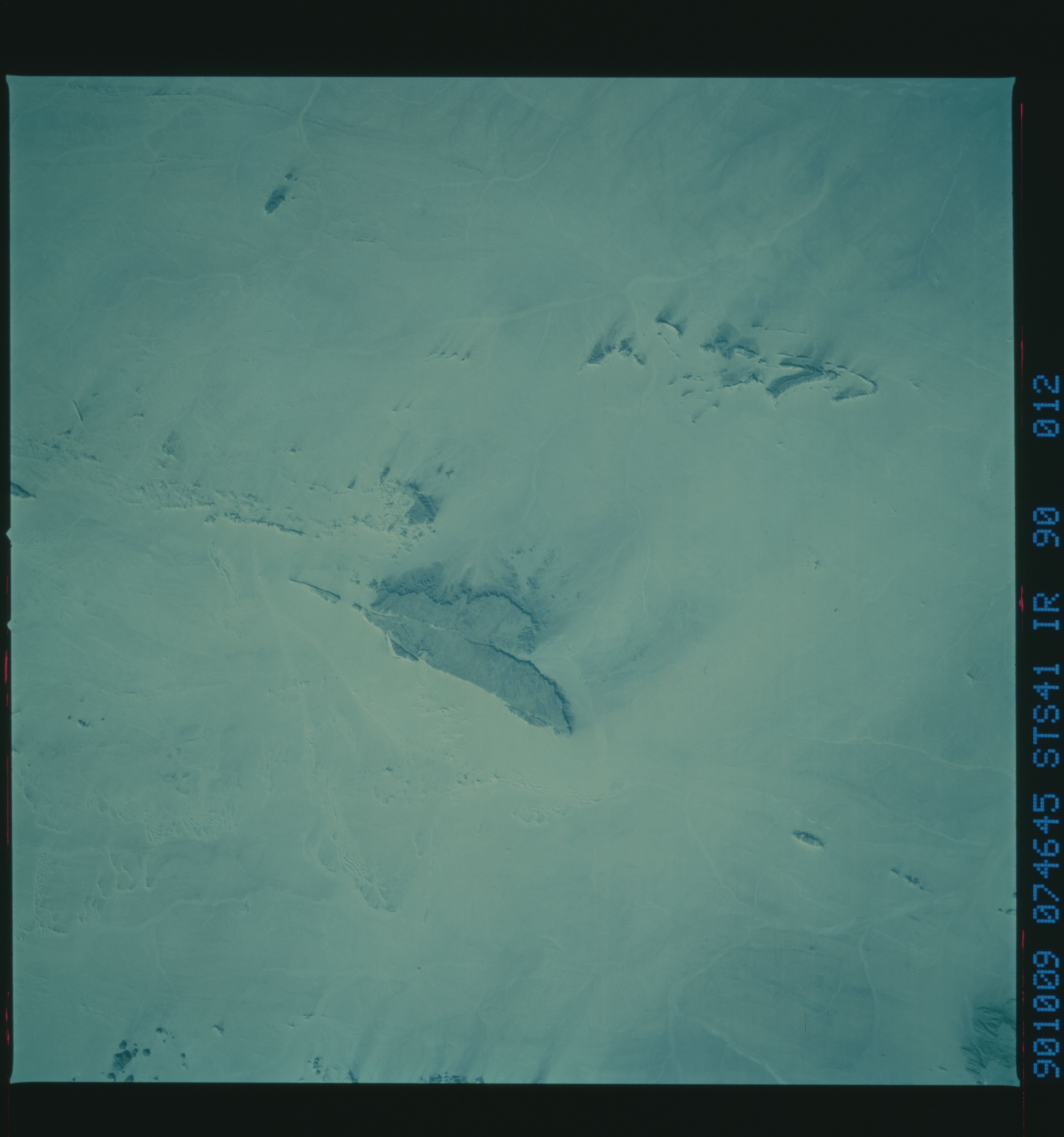
T46
The effects of wind and water--Dominant winds from the southeast
blow dustings of sand across a low massif of dark rock in south-
ern Algeria (top), giving rise to sand streaks downwind. All
along the east side of the massif lies a long sand dune parallel-
ing the windward edge of the massif (top right). This is an ex-
cellent example of an "echo dune." The effects of flowing water
are less dominant than those of wind in this area: the major,
north-flowing drainage of the area can be seen in the middle of
the image. Image scale: approximately 50 miles along a side.
(S41-90-010, 012)
