STS041-89-104
| NASA Photo ID | STS041-89-104 |
| Focal Length | 250mm |
| Date taken | 1990.10.09 |
| Time taken | 14:01:22 GMT |
Cloud masks available for this image:
Spacecraft nadir point: 2.9° S, 42.2° W
Photo center point: 3.0° S, 42.0° W
Photo center point by machine learning:
Photo center point: 3.0° S, 42.0° W
Photo center point by machine learning:
Nadir to Photo Center: Southeast
Spacecraft Altitude: 161 nautical miles (298km)
Country or Geographic Name: | BRAZIL |
Features: | COASTLINE |
| Features Found Using Machine Learning: | |
Cloud Cover Percentage: | 0 (no clouds present) |
Sun Elevation Angle: | 80° |
Sun Azimuth: | 111° |
Camera: | Hasselblad |
Focal Length: | 250mm |
Camera Tilt: | 5 degrees |
Format: | 2443: Kodak Aerochrome 2443, color IR, thin base, EA-5 process thru June 1999, E-6 process afterward |
Film Exposure: | Normal |
| Additional Information | |
| Width | Height | Annotated | Cropped | Purpose | Links |
|---|---|---|---|---|---|
| 5614 pixels | 6000 pixels | No | No | Download Image | |
| 500 pixels | 534 pixels | No | No | Download Image |
Download Packaged File
Download a Google Earth KML for this Image
View photo footprint information
Download a GeoTIFF for this photo
Image Caption:
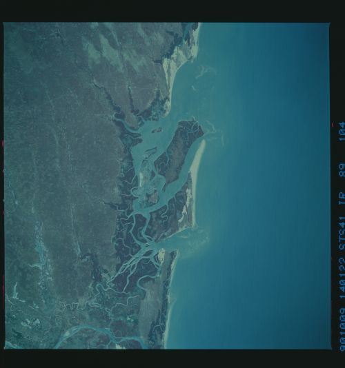
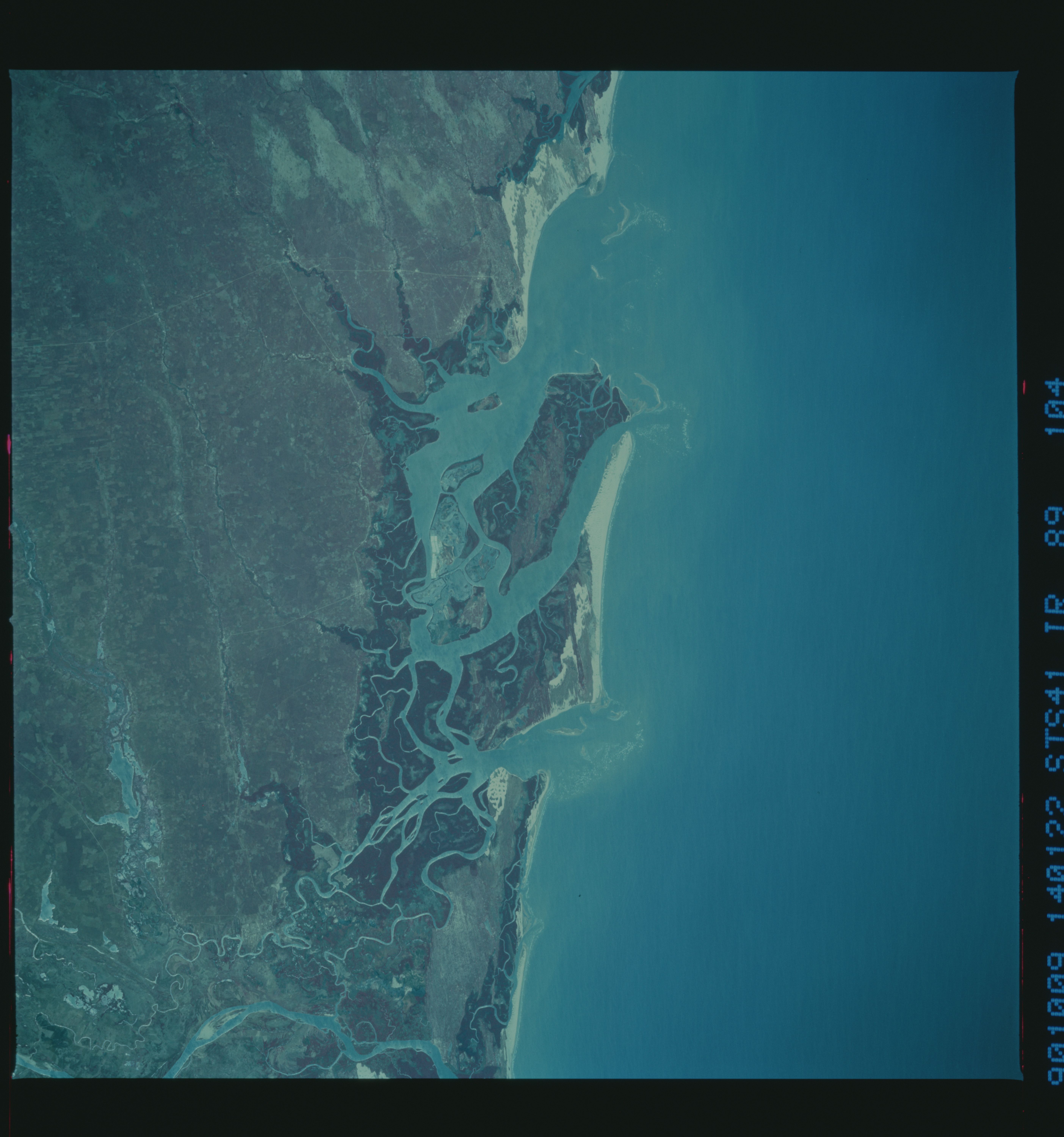
Northeastern Coastal Brazil
These two near-vertical CIR photos are representative of high
quality, cloud-free pictures (sixteen frames) of a region that
extends approximately 400 kilometers along the northeast coast of
Brazil--from Primeira Cruz to Acarau. Toward the extreme right
side of the photograph part of the Rio Parnaiba Basin can be ob-
served. High color contrasts mark different vegetation zones,
including the encroaching sand dunes and the clearly delimited
mangrove swamp area (appearing as dark crimson on the CIR film,
but in reality green vegetation). The prevailing wind direction
is evident as are the agriculture field patterns; the large in-
land areas where very little vegetation is growing, and the
development of coastal island/sand bars. (S41-89-102, 104)
