STS041-72-78
| NASA Photo ID | STS041-72-78 |
| Focal Length | 250mm |
| Date taken | 1990.10.06 |
| Time taken | 16:46:34 GMT |

Cloud masks available for this image:
Spacecraft nadir point: 1.3° S, 62.2° W
Photo center point: 1.5° S, 62.0° W
Photo center point by machine learning:
Photo center point: 1.5° S, 62.0° W
Photo center point by machine learning:
Nadir to Photo Center: Southeast
Spacecraft Altitude: 160 nautical miles (296km)
Country or Geographic Name: | BRAZIL |
Features: | RIO NEGRO |
| Features Found Using Machine Learning: | |
Cloud Cover Percentage: | 40 (26-50)% |
Sun Elevation Angle: | 77° |
Sun Azimuth: | 252° |
Camera: | Hasselblad |
Focal Length: | 250mm |
Camera Tilt: | 6 degrees |
Format: | 5017: Kodak, natural color positive, Ektachrome, X Professional, ASA 64, standard base |
Film Exposure: | Normal |
| Additional Information | |
| Width | Height | Annotated | Cropped | Purpose | Links |
|---|---|---|---|---|---|
| 5700 pixels | 5900 pixels | No | No | Download Image | |
| 500 pixels | 518 pixels | No | No | Download Image | |
| 640 pixels | 480 pixels | No | No | Download Image |
Download Packaged File
Download a Google Earth KML for this Image
View photo footprint information
Download a GeoTIFF for this photo
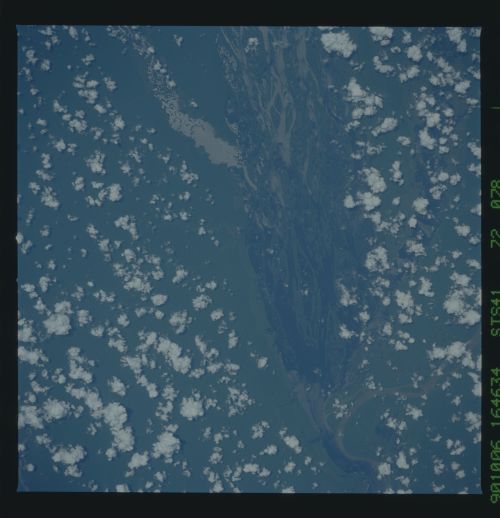
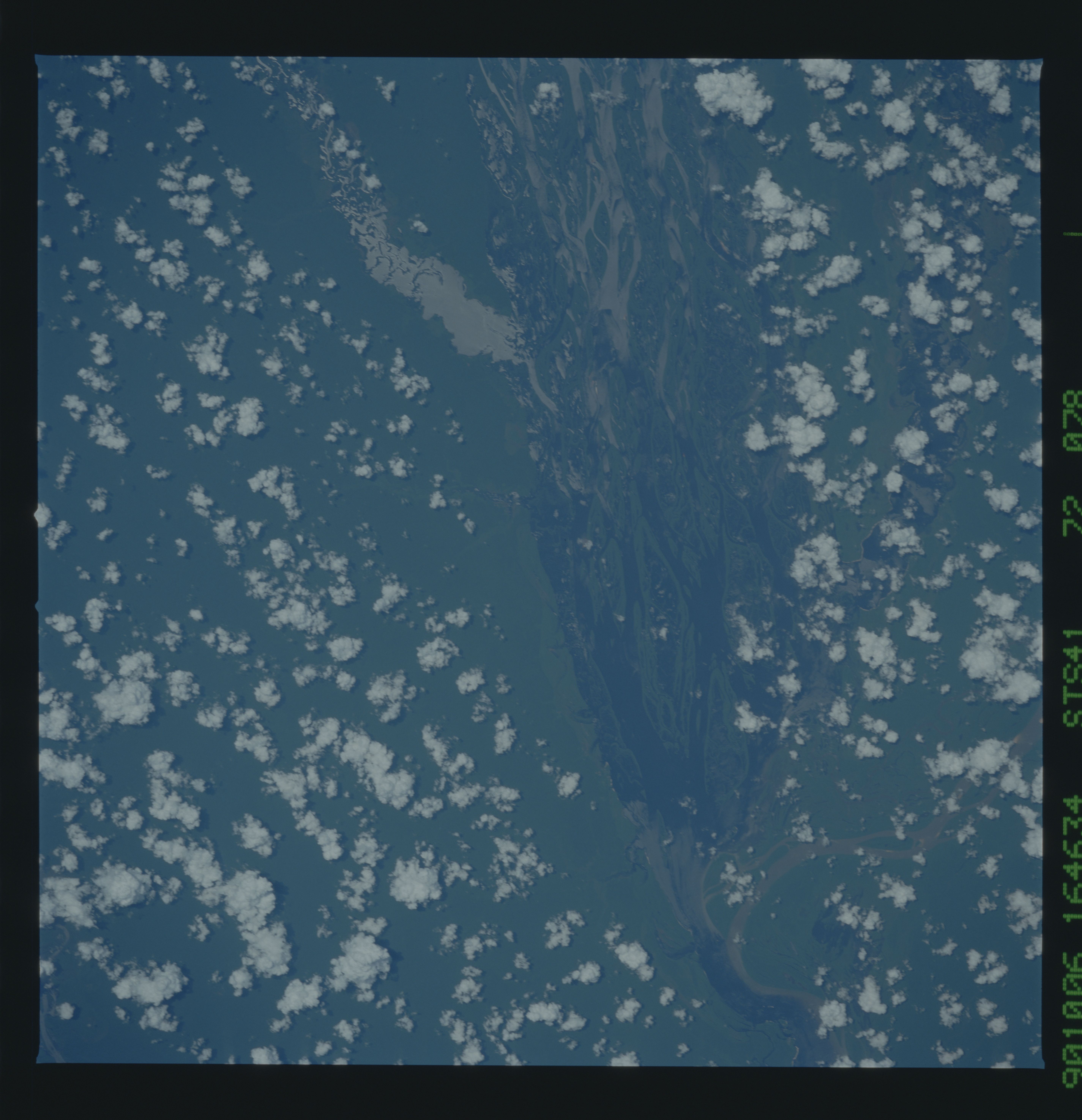
Image Caption: STS41-72-078 Rio Negro This section of the Rio Negro [1] just to the
northwest of Manaus is typical of the braided stream channels that are
found throughout the extent of this river. The mouth of the Rio Branco
(2) which is one of the major rivers that drains the Guiana Highlands
is clearly visible. This mosaic typifies some of the still unspoiled
rainforest area of the central Amazon Basin. "Popcorn" cumulus clouds
that are also typical in this area are visible: note that the clouds
are positioned predominantly over the heavily vegetated land area and
not over the river proper.
