STS040-88-Z
| NASA Photo ID | STS040-88-Z |
| Focal Length | 250mm |
| Date taken | 1991.06.__ |
| Time taken | GMT |
Resolutions offered for this image:
3904 x 3880 pixels 639 x 636 pixels 5700 x 6000 pixels 500 x 526 pixels 640 x 480 pixels
3904 x 3880 pixels 639 x 636 pixels 5700 x 6000 pixels 500 x 526 pixels 640 x 480 pixels
Cloud masks available for this image:
Spacecraft nadir point:
Photo center point: 33.0° N, 106.0° W
Photo center point by machine learning:
Photo center point: 33.0° N, 106.0° W
Photo center point by machine learning:
Nadir to Photo Center:
Spacecraft Altitude: nautical miles (0km)
Country or Geographic Name: | USA-NEW MEXICO |
Features: | WHITE SANDS, ALAMOGORDO |
| Features Found Using Machine Learning: | |
Cloud Cover Percentage: | 5 (1-10)% |
Sun Elevation Angle: | ° |
Sun Azimuth: | ° |
Camera: | Hasselblad |
Focal Length: | 250mm |
Camera Tilt: | Low Oblique |
Format: | 5017: Kodak, natural color positive, Ektachrome, X Professional, ASA 64, standard base |
Film Exposure: | Normal |
| Additional Information | |
| Width | Height | Annotated | Cropped | Purpose | Links |
|---|---|---|---|---|---|
| 3904 pixels | 3880 pixels | No | No | Earth From Space collection | Download Image |
| 639 pixels | 636 pixels | No | No | Earth From Space collection | Download Image |
| 5700 pixels | 6000 pixels | No | No | Download Image | |
| 500 pixels | 526 pixels | No | No | Download Image | |
| 640 pixels | 480 pixels | No | No | Download Image |
Download Packaged File
Download a Google Earth KML for this Image
View photo footprint information
Download a GeoTIFF for this photo
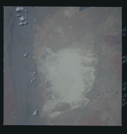
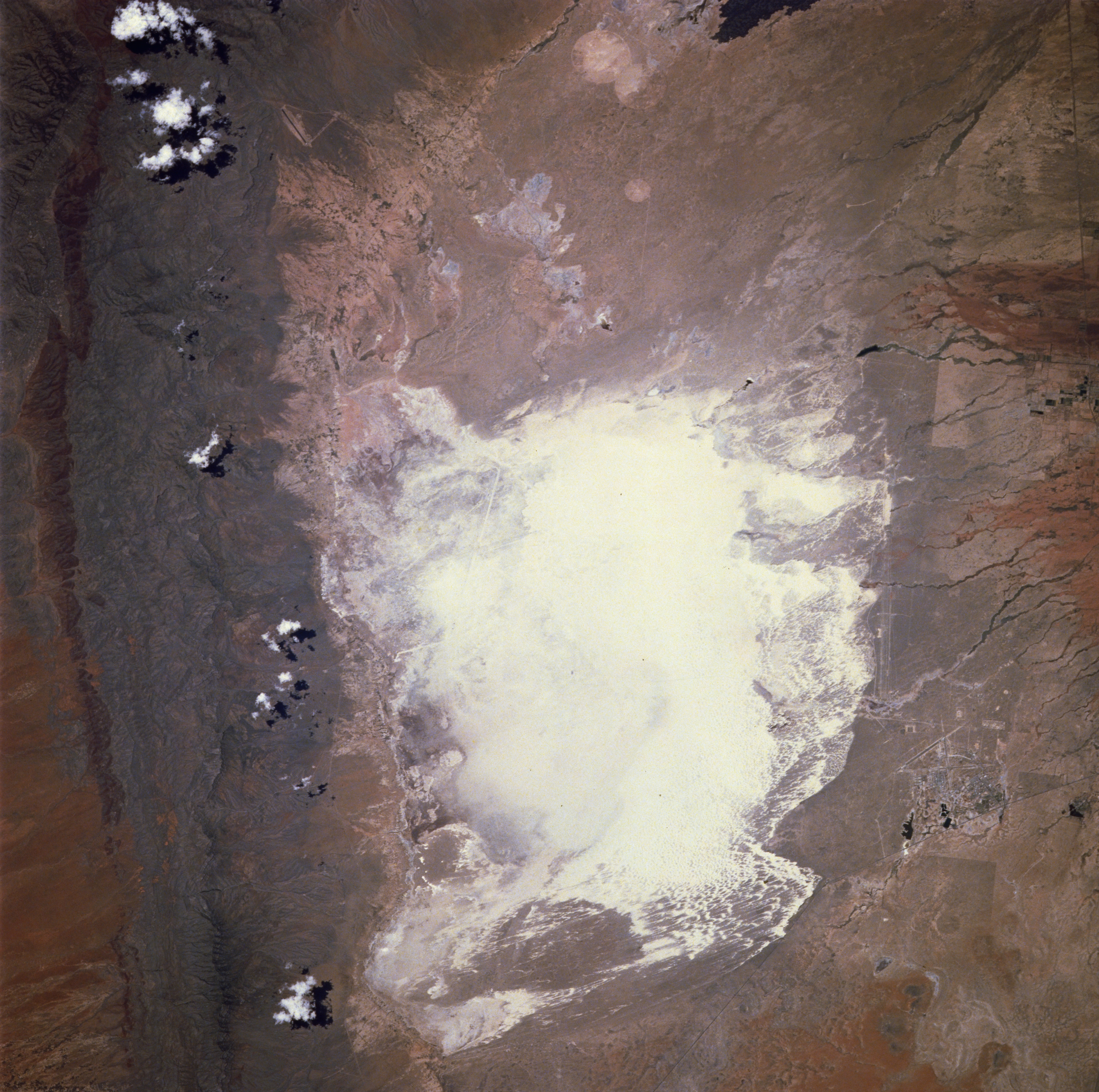
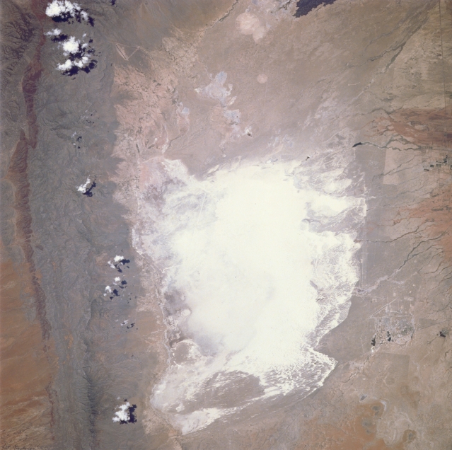
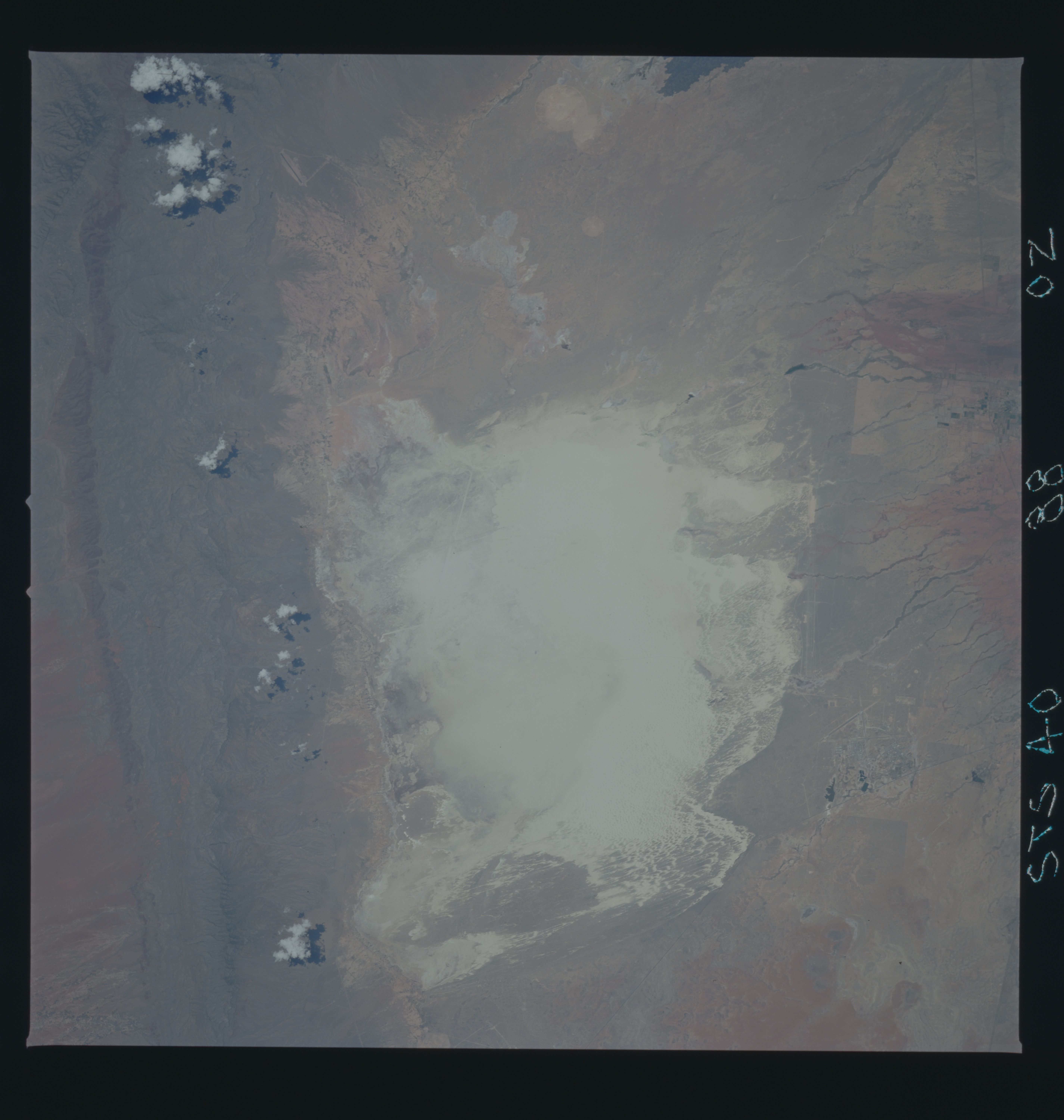
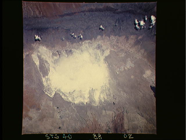
Image Caption: STS040-088-00Z White Sands National Monument, New Mexico, U.S.A. June 1991
Highly reflective White Sands National Monument in south-central New Mexico, the world's largest gypsum sand field, receives its interior drainage primarily from the San Andres Mountains to the west and the Sacramento Mountains to the east. The southwest corner of White Sands National Monument, the lowest spot in the Tularosa Valley and showing a dark accumulation of moisture, changes from a dry lakebed into Lake Lucero when summer rain falls. Manmade features visible in the photograph include weapons impact target areas (large circular features at the top of the photograph); a linear U.S. Air Force test facility along the eastern side of the San Andres Mountains; the barely discernible alternate landing site for the NASA Space Shuttle (a white linear feature in the northwest section of the monument; and the long [approximately 10 miles (16 kilometers)] linear rocket sled test bed, part of Holloman Air Force Base, east of the monument.
Highly reflective White Sands National Monument in south-central New Mexico, the world's largest gypsum sand field, receives its interior drainage primarily from the San Andres Mountains to the west and the Sacramento Mountains to the east. The southwest corner of White Sands National Monument, the lowest spot in the Tularosa Valley and showing a dark accumulation of moisture, changes from a dry lakebed into Lake Lucero when summer rain falls. Manmade features visible in the photograph include weapons impact target areas (large circular features at the top of the photograph); a linear U.S. Air Force test facility along the eastern side of the San Andres Mountains; the barely discernible alternate landing site for the NASA Space Shuttle (a white linear feature in the northwest section of the monument; and the long [approximately 10 miles (16 kilometers)] linear rocket sled test bed, part of Holloman Air Force Base, east of the monument.
