STS040-88-BQ
| NASA Photo ID | STS040-88-BQ |
| Focal Length | 250mm |
| Date taken | 1991.06.__ |
| Time taken | GMT |
Resolutions offered for this image:
5285 x 5285 pixels 639 x 639 pixels 5700 x 6000 pixels 500 x 526 pixels 640 x 480 pixels
5285 x 5285 pixels 639 x 639 pixels 5700 x 6000 pixels 500 x 526 pixels 640 x 480 pixels
Cloud masks available for this image:
Spacecraft nadir point:
Photo center point: 30.5° N, 88.0° W
Photo center point by machine learning:
Photo center point: 30.5° N, 88.0° W
Photo center point by machine learning:
Nadir to Photo Center:
Spacecraft Altitude: nautical miles (0km)
Country or Geographic Name: | USA-ALABAMA |
Features: | MOBILE, MOBILE BAY |
| Features Found Using Machine Learning: | |
Cloud Cover Percentage: | 5 (1-10)% |
Sun Elevation Angle: | ° |
Sun Azimuth: | ° |
Camera: | Hasselblad |
Focal Length: | 250mm |
Camera Tilt: | Low Oblique |
Format: | 5017: Kodak, natural color positive, Ektachrome, X Professional, ASA 64, standard base |
Film Exposure: | Normal |
| Additional Information | |
| Width | Height | Annotated | Cropped | Purpose | Links |
|---|---|---|---|---|---|
| 5285 pixels | 5285 pixels | No | No | Earth From Space collection | Download Image |
| 639 pixels | 639 pixels | No | No | Earth From Space collection | Download Image |
| 5700 pixels | 6000 pixels | No | No | Download Image | |
| 500 pixels | 526 pixels | No | No | Download Image | |
| 640 pixels | 480 pixels | No | No | Download Image |
Download Packaged File
Download a Google Earth KML for this Image
View photo footprint information
Download a GeoTIFF for this photo
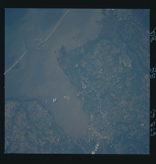
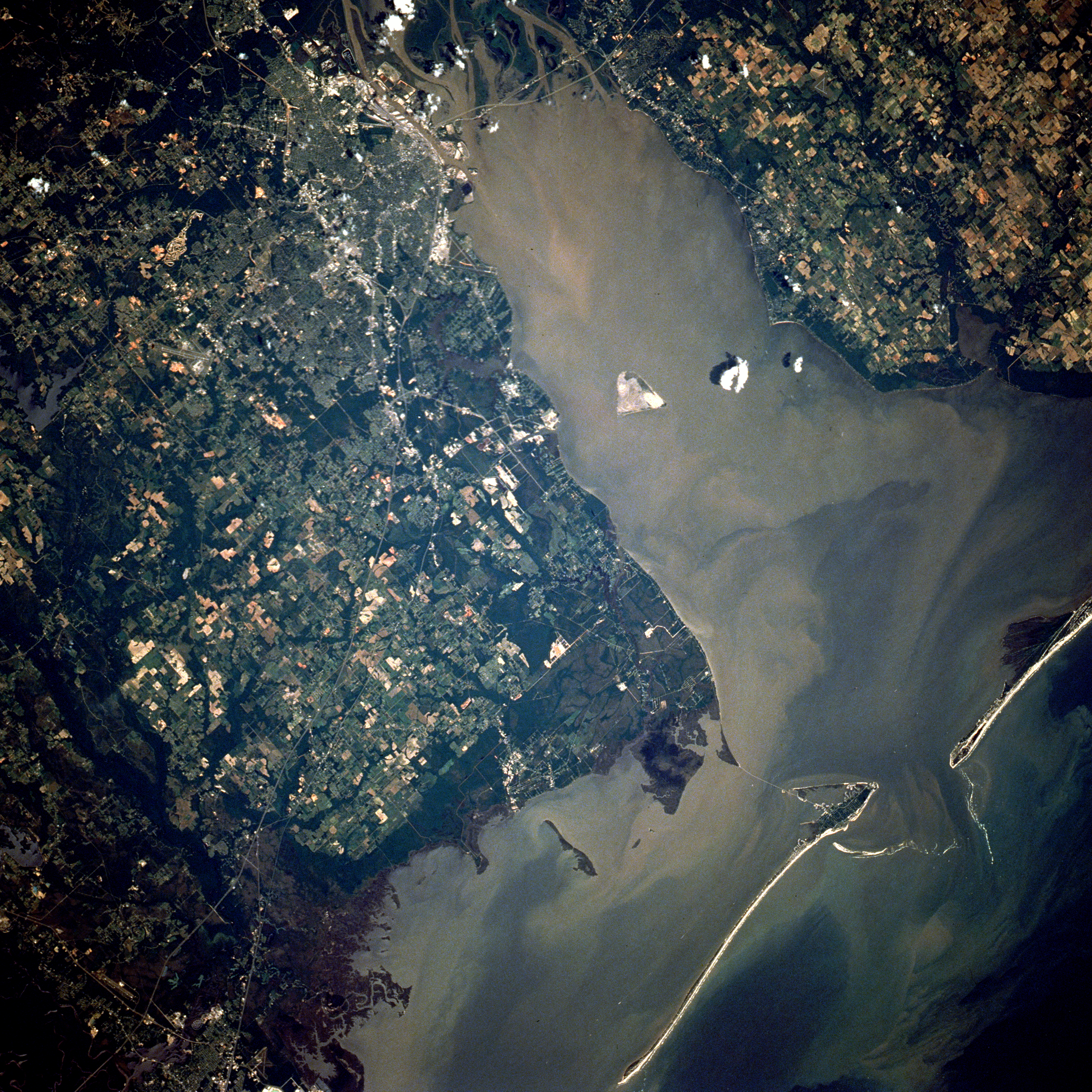
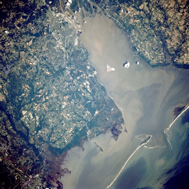
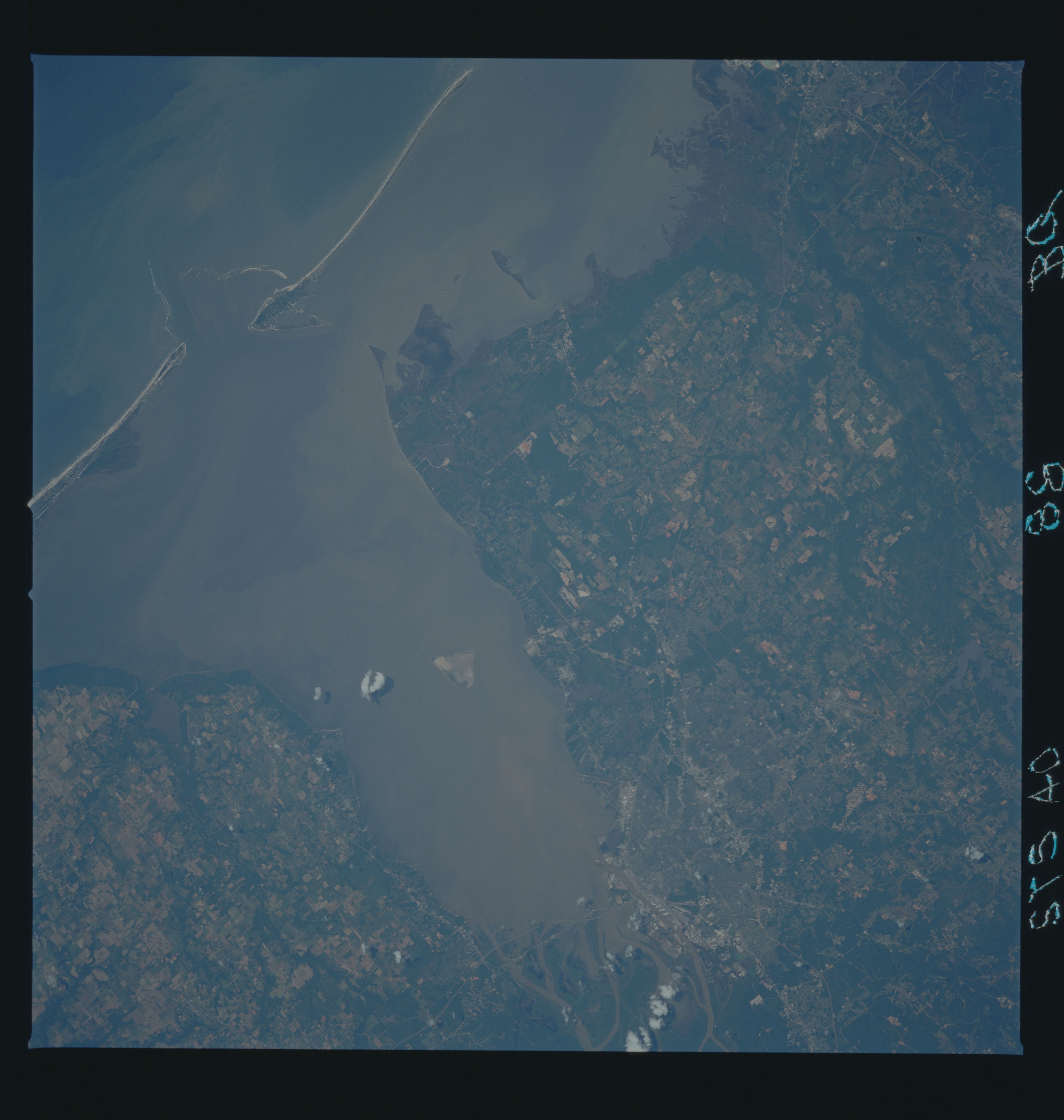
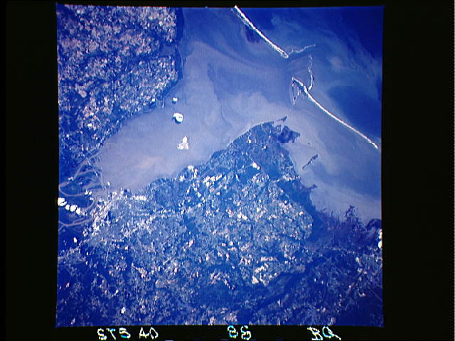
Image Caption: STS040-088-0BQ Mobile Bay, Alabama, U.S.A. June 1991
Brownish, sediment-laden Mobile Bay, which extends 35 miles (56 kilometers) from the mouth of the Mobile River southward to the Gulf of Mexico, is seen in this low-oblique, north-looking photograph. A ship channel at the southern end of the bay connects the bay with the gulf. The Intracoastal Waterway (not easily discernible in this photograph) passes through the southern part of the bay. Mobile Bay, which varies in width from 8 to 18 miles (13 to 29 kilometers), was the scene of a major Civil War naval battle in August 1864, in which Admiral Farragut of the Union forces successfully ran a blockade of mines, dispersed the Confederate naval fleet, and secured the surrender of the Confederate forces defending the bay. The city of Mobile, Alabama's only seaport, is visible at the northern end of Mobile Bay, just west of the mouth of the Mobile River. Mobile is a major shipping and shipbuilding center. Other major industries include oil refineries; chemical, textile, and paper plants; and food processing facilities. Major highways traverse the city; prominent is Interstate Highway 10, which extends west-east across the mouth of the Mobile River.
Brownish, sediment-laden Mobile Bay, which extends 35 miles (56 kilometers) from the mouth of the Mobile River southward to the Gulf of Mexico, is seen in this low-oblique, north-looking photograph. A ship channel at the southern end of the bay connects the bay with the gulf. The Intracoastal Waterway (not easily discernible in this photograph) passes through the southern part of the bay. Mobile Bay, which varies in width from 8 to 18 miles (13 to 29 kilometers), was the scene of a major Civil War naval battle in August 1864, in which Admiral Farragut of the Union forces successfully ran a blockade of mines, dispersed the Confederate naval fleet, and secured the surrender of the Confederate forces defending the bay. The city of Mobile, Alabama's only seaport, is visible at the northern end of Mobile Bay, just west of the mouth of the Mobile River. Mobile is a major shipping and shipbuilding center. Other major industries include oil refineries; chemical, textile, and paper plants; and food processing facilities. Major highways traverse the city; prominent is Interstate Highway 10, which extends west-east across the mouth of the Mobile River.
