STS040-80-43
| NASA Photo ID | STS040-80-43 |
| Focal Length | 250mm |
| Date taken | 1991.06.11 |
| Time taken | 15:19:39 GMT |
Resolutions offered for this image:
3907 x 3936 pixels 635 x 639 pixels 5700 x 6000 pixels 500 x 526 pixels 640 x 480 pixels
3907 x 3936 pixels 635 x 639 pixels 5700 x 6000 pixels 500 x 526 pixels 640 x 480 pixels


Cloud masks available for this image:
Spacecraft nadir point: 38.5° N, 118.0° W
Photo center point: 38.0° N, 119.0° W
Photo center point by machine learning:
Photo center point: 38.0° N, 119.0° W
Photo center point by machine learning:
Nadir to Photo Center:
Spacecraft Altitude: 151 nautical miles (280km)
Country or Geographic Name: | USA-CALIFORNIA |
Features: | MONO LAKE |
| Features Found Using Machine Learning: | |
Cloud Cover Percentage: | 10 (1-10)% |
Sun Elevation Angle: | 30° |
Sun Azimuth: | 83° |
Camera: | Hasselblad |
Focal Length: | 250mm |
Camera Tilt: | 24 degrees |
Format: | 5017: Kodak, natural color positive, Ektachrome, X Professional, ASA 64, standard base |
Film Exposure: | Normal |
| Additional Information | |
| Width | Height | Annotated | Cropped | Purpose | Links |
|---|---|---|---|---|---|
| 3907 pixels | 3936 pixels | No | No | Earth From Space collection | Download Image |
| 635 pixels | 639 pixels | No | No | Earth From Space collection | Download Image |
| 5700 pixels | 6000 pixels | No | No | Download Image | |
| 500 pixels | 526 pixels | No | No | Download Image | |
| 640 pixels | 480 pixels | No | No | Download Image |
Download Packaged File
Download a Google Earth KML for this Image
View photo footprint information
Download a GeoTIFF for this photo
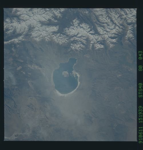
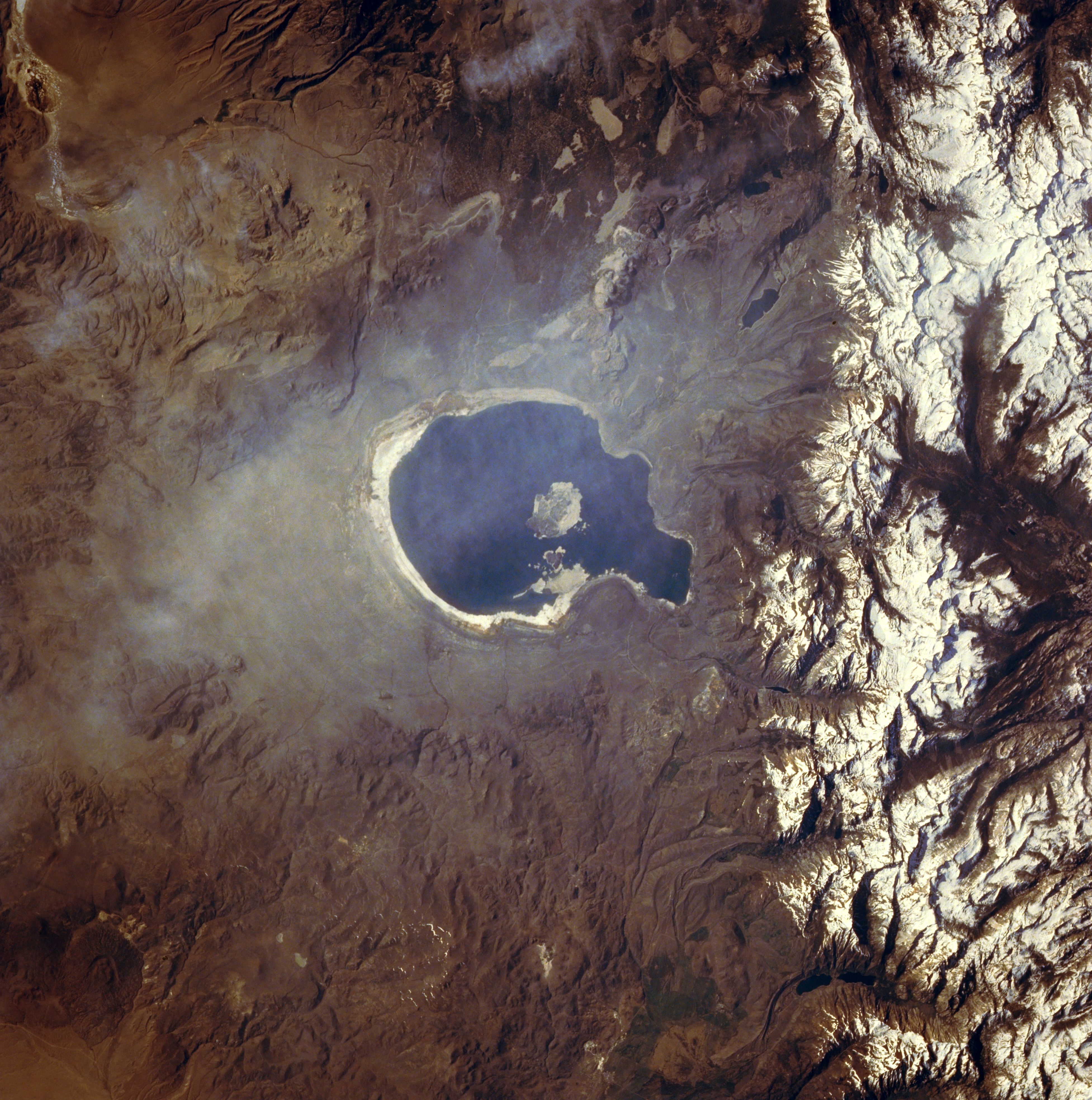
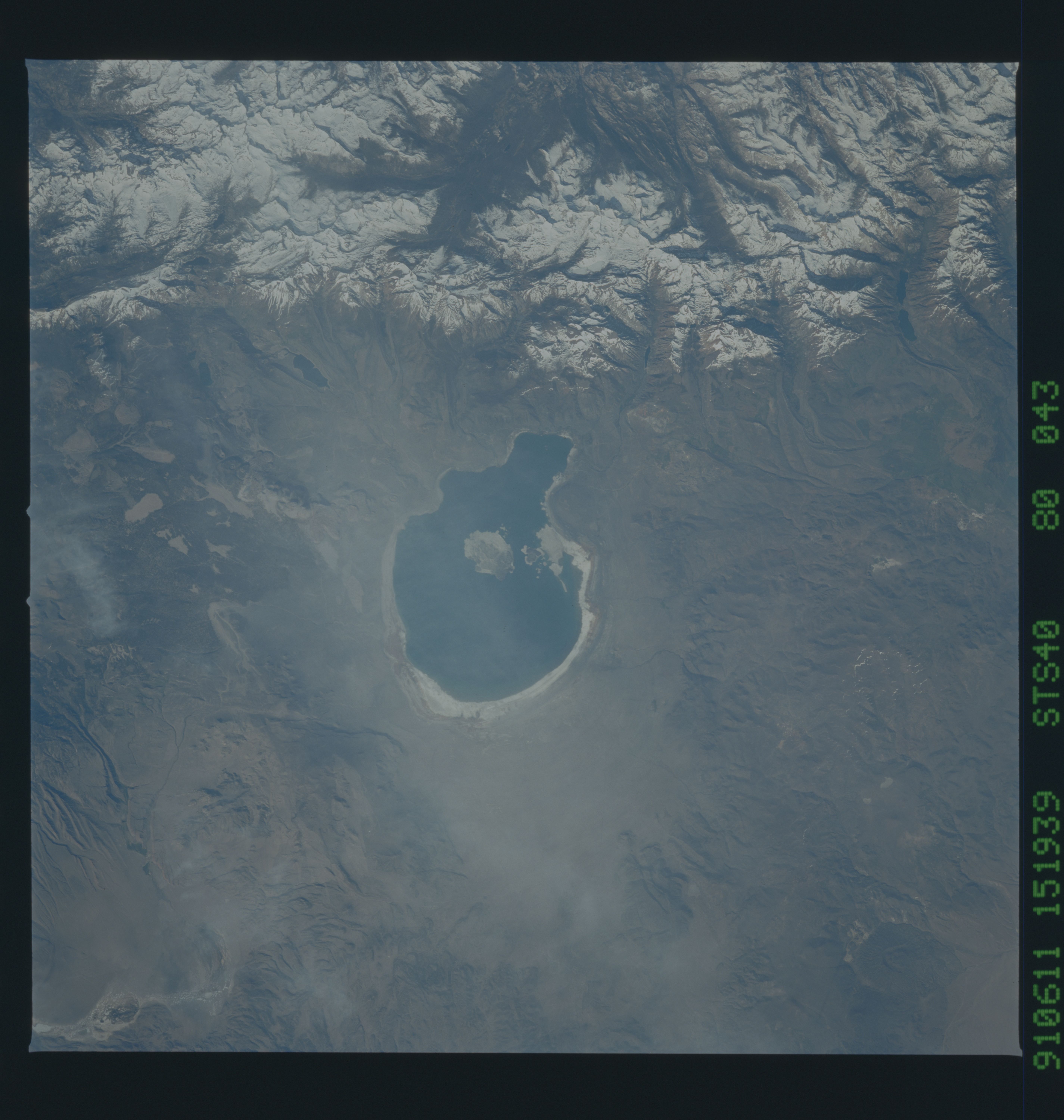
Image Caption: STS040-80-43 Mono Lake, California, U.S.A. June 1991
Nestled in a basin between the high, snow-covered Sierra Nevada Mountains to the west and the lower, barren Excelsior Mountains to the east, Mono Lake is captured in this near-vertical photograph. Highly saline Mono Lake, almost 14 miles (23 kilometers) long and 9 miles (14 kilometers) wide, is located at an elevation of 6425 feet (1959 meters). Fed by springs that rise through beds of saline sands, the lake supplies water for the growing population of Los Angeles. During the last 20 years, the lake's total volume has been halved, and its salinity has doubled. Without measures to conserve the water volume, the ecosystem of the lake and its surrounding habitat are endangered.
Nestled in a basin between the high, snow-covered Sierra Nevada Mountains to the west and the lower, barren Excelsior Mountains to the east, Mono Lake is captured in this near-vertical photograph. Highly saline Mono Lake, almost 14 miles (23 kilometers) long and 9 miles (14 kilometers) wide, is located at an elevation of 6425 feet (1959 meters). Fed by springs that rise through beds of saline sands, the lake supplies water for the growing population of Los Angeles. During the last 20 years, the lake's total volume has been halved, and its salinity has doubled. Without measures to conserve the water volume, the ecosystem of the lake and its surrounding habitat are endangered.
