STS040-78-25
| NASA Photo ID | STS040-78-25 |
| Focal Length | 50mm |
| Date taken | 1991.06.10 |
| Time taken | 09:28:05 GMT |
Resolutions offered for this image:
5167 x 5167 pixels 639 x 639 pixels 5700 x 6000 pixels 500 x 526 pixels 640 x 480 pixels
5167 x 5167 pixels 639 x 639 pixels 5700 x 6000 pixels 500 x 526 pixels 640 x 480 pixels
Cloud masks available for this image:
Spacecraft nadir point: 32.3° N, 29.7° E
Photo center point: 30.5° N, 32.5° E
Photo center point by machine learning:
Photo center point: 30.5° N, 32.5° E
Photo center point by machine learning:
Nadir to Photo Center: Southeast
Spacecraft Altitude: 155 nautical miles (287km)
Country or Geographic Name: | EGYPT |
Features: | GREAT BITTER L., G OFSUEZ |
| Features Found Using Machine Learning: | |
Cloud Cover Percentage: | 5 (1-10)% |
Sun Elevation Angle: | 78° |
Sun Azimuth: | 140° |
Camera: | Hasselblad |
Focal Length: | 50mm |
Camera Tilt: | High Oblique |
Format: | 5017: Kodak, natural color positive, Ektachrome, X Professional, ASA 64, standard base |
Film Exposure: | Normal |
| Additional Information | |
| Width | Height | Annotated | Cropped | Purpose | Links |
|---|---|---|---|---|---|
| 5167 pixels | 5167 pixels | No | No | Earth From Space collection | Download Image |
| 639 pixels | 639 pixels | No | No | Earth From Space collection | Download Image |
| 5700 pixels | 6000 pixels | No | No | Download Image | |
| 500 pixels | 526 pixels | No | No | Download Image | |
| 640 pixels | 480 pixels | No | No | Download Image |
Download Packaged File
Download a Google Earth KML for this Image
View photo footprint information
Download a GeoTIFF for this photo
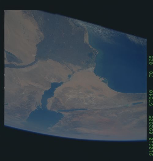
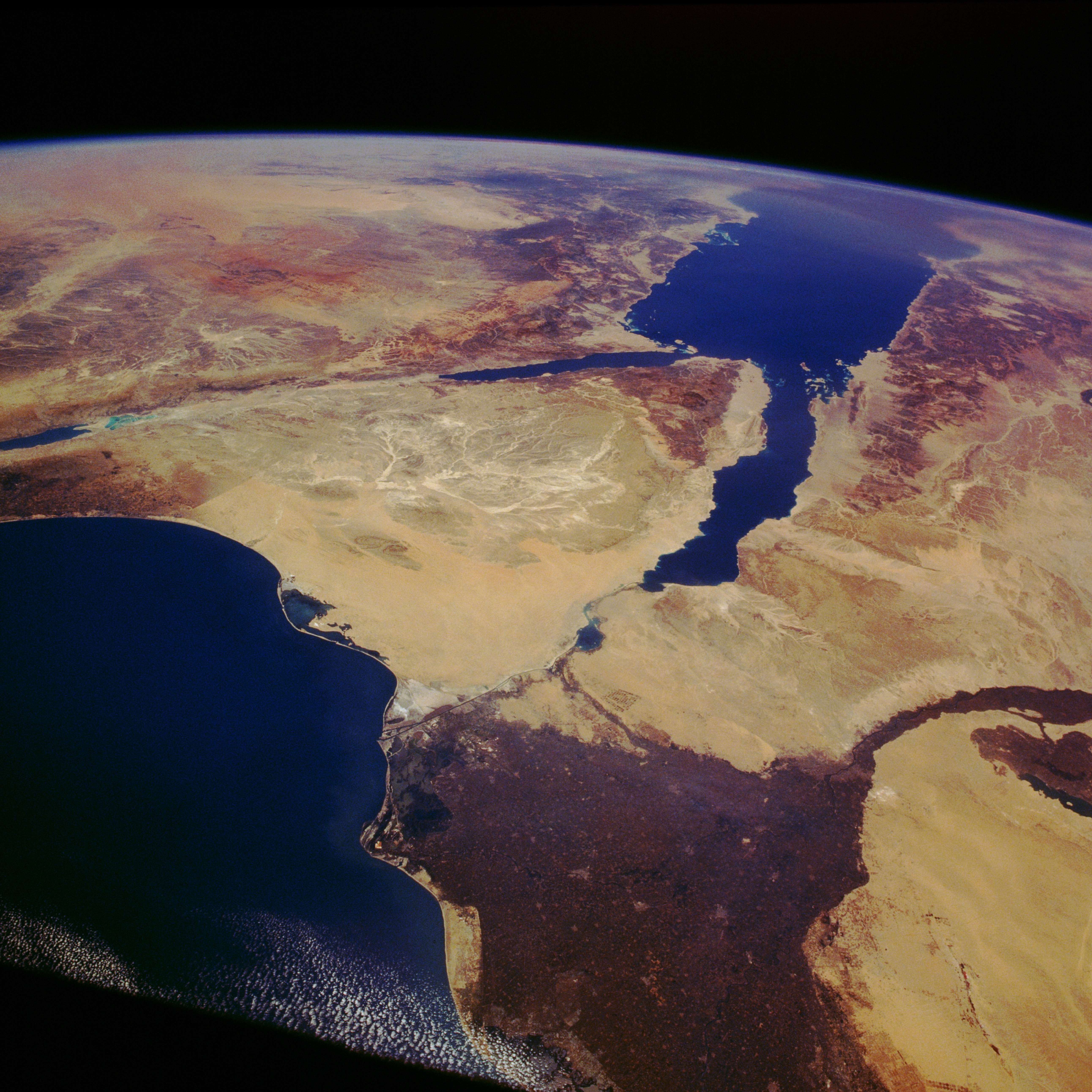
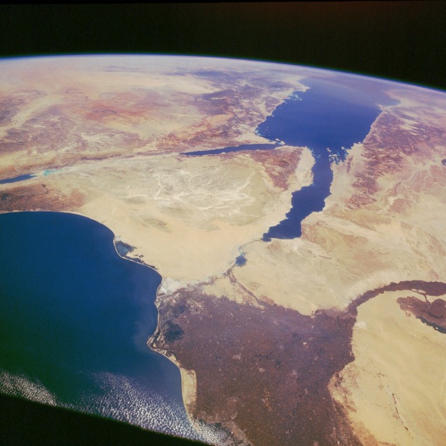
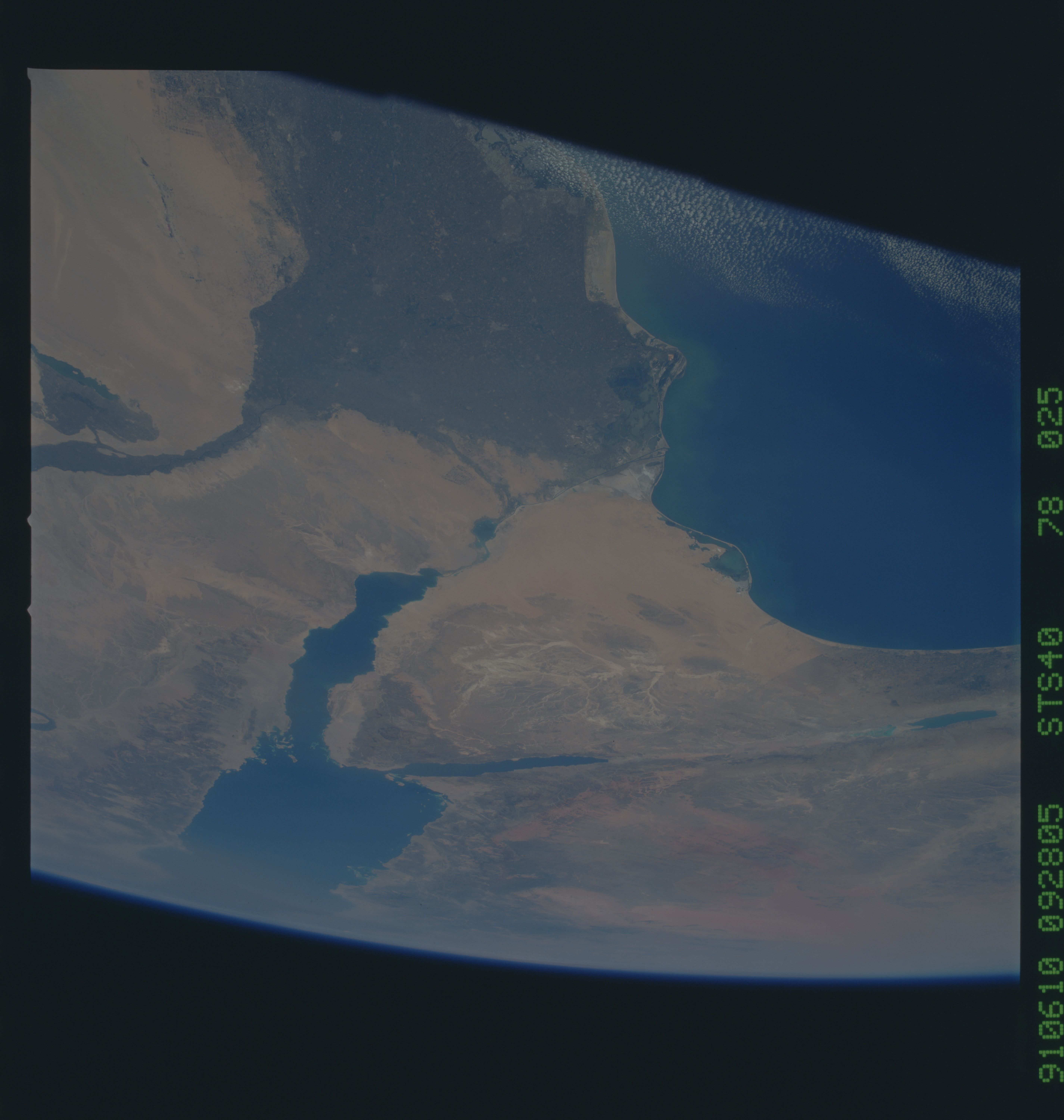
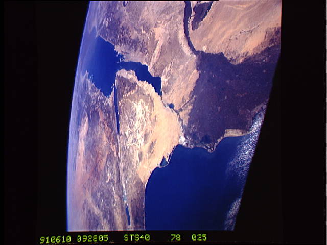
Image Caption: STS040-078-025 Nile River Delta and Sinai Peninsula, Egypt June 1991
Several physiographic provinces are captured in this southeast-looking, high-oblique photograph. The large, dark green area on the west side of the photograph is the Nile River Delta, which extends from the capital city of Cairo at the apex of the delta to the Suez Canal on the eastern edge (the relatively straight line that runs north-south) to the city of Alexandria on the west corner (outside this photograph). The alluvial soils, which have been deposited by the Nile River for many centuries, provide a unique environment for the production of a variety of crops, and the flooding of the river makes up for lack of rainfall. The entire region is classified as desert [less than 10 inches (25 centimeters) of rainfall per year]. Desert-like sandy areas are visible southwest of the delta and in the northwestern part of the Sinai Peninsula. In addition to these sandy areas, major rock outcrops (darker areas) are seen encircling the Red Sea, including the southern two-thirds of the Sinai Peninsula. The darker, hilly terrain along the western shore of the Red Sea is the Arabian Desert, and the low mountains along the eastern shore of the Red Sea in Saudi Arabia are the Al Hijaz Mountains. The two elongated bodies of water flanking the southern end of the Sinai Peninsula are the Gulf of Suez (western boundary) and the Gulf of Aqaba (eastern boundary). The linear feature extending to the northeast from the northern end of the Gulf of Aqaba is the southern end of the Dead Sea Rift, which is part of the much larger East African Rift Valley that runs 6000 miles (9600 kilometers)--from the Middle East to south-central Africa. The faint line that can be seen along the eastern part of the Sinai Peninsula is the boundary between Egypt and Israel. The line is a result of different densities in vegetation.
Several physiographic provinces are captured in this southeast-looking, high-oblique photograph. The large, dark green area on the west side of the photograph is the Nile River Delta, which extends from the capital city of Cairo at the apex of the delta to the Suez Canal on the eastern edge (the relatively straight line that runs north-south) to the city of Alexandria on the west corner (outside this photograph). The alluvial soils, which have been deposited by the Nile River for many centuries, provide a unique environment for the production of a variety of crops, and the flooding of the river makes up for lack of rainfall. The entire region is classified as desert [less than 10 inches (25 centimeters) of rainfall per year]. Desert-like sandy areas are visible southwest of the delta and in the northwestern part of the Sinai Peninsula. In addition to these sandy areas, major rock outcrops (darker areas) are seen encircling the Red Sea, including the southern two-thirds of the Sinai Peninsula. The darker, hilly terrain along the western shore of the Red Sea is the Arabian Desert, and the low mountains along the eastern shore of the Red Sea in Saudi Arabia are the Al Hijaz Mountains. The two elongated bodies of water flanking the southern end of the Sinai Peninsula are the Gulf of Suez (western boundary) and the Gulf of Aqaba (eastern boundary). The linear feature extending to the northeast from the northern end of the Gulf of Aqaba is the southern end of the Dead Sea Rift, which is part of the much larger East African Rift Valley that runs 6000 miles (9600 kilometers)--from the Middle East to south-central Africa. The faint line that can be seen along the eastern part of the Sinai Peninsula is the boundary between Egypt and Israel. The line is a result of different densities in vegetation.
