STS040-74-69
| NASA Photo ID | STS040-74-69 |
| Focal Length | 250mm |
| Date taken | 1991.06.13 |
| Time taken | 15:28:50 GMT |
Resolutions offered for this image:
4000 x 4000 pixels 791 x 788 pixels 3962 x 3940 pixels 639 x 636 pixels 5700 x 6000 pixels 4000 x 4000 pixels 500 x 526 pixels 640 x 480 pixels
4000 x 4000 pixels 791 x 788 pixels 3962 x 3940 pixels 639 x 636 pixels 5700 x 6000 pixels 4000 x 4000 pixels 500 x 526 pixels 640 x 480 pixels


Cloud masks available for this image:
Spacecraft nadir point: 36.0° N, 97.3° W
Photo center point: 35.5° N, 97.5° W
Photo center point by machine learning:
Photo center point: 35.5° N, 97.5° W
Photo center point by machine learning:
Nadir to Photo Center: South
Spacecraft Altitude: 151 nautical miles (280km)
Country or Geographic Name: | USA-OKLAHOMA |
Features: | OKLAHOMA CITY, NORMAN |
| Features Found Using Machine Learning: | |
Cloud Cover Percentage: | 0 (no clouds present) |
Sun Elevation Angle: | 49° |
Sun Azimuth: | 95° |
Camera: | Hasselblad |
Focal Length: | 250mm |
Camera Tilt: | 12 degrees |
Format: | 5017: Kodak, natural color positive, Ektachrome, X Professional, ASA 64, standard base |
Film Exposure: | Normal |
| Additional Information | |
| Width | Height | Annotated | Cropped | Purpose | Links |
|---|---|---|---|---|---|
| 4000 pixels | 4000 pixels | Cities collection | Download Image | ||
| 791 pixels | 788 pixels | No | No | Cities collection | Download Image |
| 3962 pixels | 3940 pixels | No | No | Earth From Space collection | Download Image |
| 639 pixels | 636 pixels | No | No | Earth From Space collection | Download Image |
| 5700 pixels | 6000 pixels | No | No | Download Image | |
| 4000 pixels | 4000 pixels | No | No | Download Image | |
| 500 pixels | 526 pixels | No | No | Download Image | |
| 640 pixels | 480 pixels | No | No | Download Image |
Download Packaged File
Download a Google Earth KML for this Image
View photo footprint information
Download a GeoTIFF for this photo
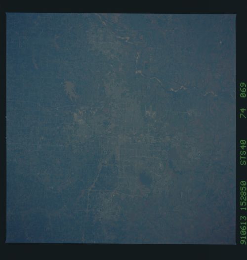
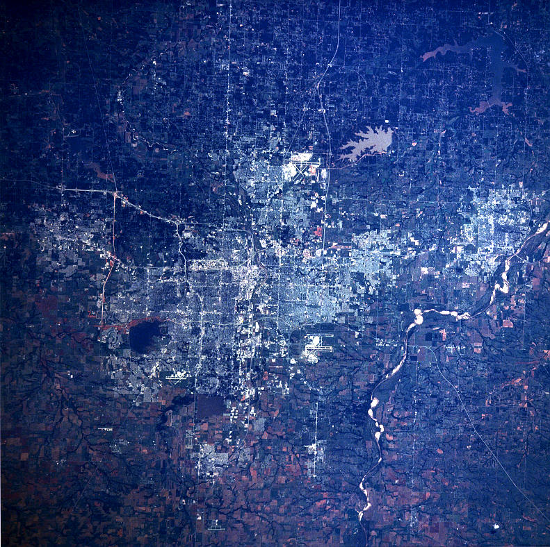
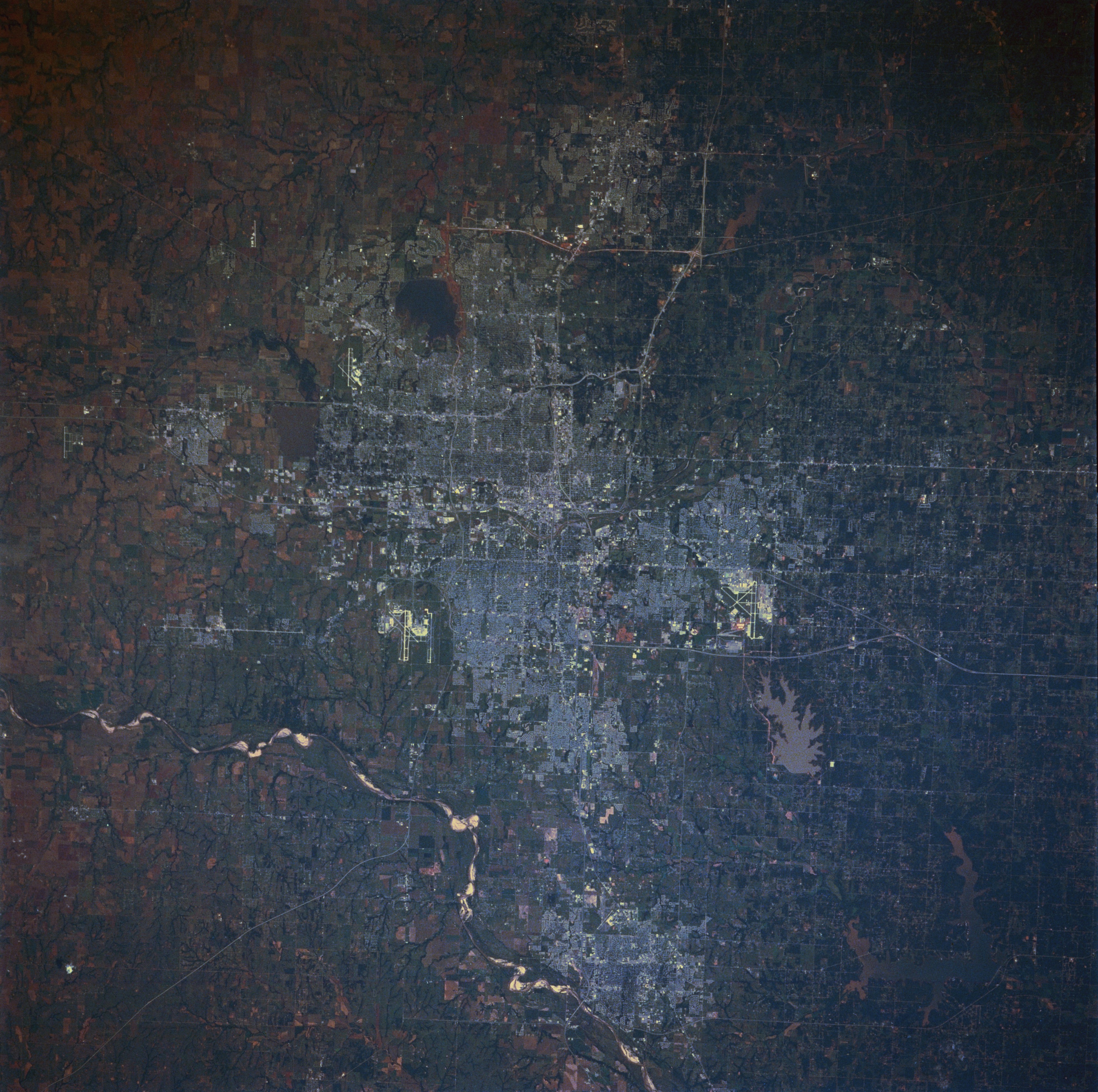
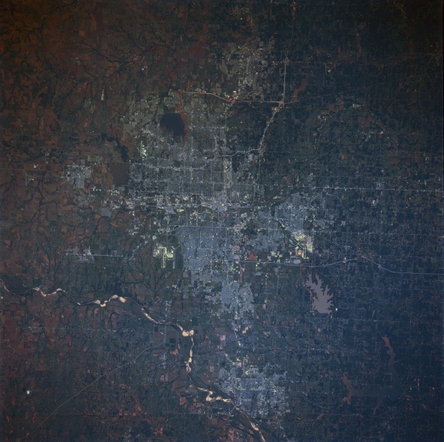
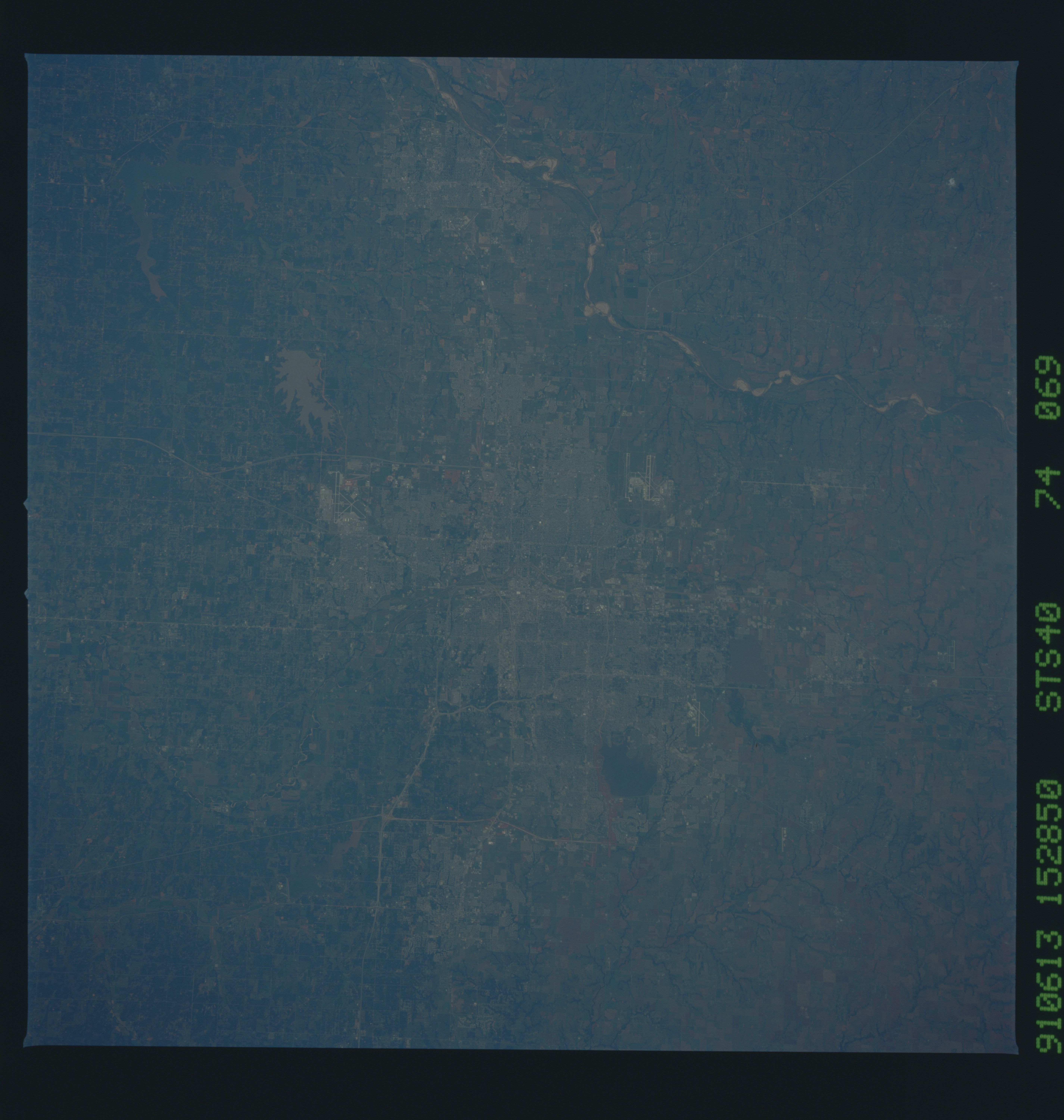
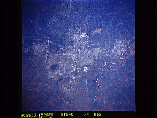
Image Caption: STS040-074-069 Oklahoma City and Norman, Oklahoma, U.S.A. June 1991
Oklahoma City, an important livestock market and Oklahoma's wholesale distribution center with numerous major highways traversing it, is captured in this very clear, near-vertical photograph. The city is situated in the middle of a large oil field, which was discovered in 1928. Oil wells are present, even on the capitol grounds. The city has a diverse industrial base, including large stockyards and meat-packing houses; grain mills; and plants for cotton processing, oil drilling equipment, steel products, computers, and aircraft manufacturing. Tinker Air Force Base (runways visible east-southeast of the city center), a logistics center with one of the world's largest air depots, is an important source of civilian employment. Southwest of downtown Oklahoma City, the runways of Will Rogers World Airport can be seen; the smaller airport in the northwestern part of the city is Wiley Post Airport. Many lakes and reservoirs surround the city; starting on the west side, they include Lake Hefner (southwest of Wiley Post Airport), Lake Overholster (northeast of Wiley Post Airport), sediment-laden Stanley Draper Lake (south of Tinker Air Force Base), and Lake Thunderbird (east of Norman). Norman, the home of the University of Oklahoma, is located on the northeast bank of the Canadian River south of Oklahoma City. Major products manufactured in Norman include air conditioners, packaged foods, and airplanes. Oklahoma City and Norman were settled in a land rush after the area was opened to homesteaders on April 22, 1889.
Oklahoma City, an important livestock market and Oklahoma's wholesale distribution center with numerous major highways traversing it, is captured in this very clear, near-vertical photograph. The city is situated in the middle of a large oil field, which was discovered in 1928. Oil wells are present, even on the capitol grounds. The city has a diverse industrial base, including large stockyards and meat-packing houses; grain mills; and plants for cotton processing, oil drilling equipment, steel products, computers, and aircraft manufacturing. Tinker Air Force Base (runways visible east-southeast of the city center), a logistics center with one of the world's largest air depots, is an important source of civilian employment. Southwest of downtown Oklahoma City, the runways of Will Rogers World Airport can be seen; the smaller airport in the northwestern part of the city is Wiley Post Airport. Many lakes and reservoirs surround the city; starting on the west side, they include Lake Hefner (southwest of Wiley Post Airport), Lake Overholster (northeast of Wiley Post Airport), sediment-laden Stanley Draper Lake (south of Tinker Air Force Base), and Lake Thunderbird (east of Norman). Norman, the home of the University of Oklahoma, is located on the northeast bank of the Canadian River south of Oklahoma City. Major products manufactured in Norman include air conditioners, packaged foods, and airplanes. Oklahoma City and Norman were settled in a land rush after the area was opened to homesteaders on April 22, 1889.
