STS040-74-2
| NASA Photo ID | STS040-74-2 |
| Focal Length | 250mm |
| Date taken | 1991.06.12 |
| Time taken | 09:21:53 GMT |
Resolutions offered for this image:
5329 x 5276 pixels 639 x 633 pixels 5700 x 6000 pixels 500 x 526 pixels 640 x 480 pixels
5329 x 5276 pixels 639 x 633 pixels 5700 x 6000 pixels 500 x 526 pixels 640 x 480 pixels
Cloud masks available for this image:
Spacecraft nadir point: 39.1° N, 26.3° W
Photo center point: 38.6° N, 28.4° W
Photo center point by machine learning:
Photo center point: 38.6° N, 28.4° W
Photo center point by machine learning:
Nadir to Photo Center: West
Spacecraft Altitude: 150 nautical miles (278km)
Country or Geographic Name: | AZORES |
Features: | PICO, FAIAL, SAO JORGE ISL |
| Features Found Using Machine Learning: | |
Cloud Cover Percentage: | 40 (26-50)% |
Sun Elevation Angle: | 32° |
Sun Azimuth: | 85° |
Camera: | Hasselblad |
Focal Length: | 250mm |
Camera Tilt: | 41 degrees |
Format: | 5017: Kodak, natural color positive, Ektachrome, X Professional, ASA 64, standard base |
Film Exposure: | Normal |
| Additional Information | |
| Width | Height | Annotated | Cropped | Purpose | Links |
|---|---|---|---|---|---|
| 5329 pixels | 5276 pixels | No | No | Earth From Space collection | Download Image |
| 639 pixels | 633 pixels | No | No | Earth From Space collection | Download Image |
| 5700 pixels | 6000 pixels | No | No | Download Image | |
| 500 pixels | 526 pixels | No | No | Download Image | |
| 640 pixels | 480 pixels | No | No | Download Image |
Download Packaged File
Download a Google Earth KML for this Image
View photo footprint information
Download a GeoTIFF for this photo
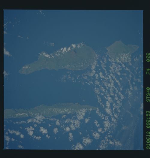
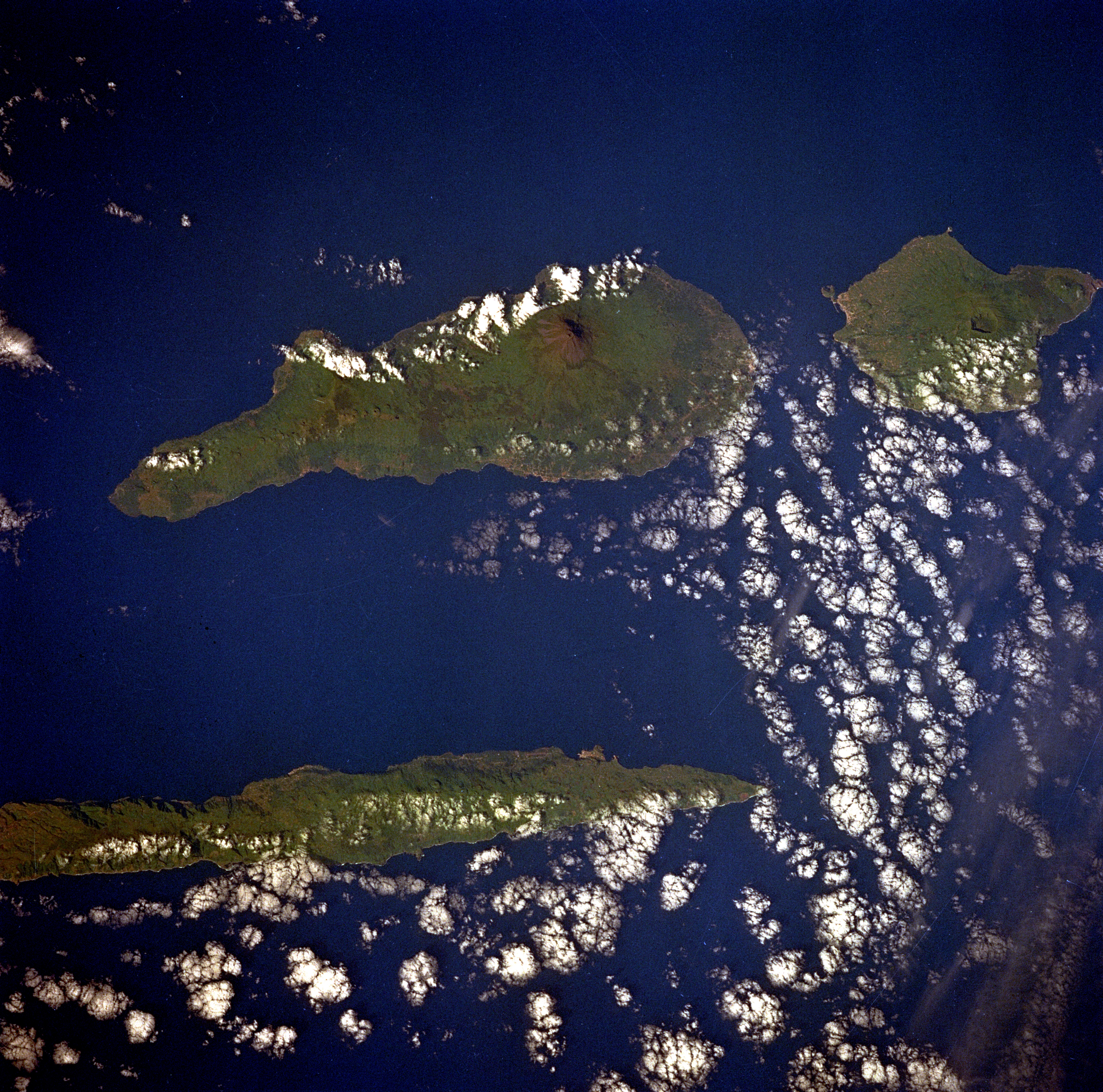
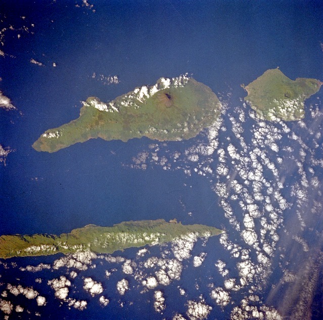
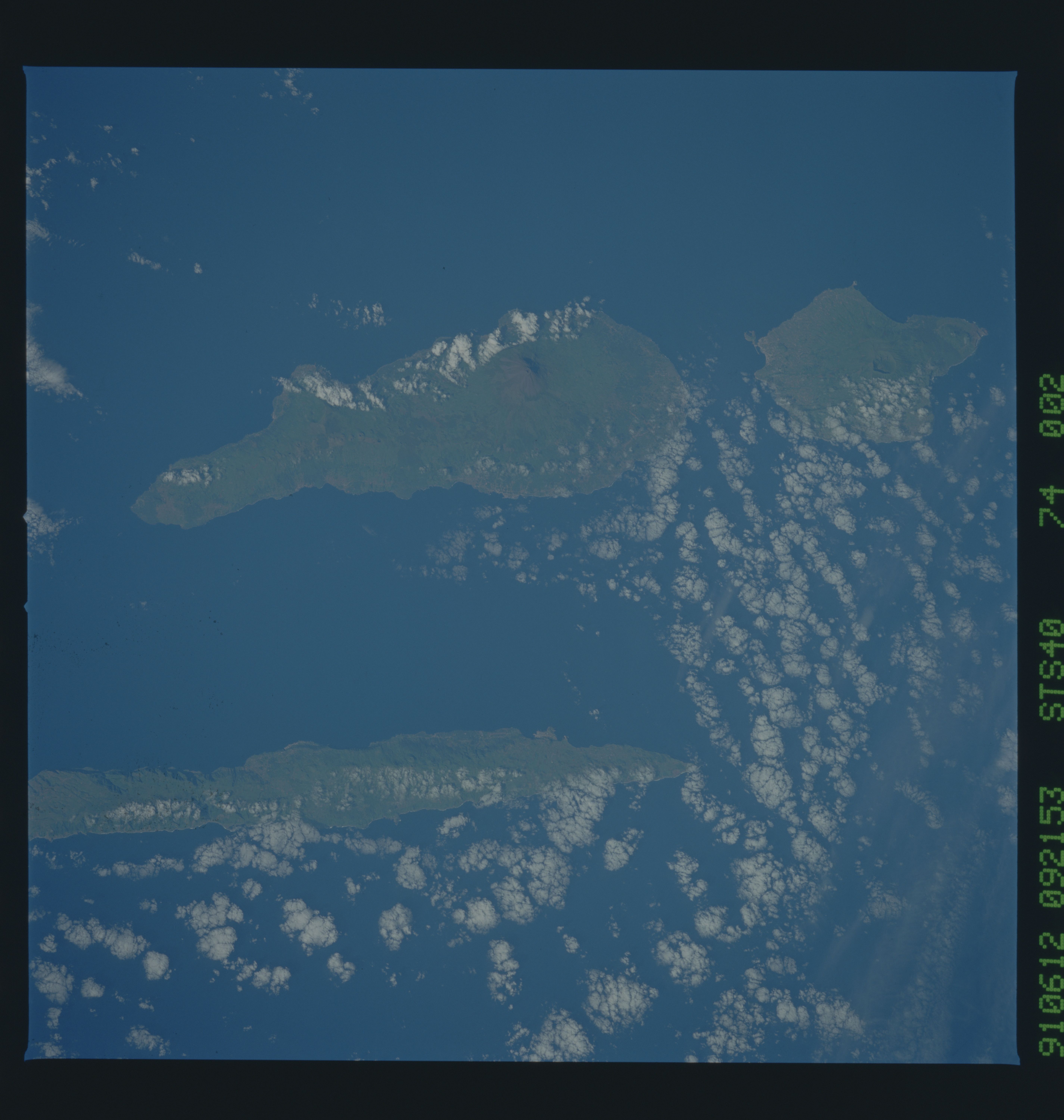
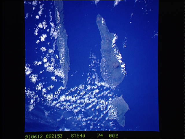
Image Caption: STS040-74-2 Azores, Atlantic Ocean June 1991
Three islands of the central Azores--spear-shaped Sao Jorge Island, Pico Island with its large volcano, and circular volcanic Faial Island--are visible in this low-oblique, southwest-looking photograph. The Azores, formed millions of years ago by vulcanism, have fertile soils that yield many crops, including pineapples, bananas, oranges, wine grapes, tobacco, tea, and grains. Fishing is an important industry, and tourism has increased since the 1960s. Sao Jorge Island covers an area of 85 square miles (220 square kilometers) and has a hilly, rolling terrain. On Pico Island [167 square miles (433 square kilometers)] is the large Pico Alto stratovolcano, the tallest point in the Azores at an altitude of 7711 feet (2352 meters). Pico Alto last erupted in 1720. Faial Island, another stratovolcano with a large caldera and a major rift zone, acquired new land on its west cape following explosive eruptions and lava flows just offshore in 1957 and 1958. Major lava flows from higher elevations in the same rift zone occurred in 1672.
Three islands of the central Azores--spear-shaped Sao Jorge Island, Pico Island with its large volcano, and circular volcanic Faial Island--are visible in this low-oblique, southwest-looking photograph. The Azores, formed millions of years ago by vulcanism, have fertile soils that yield many crops, including pineapples, bananas, oranges, wine grapes, tobacco, tea, and grains. Fishing is an important industry, and tourism has increased since the 1960s. Sao Jorge Island covers an area of 85 square miles (220 square kilometers) and has a hilly, rolling terrain. On Pico Island [167 square miles (433 square kilometers)] is the large Pico Alto stratovolcano, the tallest point in the Azores at an altitude of 7711 feet (2352 meters). Pico Alto last erupted in 1720. Faial Island, another stratovolcano with a large caldera and a major rift zone, acquired new land on its west cape following explosive eruptions and lava flows just offshore in 1957 and 1958. Major lava flows from higher elevations in the same rift zone occurred in 1672.
