STS040-74-1

| NASA Photo ID | STS040-74-1 |
| Focal Length | 250mm |
| Date taken | 1991.06.12 |
| Time taken | 09:21:27 GMT |

Cloud masks available for this image:
Spacecraft nadir point: 39.0° N, 28.5° W
Photo center point: 38.7° N, 27.2° W
Photo center point by machine learning:
Photo center point: 38.7° N, 27.2° W
Photo center point by machine learning:
Nadir to Photo Center: East
Spacecraft Altitude: 150 nautical miles (278km)
Country or Geographic Name: | AZORES |
Features: | TERCEIRA I, HALF CLD COV. |
| Features Found Using Machine Learning: | |
Cloud Cover Percentage: | 50 (26-50)% |
Sun Elevation Angle: | 30° |
Sun Azimuth: | 83° |
Camera: | Hasselblad |
Focal Length: | 250mm |
Camera Tilt: | 28 degrees |
Format: | 5017: Kodak, natural color positive, Ektachrome, X Professional, ASA 64, standard base |
Film Exposure: | Normal |
| Additional Information | |
| Width | Height | Annotated | Cropped | Purpose | Links |
|---|---|---|---|---|---|
| 5700 pixels | 6000 pixels | No | No | Download Image | |
| 500 pixels | 526 pixels | No | No | Download Image | |
| 640 pixels | 480 pixels | No | No | Download Image |
Download Packaged File
Download a Google Earth KML for this Image
View photo footprint information
Download a GeoTIFF for this photo
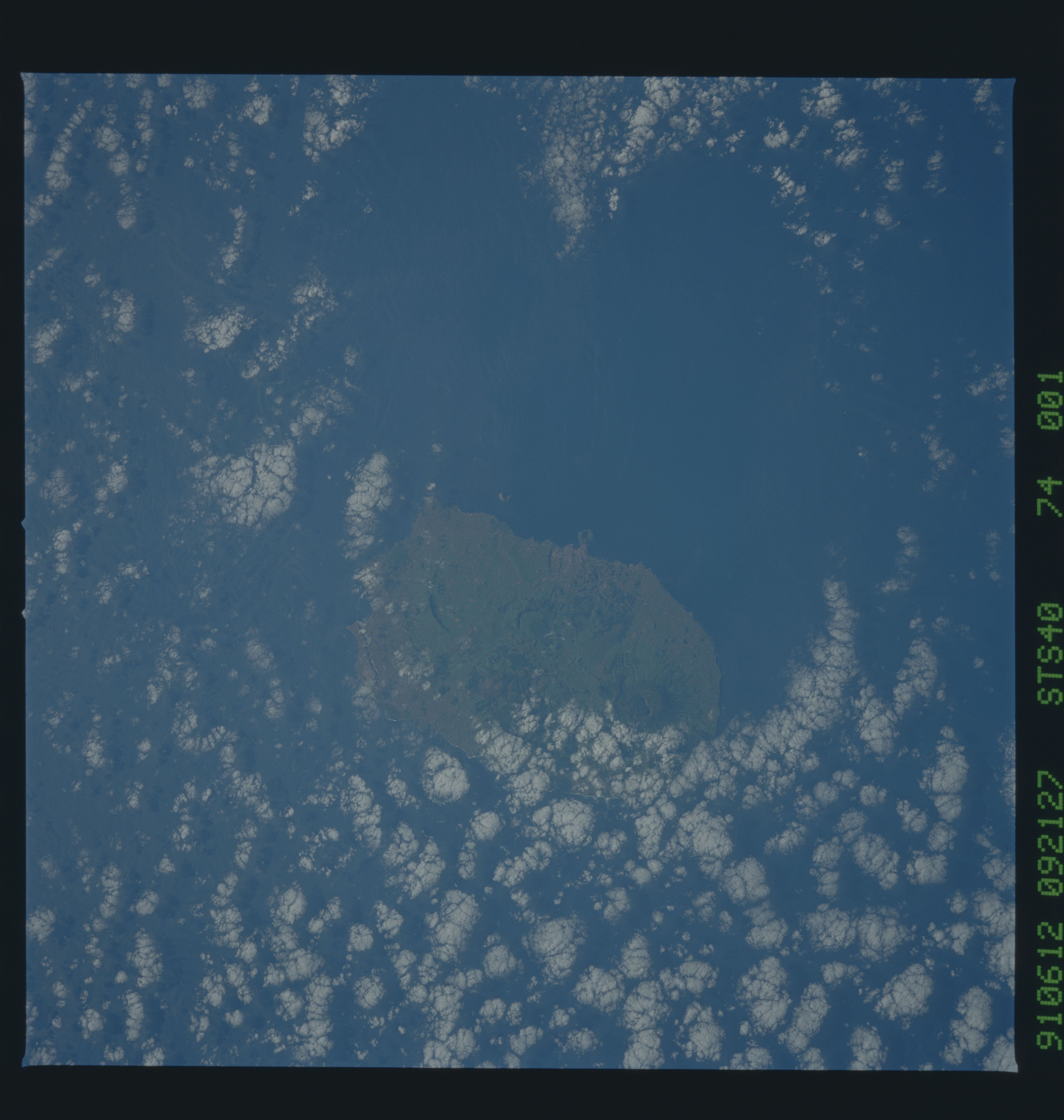
Image Caption: STS040-74-1: Terceira Island, Azores
These are first-ever photographs of the central Azores. Like Hawaii, the Azores result from a deep-seated hot spot. Like Iceland, the hot spot sits near the mid-ocean ridge in the Atlantic (Mid-Atlantic Spreading Center). Since Iceland will never be photographed, the Azores are the best example of this phenomenon. They also stride a major east-west fracture zone from the mid-Atlantic ridge. The trend of the islands (roughly ESE) and the arrangement of volcanic edifices on the islands demonstrate the influence of this deep structure on the distribution of volcanoes. Terceira boasts two large calderas and several fault scarps from earlier calderas, as well as many cinder cones.
These are first-ever photographs of the central Azores. Like Hawaii, the Azores result from a deep-seated hot spot. Like Iceland, the hot spot sits near the mid-ocean ridge in the Atlantic (Mid-Atlantic Spreading Center). Since Iceland will never be photographed, the Azores are the best example of this phenomenon. They also stride a major east-west fracture zone from the mid-Atlantic ridge. The trend of the islands (roughly ESE) and the arrangement of volcanic edifices on the islands demonstrate the influence of this deep structure on the distribution of volcanoes. Terceira boasts two large calderas and several fault scarps from earlier calderas, as well as many cinder cones.
