STS040-73-85
| NASA Photo ID | STS040-73-85 |
| Focal Length | 50mm |
| Date taken | 1991.06.06 |
| Time taken | 09:19:49 GMT |
Resolutions offered for this image:
5145 x 4425 pixels 639 x 550 pixels 5700 x 6000 pixels 500 x 526 pixels 640 x 480 pixels
5145 x 4425 pixels 639 x 550 pixels 5700 x 6000 pixels 500 x 526 pixels 640 x 480 pixels


Cloud masks available for this image:
Spacecraft nadir point: 32.6° N, 61.6° E
Photo center point: 28.0° N, 59.0° E
Photo center point by machine learning:
Photo center point: 28.0° N, 59.0° E
Photo center point by machine learning:
Nadir to Photo Center: Southwest
Spacecraft Altitude: 159 nautical miles (294km)
Country or Geographic Name: | IRAN |
Features: | PERSIAN G, HORMUZ STR. |
| Features Found Using Machine Learning: | |
Cloud Cover Percentage: | 0 (no clouds present) |
Sun Elevation Angle: | 68° |
Sun Azimuth: | 248° |
Camera: | Hasselblad |
Focal Length: | 50mm |
Camera Tilt: | High Oblique |
Format: | 5017: Kodak, natural color positive, Ektachrome, X Professional, ASA 64, standard base |
Film Exposure: | Normal |
| Additional Information | |
| Width | Height | Annotated | Cropped | Purpose | Links |
|---|---|---|---|---|---|
| 5145 pixels | 4425 pixels | No | No | Earth From Space collection | Download Image |
| 639 pixels | 550 pixels | No | No | Earth From Space collection | Download Image |
| 5700 pixels | 6000 pixels | No | No | Download Image | |
| 500 pixels | 526 pixels | No | No | Download Image | |
| 640 pixels | 480 pixels | No | No | Download Image |
Download Packaged File
Download a Google Earth KML for this Image
View photo footprint information
Download a GeoTIFF for this photo
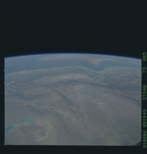
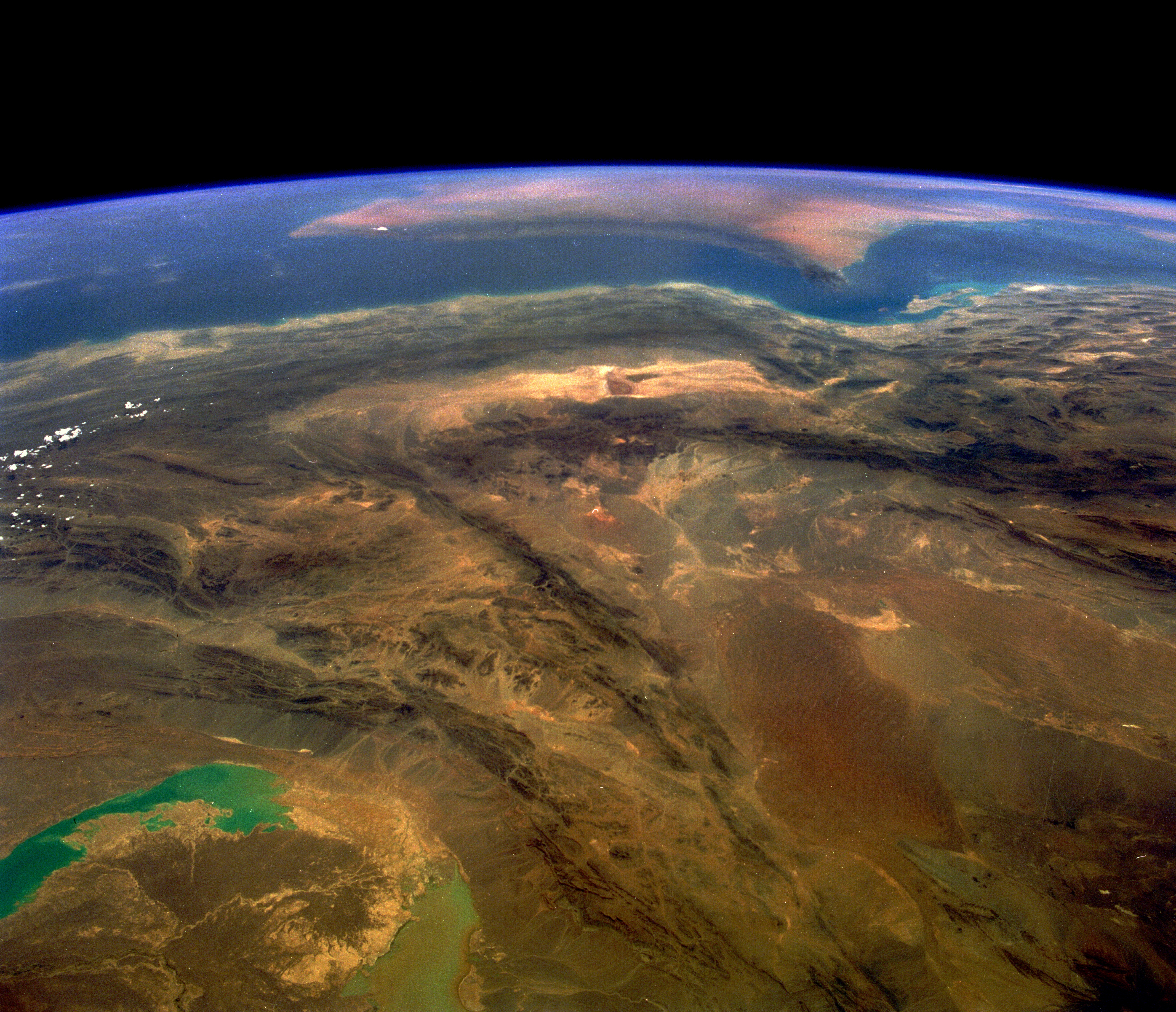
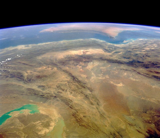
Image Caption: STS040-073-085 Southwest Iran June 1991
This southwest-looking photograph toward the Strait of Hormuz and the southeastern tip of the Saudi Arabian Peninsula (visible near the horizon) shows a rugged, arid landscape of unusually dry basins and formidable mountain ranges. The large U-shaped basin toward the northwest is part of the Shahdab Salt Desert, and the smaller east-west trending, southern basin is the Murian Marsh Basin. The basins and valleys, usually identifiable by light colors, contain many salt flats and wide expanses of stone. The southern end of the folded Zagros Mountains edging western Iran is visible in the western section of the photograph. The bluish and milky lakes in the northeast corner are normally dry lake beds in the southwest corner of Afghanistan, with numerous alluvial fans along the eastern flanks of the mountains immediately southwest of the lakes.
This southwest-looking photograph toward the Strait of Hormuz and the southeastern tip of the Saudi Arabian Peninsula (visible near the horizon) shows a rugged, arid landscape of unusually dry basins and formidable mountain ranges. The large U-shaped basin toward the northwest is part of the Shahdab Salt Desert, and the smaller east-west trending, southern basin is the Murian Marsh Basin. The basins and valleys, usually identifiable by light colors, contain many salt flats and wide expanses of stone. The southern end of the folded Zagros Mountains edging western Iran is visible in the western section of the photograph. The bluish and milky lakes in the northeast corner are normally dry lake beds in the southwest corner of Afghanistan, with numerous alluvial fans along the eastern flanks of the mountains immediately southwest of the lakes.
