STS040-72-54
| NASA Photo ID | STS040-72-54 |
| Focal Length | 250mm |
| Date taken | 1991.06.07 |
| Time taken | 00:10:38 GMT |
Resolutions offered for this image:
4048 x 4048 pixels 639 x 639 pixels 5700 x 6000 pixels 500 x 526 pixels 640 x 480 pixels
4048 x 4048 pixels 639 x 639 pixels 5700 x 6000 pixels 500 x 526 pixels 640 x 480 pixels

Cloud masks available for this image:
Spacecraft nadir point: 38.1° N, 141.1° E
Photo center point: 39.9° N, 140.0° E
Photo center point by machine learning:
Photo center point: 39.9° N, 140.0° E
Photo center point by machine learning:
Nadir to Photo Center: Northwest
Spacecraft Altitude: 155 nautical miles (287km)
Camera: | Hasselblad |
Focal Length: | 250mm |
Camera Tilt: | 39 degrees |
Format: | 5017: Kodak, natural color positive, Ektachrome, X Professional, ASA 64, standard base |
Film Exposure: | Normal |
| Additional Information | |
| Width | Height | Annotated | Cropped | Purpose | Links |
|---|---|---|---|---|---|
| 4048 pixels | 4048 pixels | No | No | Earth From Space collection | Download Image |
| 639 pixels | 639 pixels | No | No | Earth From Space collection | Download Image |
| 5700 pixels | 6000 pixels | No | No | Download Image | |
| 500 pixels | 526 pixels | No | No | Download Image | |
| 640 pixels | 480 pixels | No | No | Download Image |
Download Packaged File
Download a Google Earth KML for this Image
View photo footprint information
Download a GeoTIFF for this photo
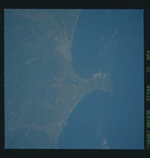
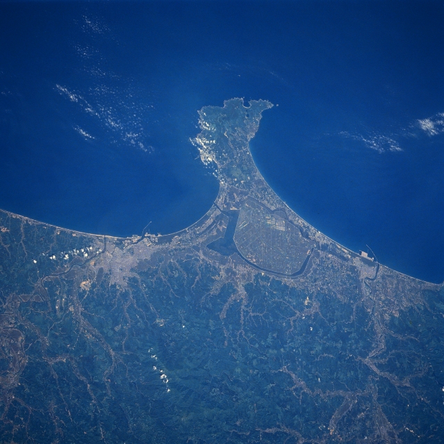
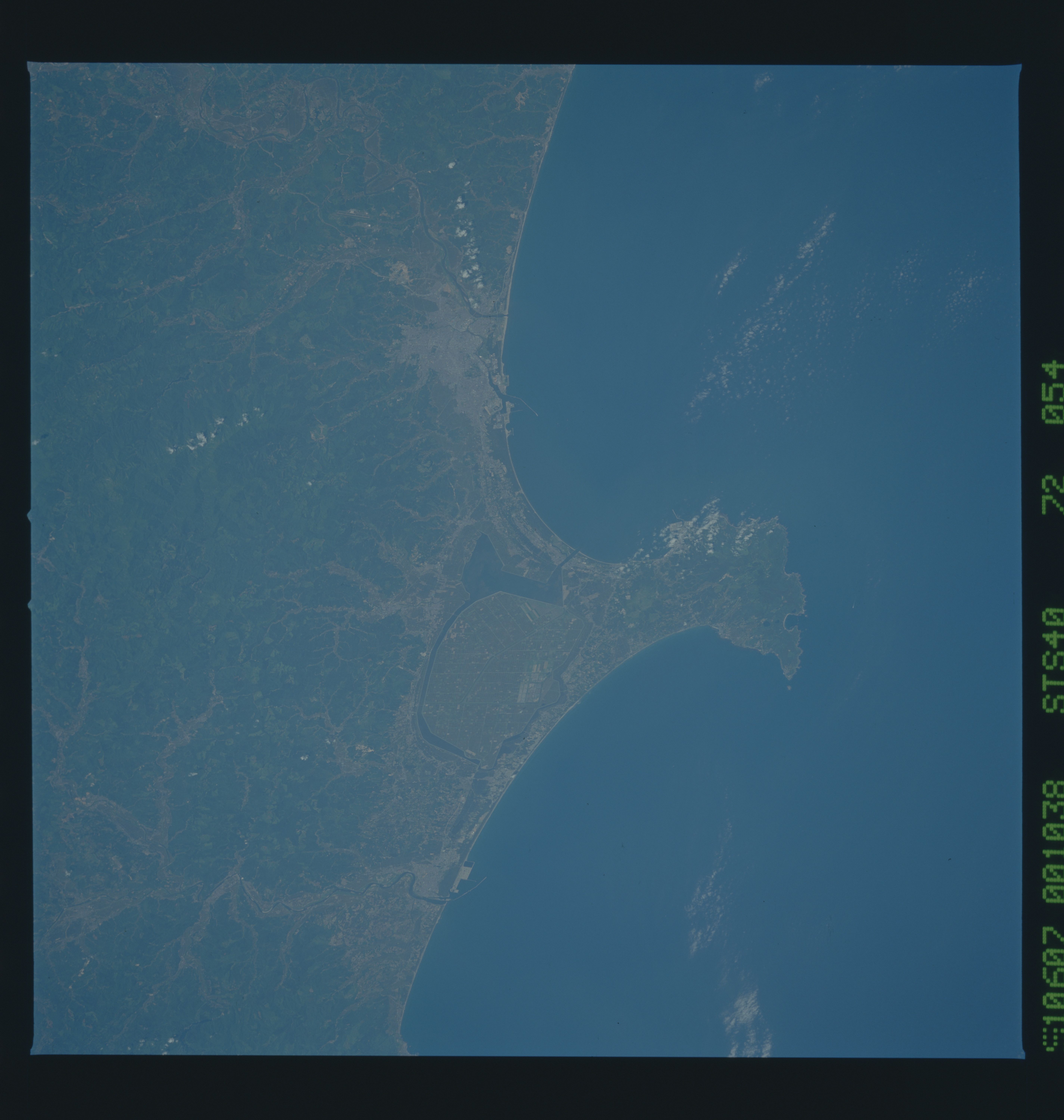
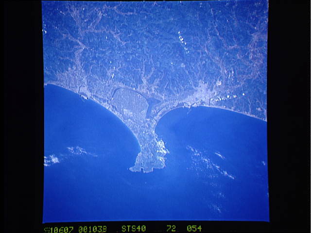
Image Caption: STS040-072-054 Akita Area, Honshu, Japan June 1991
The Oga Peninsula juts westward into the Sea of Japan along this part of the northwest coast of Honshu Island. Along the eastern neck of the peninsula, an intensive farming region known as Ogata-village can be identified (uniform color with a series of intersecting, light-colored lines). This site has been established as a model farm management project with a new style of agricultural society. The fertile soils of the Ogata-village region have been derived by reclaiming land from Lake Hachirogata, the oval, dark-feature that encircles the intensively cultivated project. Lake Hachirogata has a channel that connects the lake with the Sea of Japan. The coastal city of Akita is the concentrated, lighter-colored area south of the peninsula (Yoneshiro River). The western edge of the north-south aligned Ou Mountains (darker, heavily wooded landscape) dominates the bottom of the image.
The Oga Peninsula juts westward into the Sea of Japan along this part of the northwest coast of Honshu Island. Along the eastern neck of the peninsula, an intensive farming region known as Ogata-village can be identified (uniform color with a series of intersecting, light-colored lines). This site has been established as a model farm management project with a new style of agricultural society. The fertile soils of the Ogata-village region have been derived by reclaiming land from Lake Hachirogata, the oval, dark-feature that encircles the intensively cultivated project. Lake Hachirogata has a channel that connects the lake with the Sea of Japan. The coastal city of Akita is the concentrated, lighter-colored area south of the peninsula (Yoneshiro River). The western edge of the north-south aligned Ou Mountains (darker, heavily wooded landscape) dominates the bottom of the image.
