STS040-72-24
| NASA Photo ID | STS040-72-24 |
| Focal Length | 250mm |
| Date taken | 1991.06.06 |
| Time taken | 16:43:33 GMT |
Resolutions offered for this image:
3904 x 3874 pixels 639 x 635 pixels 5700 x 6000 pixels 500 x 526 pixels 640 x 480 pixels
3904 x 3874 pixels 639 x 635 pixels 5700 x 6000 pixels 500 x 526 pixels 640 x 480 pixels


Cloud masks available for this image:
Spacecraft nadir point: 39.1° N, 86.0° W
Photo center point: 39.1° N, 86.4° W
Photo center point by machine learning:
Photo center point: 39.1° N, 86.4° W
Photo center point by machine learning:
Nadir to Photo Center: West
Spacecraft Altitude: 156 nautical miles (289km)
Country or Geographic Name: | USA-INDIANA |
Features: | BLOOMINGTON, MONROE RES. |
| Features Found Using Machine Learning: | |
Cloud Cover Percentage: | 5 (1-10)% |
Sun Elevation Angle: | 69° |
Sun Azimuth: | 137° |
Camera: | Hasselblad |
Focal Length: | 250mm |
Camera Tilt: | 9 degrees |
Format: | 5017: Kodak, natural color positive, Ektachrome, X Professional, ASA 64, standard base |
Film Exposure: | Normal |
| Additional Information | |
| Width | Height | Annotated | Cropped | Purpose | Links |
|---|---|---|---|---|---|
| 3904 pixels | 3874 pixels | No | No | Earth From Space collection | Download Image |
| 639 pixels | 635 pixels | No | No | Earth From Space collection | Download Image |
| 5700 pixels | 6000 pixels | No | No | Download Image | |
| 500 pixels | 526 pixels | No | No | Download Image | |
| 640 pixels | 480 pixels | No | No | Download Image |
Download Packaged File
Download a Google Earth KML for this Image
View photo footprint information
Download a GeoTIFF for this photo
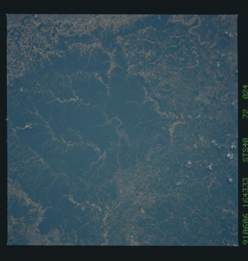
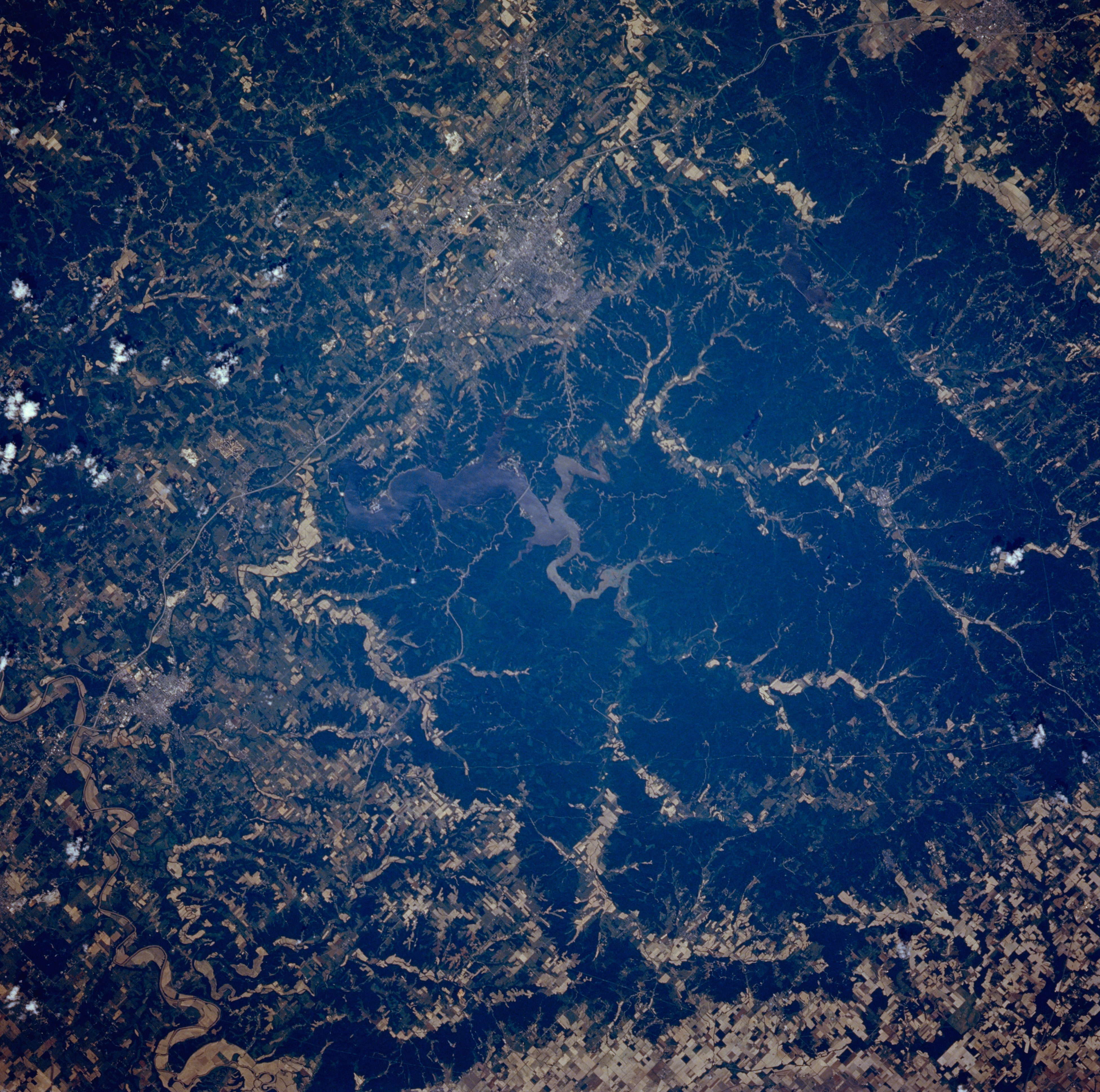
Image Caption: STS040-072-024 Monroe Lake and Bloomington, Indiana, U.S.A. June 1991
Within the woodlands of Hoosier National Forest, sediment-laden Monroe Lake (center of photograph), the largest lake in Indiana, is featured in this northwest-looking, low-oblique photograph. Near the lake are Bloomington, home of the University of Indiana, to the northwest and Bedford, noted for its limestone that is shipped worldwide, to the south (below left center). The floodplain of the East Fork White River (bottom left) is discernible southeast of the lake. The terrain of the region is hilly with forests, scattered agricultural areas, and abundant limestone.
Within the woodlands of Hoosier National Forest, sediment-laden Monroe Lake (center of photograph), the largest lake in Indiana, is featured in this northwest-looking, low-oblique photograph. Near the lake are Bloomington, home of the University of Indiana, to the northwest and Bedford, noted for its limestone that is shipped worldwide, to the south (below left center). The floodplain of the East Fork White River (bottom left) is discernible southeast of the lake. The terrain of the region is hilly with forests, scattered agricultural areas, and abundant limestone.
