STS040-614-46
| NASA Photo ID | STS040-614-46 |
| Focal Length | 250mm |
| Date taken | 1991.06.__ |
| Time taken | GMT |
Cloud masks available for this image:
Spacecraft nadir point:
Photo center point: 37.0° N, 76.0° W
Photo center point by machine learning:
Photo center point: 37.0° N, 76.0° W
Photo center point by machine learning:
Nadir to Photo Center:
Spacecraft Altitude: nautical miles (0km)
Country or Geographic Name: | USA-VIRGINIA |
Features: | NORFOLK, DELMARVA PEN. |
| Features Found Using Machine Learning: | |
Cloud Cover Percentage: | 0 (no clouds present) |
Sun Elevation Angle: | ° |
Sun Azimuth: | ° |
Camera: | Rolleiflex |
Focal Length: | 250mm |
Camera Tilt: | Low Oblique |
Format: | 5017: Kodak, natural color positive, Ektachrome, X Professional, ASA 64, standard base |
Film Exposure: | Normal |
| Additional Information | |
| Width | Height | Annotated | Cropped | Purpose | Links |
|---|---|---|---|---|---|
| 5700 pixels | 6000 pixels | No | No | Download Image | |
| 500 pixels | 526 pixels | No | No | Download Image | |
| 640 pixels | 480 pixels | No | No | Download Image |
Download Packaged File
Download a Google Earth KML for this Image
View photo footprint information
Download a GeoTIFF for this photo
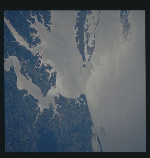
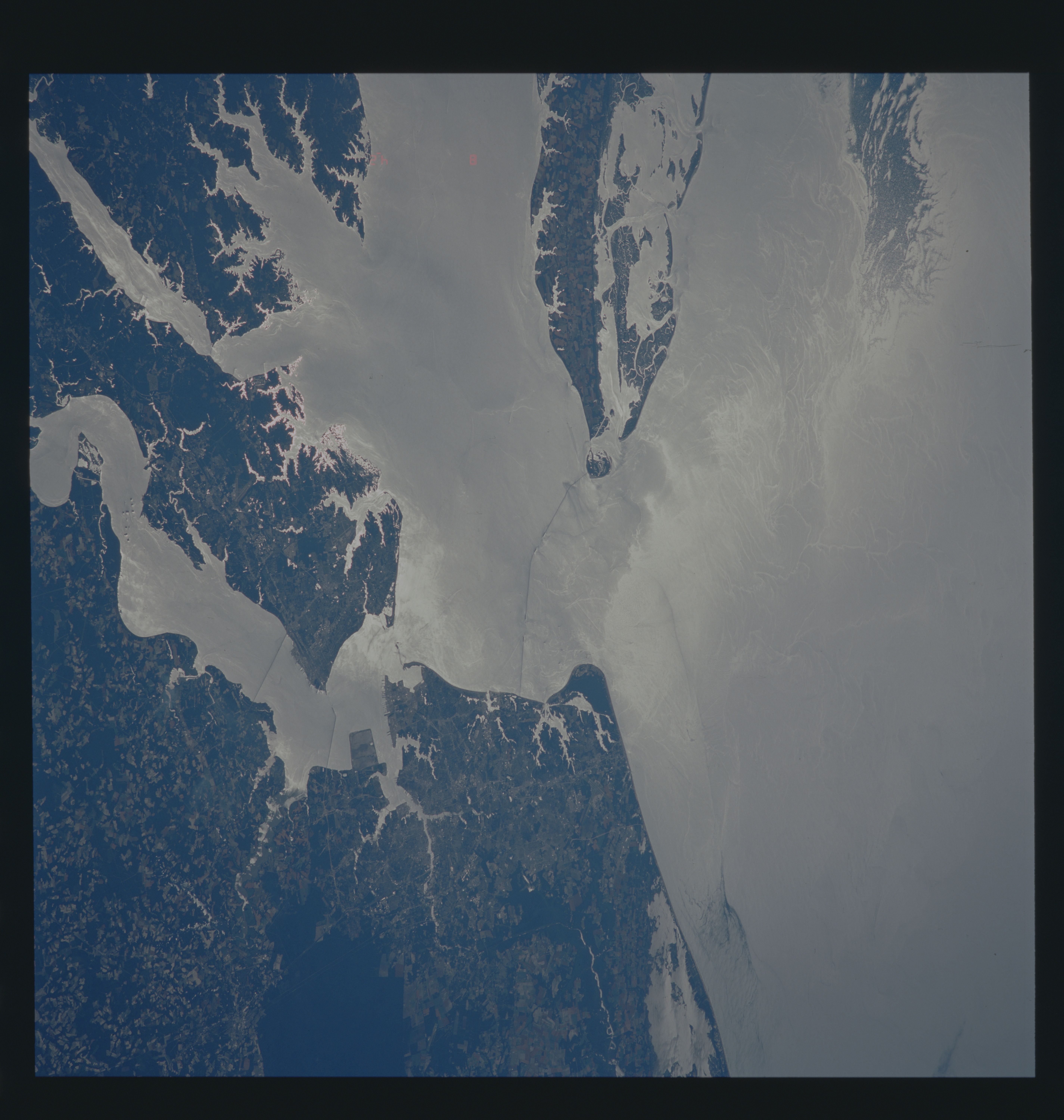
Image Caption: Sunglint on Chesapeake Bay
In this photograph of the lower Chesapeake Bay and adjacent
coastal waters of the Atlantic Ocean, glint-roughness and
color variation patterns provide a graphic demonstration of
surface layer complexities and inferred
oceanographic/atmospheric processes. Glint patterns are the
result of Sun reflections off small-scale surface waves,
whose spatial distribution is determined by a variety of
ocean-air boundary layer interactions. Color changes are
related to bio-optic variability in regional water masses.
The photo was taken at midday on June 8, 1991, on an
ebbing tide by the STS-40 space shuttle crew from an
altitude of 196 km (106 nm). The film was underexposed to
show details in the bright sunglint. As a result, land
areas appear dark.
The enhanced land/water boundary reveals the intricate
structure of the tidal dominated salt marshes along
Virginia's Eastern Shore. The broader bright areas are
tide-covered flats. Spanning the mouth of the Chesapeake
Bay is the Chesapeake Bay Bridge/Tunnel.
Complex surface roughness patterns are especially visible
in the coastal waters off the Eastern Shore, where the
central sunglint area displays slicks of concentrated oils
(surfactants). Numerous swirls and eddies indicative of
surface and subsurface ocean processes are outlined in these
patterns. The large sunglint streak (upper right) suggests
that cool northern Middle Atlantic Bight Water had
penetrated southward and, by altering the atmospheric
boundary layer's stability, reduced local wind stress. This
produced a relatively smoother water surface, creating an
outline of the jet-like structure.
Farther south, a plume flowing from Chesapeake Bay extends
southward along Virginia Beach. A strong front (dashed
lines in sketch) separates the fresher bay water within the
plume from the more saline ocean water. Although this
southerly plume extension is a common occurrence, the
northern edge of the plume is less understood. This
photograph shows evidence of a complex interaction in the
area between the plume and the immediate shelf waters. This
may be due to the periodic shifts in the strength and
direction of the tidal current. Several ship wakes can
clearly be seen in the highly intriguing smooth patch lying
just outside the bay entrance. (Paul E LaViolette,
Mississippi State University Research Center: Donald R.
Johnson, Naval Oceanographic and Atmospheric Research
Laboratory; and Steven G. Ackleson, Lockheed Engineering and
Science Company.)
