STS040-613-49
| NASA Photo ID | STS040-613-49 |
| Focal Length | 100mm |
| Date taken | 1991.06.__ |
| Time taken | GMT |
Resolutions offered for this image:
5700 x 6000 pixels 500 x 526 pixels 640 x 480 pixels 2400 x 2400 pixels 4064 x 4064 pixels 640 x 640 pixels
5700 x 6000 pixels 500 x 526 pixels 640 x 480 pixels 2400 x 2400 pixels 4064 x 4064 pixels 640 x 640 pixels


Cloud masks available for this image:
Spacecraft nadir point:
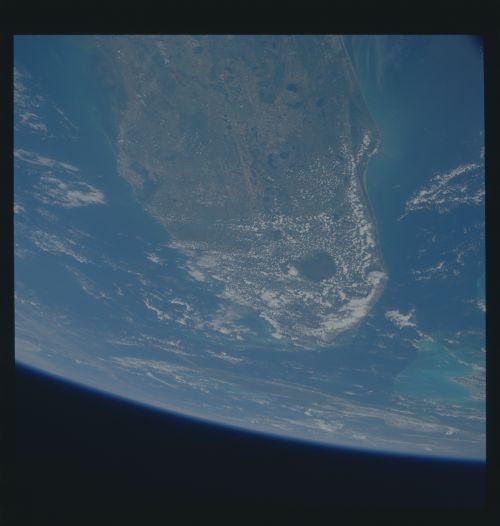
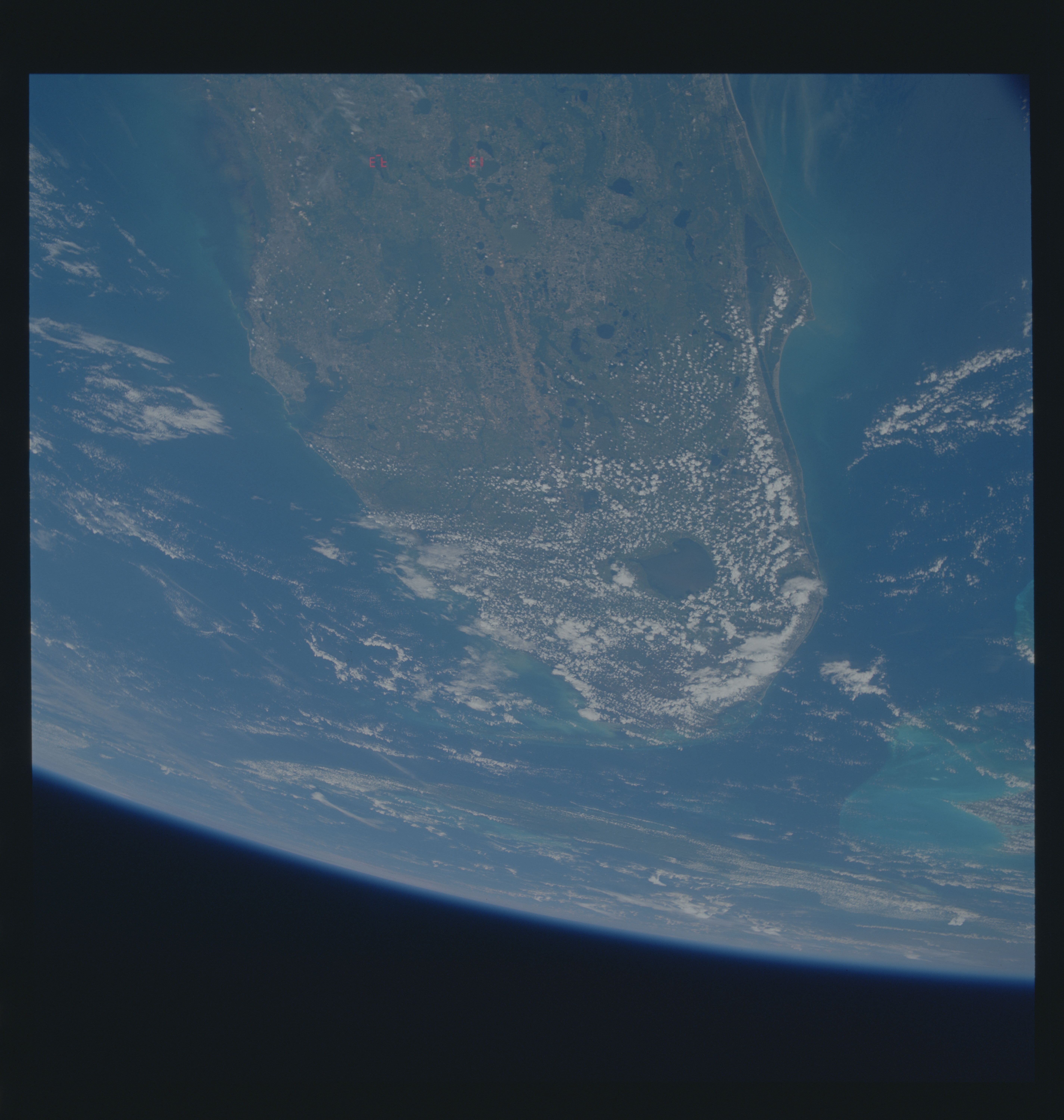
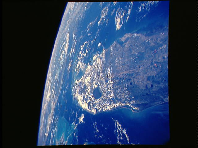
Photo center point: 27.0° N, 81.0° W
Photo center point by machine learning:
Photo center point: 27.0° N, 81.0° W
Photo center point by machine learning:
Nadir to Photo Center:
Spacecraft Altitude: nautical miles (0km)
Country or Geographic Name: | USA-FLORIDA |
Features: | SOUTH, CENTRAL FLORIDA |
| Features Found Using Machine Learning: | |
Cloud Cover Percentage: | 25 (11-25)% |
Sun Elevation Angle: | ° |
Sun Azimuth: | ° |
Camera: | Rolleiflex |
Focal Length: | 100mm |
Camera Tilt: | High Oblique |
Format: | 5017: Kodak, natural color positive, Ektachrome, X Professional, ASA 64, standard base |
Film Exposure: | Normal |
| Additional Information | |
| Width | Height | Annotated | Cropped | Purpose | Links |
|---|---|---|---|---|---|
| 5700 pixels | 6000 pixels | No | No | Download Image | |
| 500 pixels | 526 pixels | No | No | Download Image | |
| 640 pixels | 480 pixels | No | No | Download Image | |
| 2400 pixels | 2400 pixels | No | No | Download Image | |
| 4064 pixels | 4064 pixels | No | No | Download Image | |
| 640 pixels | 640 pixels | No | No | Download Image |
Download Packaged File
Download a Google Earth KML for this Image
View photo footprint information
Download a GeoTIFF for this photo
Image Caption: In this view of Florida (27.0N, 81.0W) looking south, Cape Canaveral and part of the Kennedy Space Center launch complex can be seen, under cloud cover, on the Atlantic coast. Note the meteorological effect of clouds over the land mass but not over water bodies such as Lake Okeechobee. Cuba is near the edge of the image as are the Bahama Banks. The effects of a downcoast current can be observed bringing turbid water offshore to Cape Canaveral.
