STS040-610-28
| NASA Photo ID | STS040-610-28 |
| Focal Length | 100mm |
| Date taken | 1991.06.__ |
| Time taken | GMT |
Resolutions offered for this image:
4096 x 4096 pixels 640 x 640 pixels 5700 x 6000 pixels 500 x 526 pixels 640 x 480 pixels
4096 x 4096 pixels 640 x 640 pixels 5700 x 6000 pixels 500 x 526 pixels 640 x 480 pixels

Cloud masks available for this image:
Spacecraft nadir point:
Photo center point: 40.0° N, 140.0° E
Photo center point by machine learning:
Photo center point: 40.0° N, 140.0° E
Photo center point by machine learning:
Nadir to Photo Center:
Spacecraft Altitude: nautical miles (0km)
Country or Geographic Name: | JAPAN |
Features: | N. HONSHU, TSUGARN STR. |
| Features Found Using Machine Learning: | |
Cloud Cover Percentage: | 0 (no clouds present) |
Sun Elevation Angle: | ° |
Sun Azimuth: | ° |
Camera: | Rolleiflex |
Focal Length: | 100mm |
Camera Tilt: | Low Oblique |
Format: | 5017: Kodak, natural color positive, Ektachrome, X Professional, ASA 64, standard base |
Film Exposure: | Normal |
| Additional Information | |
| Width | Height | Annotated | Cropped | Purpose | Links |
|---|---|---|---|---|---|
| 4096 pixels | 4096 pixels | No | No | Earth From Space collection | Download Image |
| 640 pixels | 640 pixels | No | No | Earth From Space collection | Download Image |
| 5700 pixels | 6000 pixels | No | No | Download Image | |
| 500 pixels | 526 pixels | No | No | Download Image | |
| 640 pixels | 480 pixels | No | No | Download Image |
Download Packaged File
Download a Google Earth KML for this Image
View photo footprint information
Download a GeoTIFF for this photo
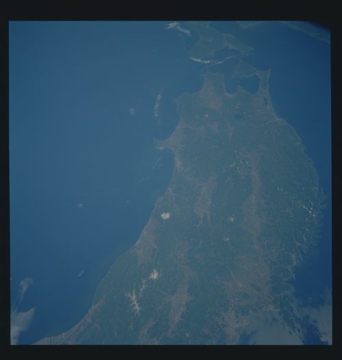
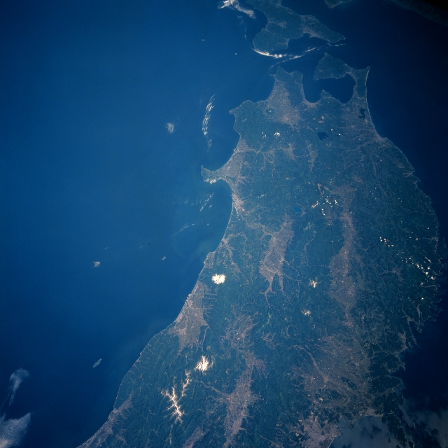
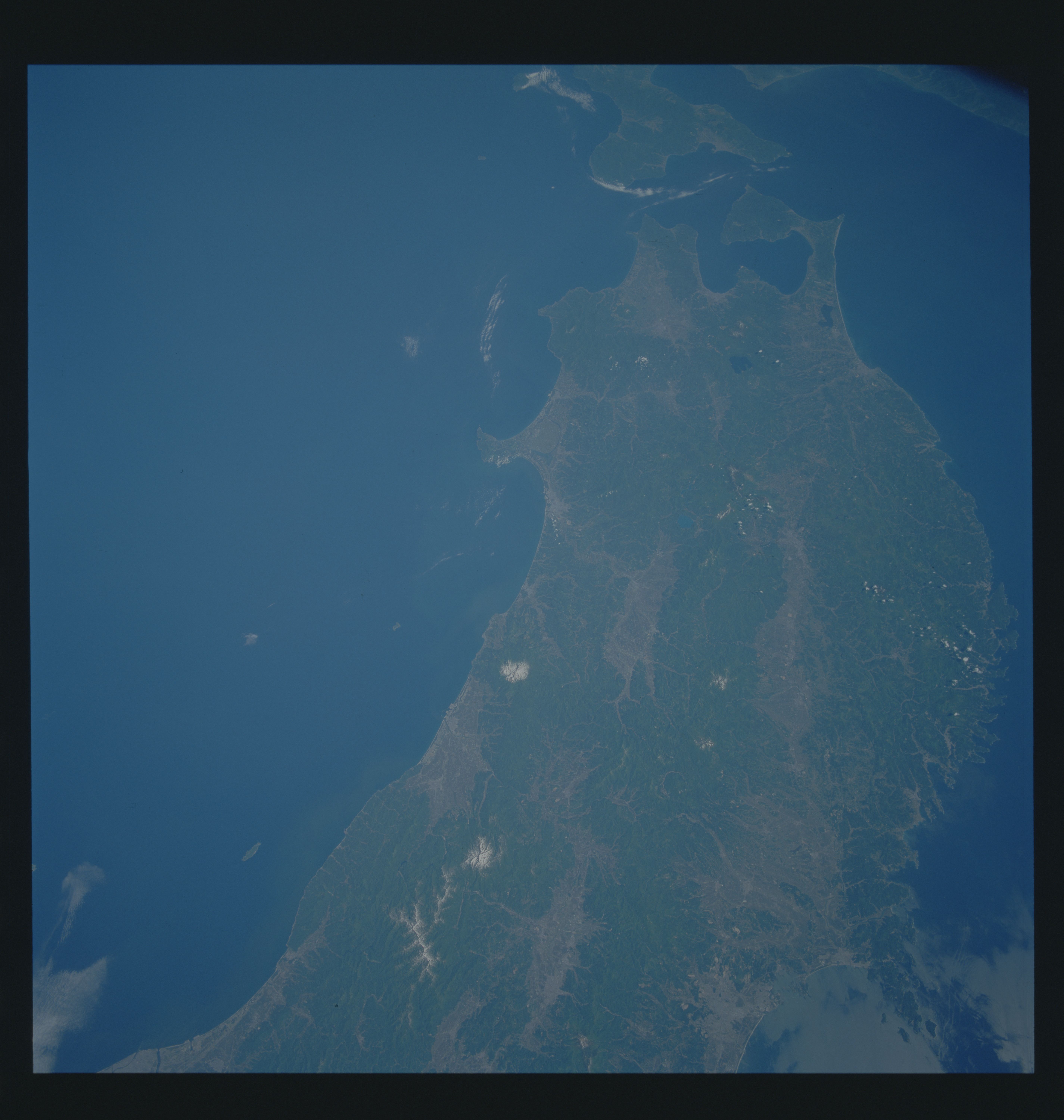
Image Caption: STS040-610-028 Northern Honshu, Japan June 1991
The physical landscapes of the northern end of Honshu Island are visible in this north-looking, synoptic view. The north-south coverage extends from the Sendai Plain (lighter-colored area, bottom right) along the southern coast to beyond the Tsuruga Strait, which separates northern Honshu from Hokkaido Island (top center). The limited amount of intermontane valleys and coastal plains are easy to identify as the lighter-colored areas in the image. The overwhelming, darker terrain shows the extensiveness of the forested mountains that dominate the scene. The image provides a vivid reminder that in Japan only about 20 percent of the land is suitable for human habitation or agriculture. The two white spots near the west coast of Honshu are dormant, snow-capped volcanic peaks- Mt. Chokai (north) at 7317 feet (2230 meters) above sea level and Mt. Gassan (more southerly) at 6496 feet (1980 meters) above sea level.
The physical landscapes of the northern end of Honshu Island are visible in this north-looking, synoptic view. The north-south coverage extends from the Sendai Plain (lighter-colored area, bottom right) along the southern coast to beyond the Tsuruga Strait, which separates northern Honshu from Hokkaido Island (top center). The limited amount of intermontane valleys and coastal plains are easy to identify as the lighter-colored areas in the image. The overwhelming, darker terrain shows the extensiveness of the forested mountains that dominate the scene. The image provides a vivid reminder that in Japan only about 20 percent of the land is suitable for human habitation or agriculture. The two white spots near the west coast of Honshu are dormant, snow-capped volcanic peaks- Mt. Chokai (north) at 7317 feet (2230 meters) above sea level and Mt. Gassan (more southerly) at 6496 feet (1980 meters) above sea level.
