STS040-609-43
| NASA Photo ID | STS040-609-43 |
| Focal Length | 100mm |
| Date taken | 1991.06.__ |
| Time taken | GMT |
Resolutions offered for this image:
3936 x 3872 pixels 639 x 629 pixels 5700 x 6000 pixels 500 x 526 pixels 640 x 480 pixels
3936 x 3872 pixels 639 x 629 pixels 5700 x 6000 pixels 500 x 526 pixels 640 x 480 pixels

Cloud masks available for this image:
Spacecraft nadir point:
Photo center point: 36.0° N, 117.0° W
Photo center point by machine learning:
Photo center point: 36.0° N, 117.0° W
Photo center point by machine learning:
Nadir to Photo Center:
Spacecraft Altitude: nautical miles (0km)
Country or Geographic Name: | USA-CALIFORNIA |
Features: | GREAT BASIN, MOJAVE DES. |
| Features Found Using Machine Learning: | |
Cloud Cover Percentage: | 20 (11-25)% |
Sun Elevation Angle: | ° |
Sun Azimuth: | ° |
Camera: | Rolleiflex |
Focal Length: | 100mm |
Camera Tilt: | High Oblique |
Format: | 5017: Kodak, natural color positive, Ektachrome, X Professional, ASA 64, standard base |
Film Exposure: | Normal |
| Additional Information | |
| Width | Height | Annotated | Cropped | Purpose | Links |
|---|---|---|---|---|---|
| 3936 pixels | 3872 pixels | No | No | Earth From Space collection | Download Image |
| 639 pixels | 629 pixels | No | No | Earth From Space collection | Download Image |
| 5700 pixels | 6000 pixels | No | No | Download Image | |
| 500 pixels | 526 pixels | No | No | Download Image | |
| 640 pixels | 480 pixels | No | No | Download Image |
Download Packaged File
Download a Google Earth KML for this Image
View photo footprint information
Download a GeoTIFF for this photo
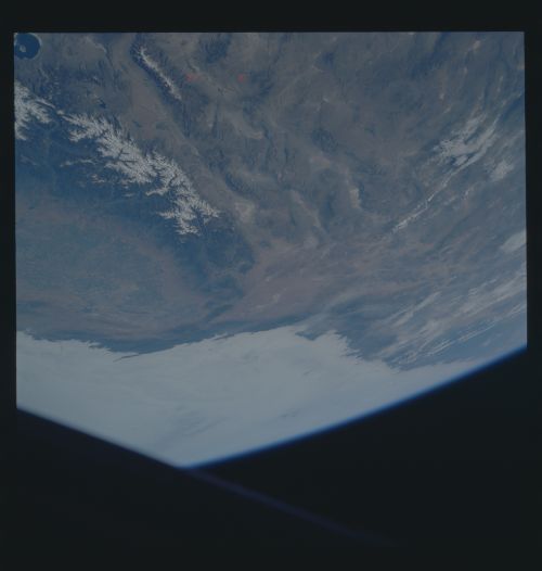
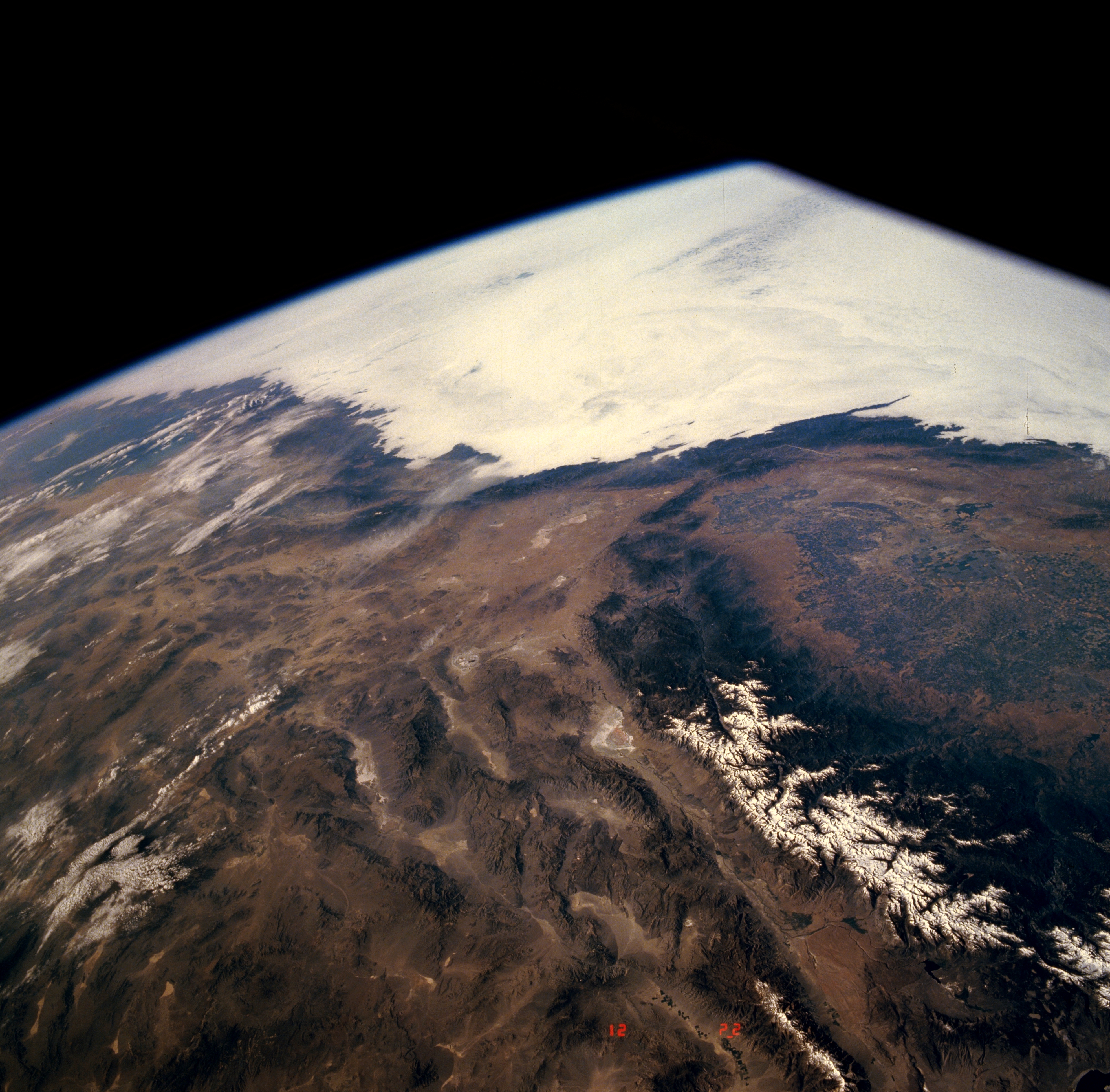
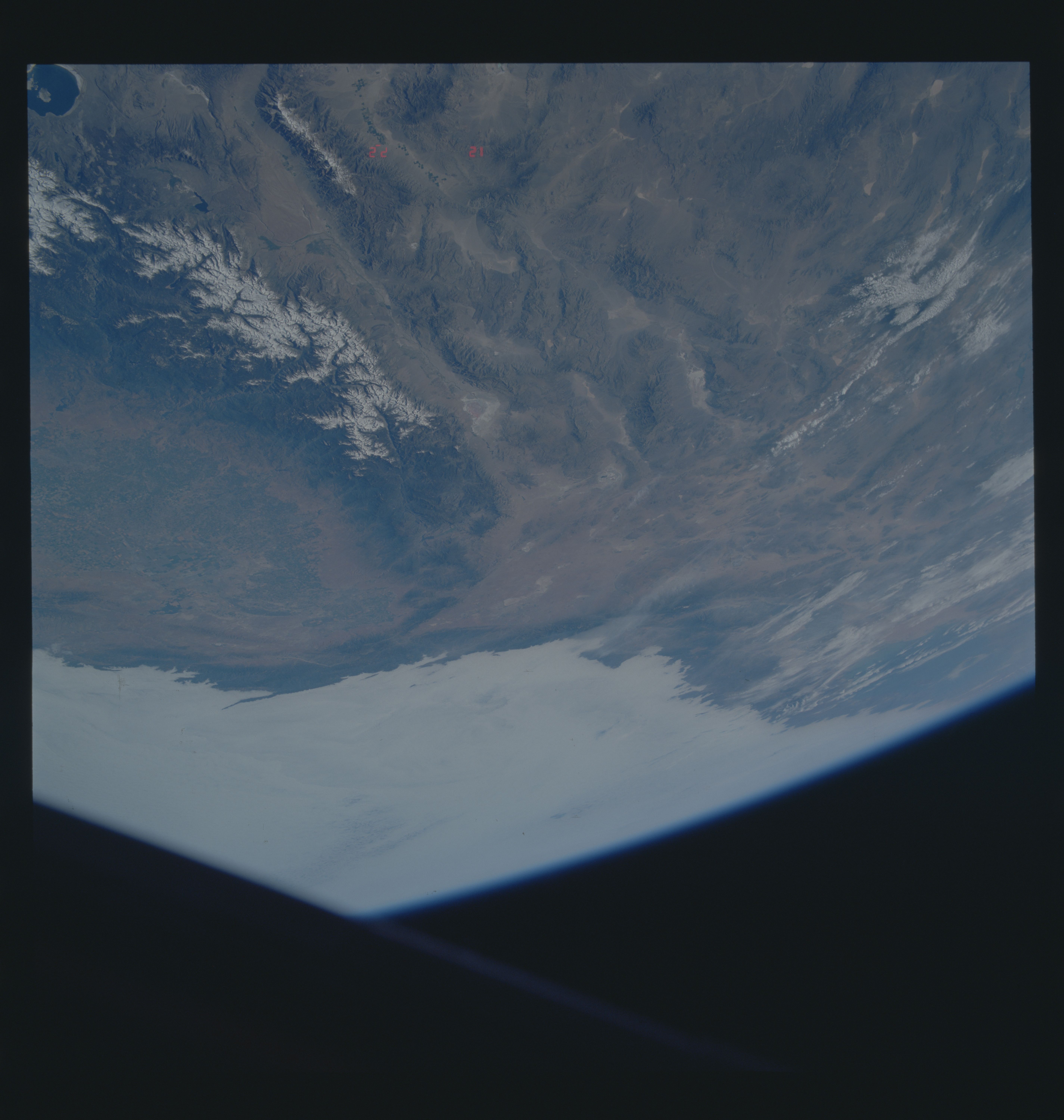
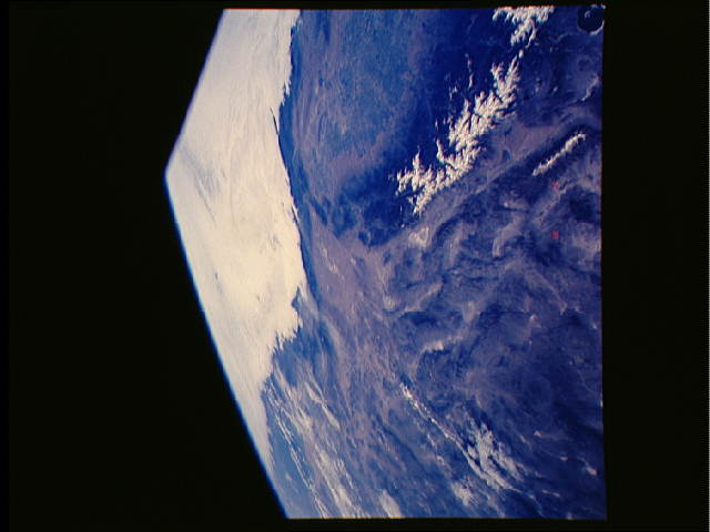
Image Caption: STS040-609-043 Southern California, U.S.A. June 1991
This partially cloud-covered, high-oblique photograph shows the diversity of southern California landscapes, including the southern end of the San Joaquin Valley, the Mojave Desert, and the snowcapped Sierra Nevada Mountains, east of which lie three major valleys--Owens River Valley, Panamint Valley, and Death Valley. Within these valleys several large, dry lakes (playas) can be identified by their highly reflective surfaces. The mottled green area within the San Joaquin Valley indicates irrigated agricultural fields.
This partially cloud-covered, high-oblique photograph shows the diversity of southern California landscapes, including the southern end of the San Joaquin Valley, the Mojave Desert, and the snowcapped Sierra Nevada Mountains, east of which lie three major valleys--Owens River Valley, Panamint Valley, and Death Valley. Within these valleys several large, dry lakes (playas) can be identified by their highly reflective surfaces. The mottled green area within the San Joaquin Valley indicates irrigated agricultural fields.
