STS040-151-130
| NASA Photo ID | STS040-151-130 |
| Focal Length | 90mm |
| Date taken | 1991.06.09 |
| Time taken | 15:21:42 GMT |

Cloud masks available for this image:
Spacecraft nadir point: 38.1° N, 76.1° W
Photo center point: 38.5° N, 76.5° W
Photo center point by machine learning:
Photo center point: 38.5° N, 76.5° W
Photo center point by machine learning:
Nadir to Photo Center: Northwest
Spacecraft Altitude: 154 nautical miles (285km)
Country or Geographic Name: | USA-MARYLAND |
Features: | WASHINGTON, BALTIMORE |
| Features Found Using Machine Learning: | |
Cloud Cover Percentage: | 0 (no clouds present) |
Sun Elevation Angle: | 63° |
Sun Azimuth: | 117° |
Camera: | Linhof |
Focal Length: | 90mm |
Camera Tilt: | 12 degrees |
Format: | QX868: Kodak, natural color positive, Ektachrome QX868(5017 emulsion), ASA 64, thin base |
Film Exposure: | Normal |
| Additional Information | |
| Width | Height | Annotated | Cropped | Purpose | Links |
|---|---|---|---|---|---|
| 5184 pixels | 4096 pixels | No | No | Earth From Space collection | Download Image |
| 640 pixels | 505 pixels | No | No | Earth From Space collection | Download Image |
| 640 pixels | 480 pixels | No | No | ISD 1 | Download Image |
Download Packaged File
Download a Google Earth KML for this Image
View photo footprint information
Download a GeoTIFF for this photo
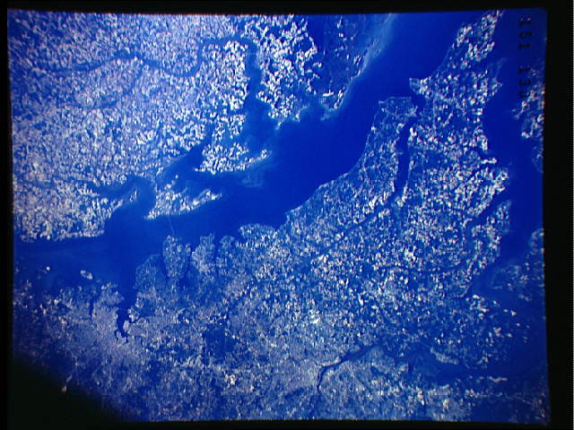
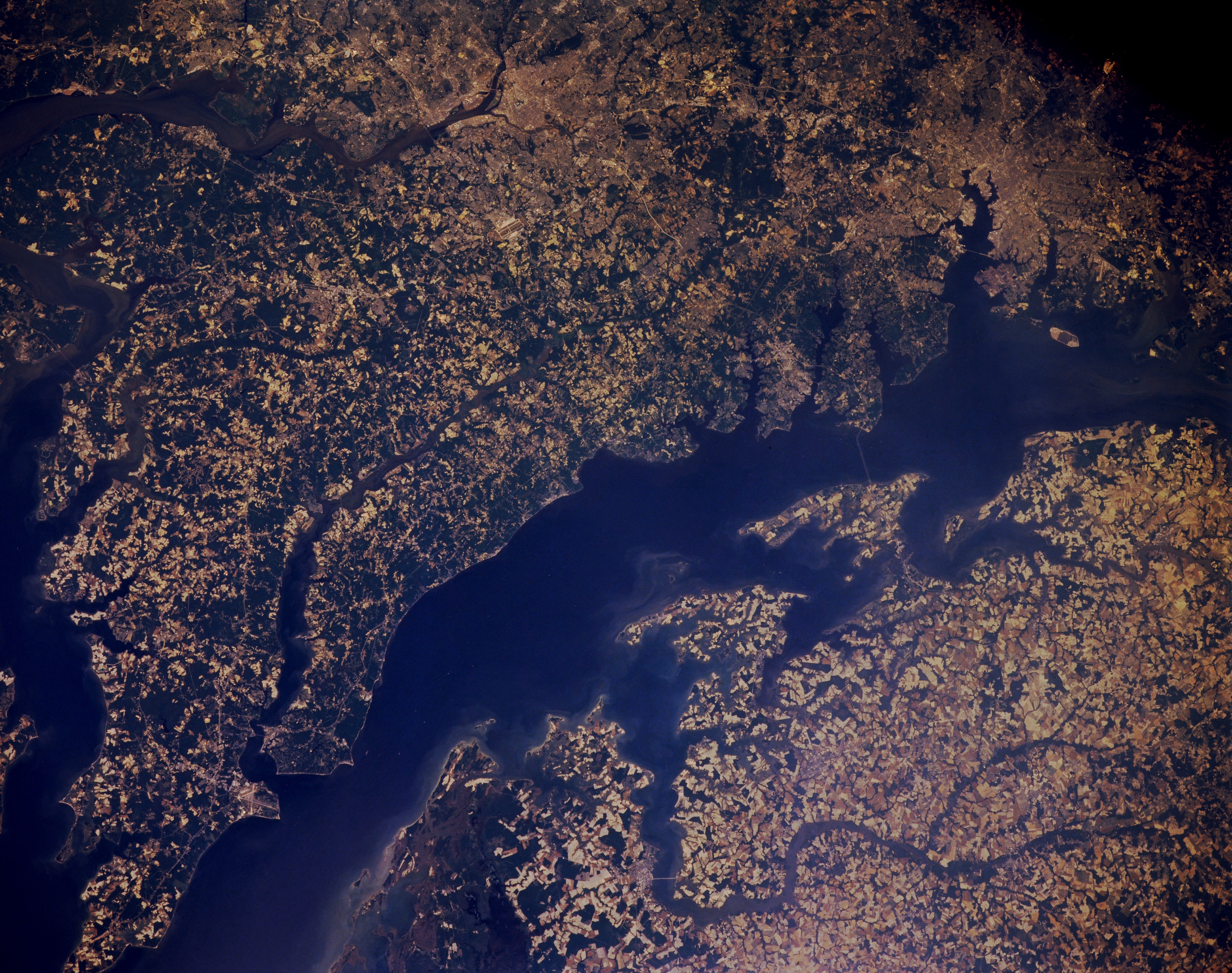
Image Caption: STS040-151-130 Chesapeake Bay, Maryland and Virginia, U.S.A. June 1991
This northwest-looking, low-oblique photograph shows the blue waters of the middle portion of Chesapeake Bay, the largest estuary in the United States. The cities of Washington, DC, and Baltimore are visible west of the bay. The bay, an inlet of the Atlantic Ocean, is 200 miles (320 kilometers) long, 3 to 30 miles (5 to 48 kilometers) wide, and separates the Delmarva Peninsula to the east from the mainland to the west. The bay begins at the mouth of the Susquehanna River and is fed by as many as 150 rivers and small streams, including the Potomac, the Patuxent, the Rappahannock, and the James. Chesapeake Bay is home to one of the most productive ecosystems in the world. State and local governments are enacting policies to help alter the water quality deterioration in the bay. The bay is used for sports and other recreational activities as well as commercial fishing. It is also an important part of the Intracoastal Waterway.
This northwest-looking, low-oblique photograph shows the blue waters of the middle portion of Chesapeake Bay, the largest estuary in the United States. The cities of Washington, DC, and Baltimore are visible west of the bay. The bay, an inlet of the Atlantic Ocean, is 200 miles (320 kilometers) long, 3 to 30 miles (5 to 48 kilometers) wide, and separates the Delmarva Peninsula to the east from the mainland to the west. The bay begins at the mouth of the Susquehanna River and is fed by as many as 150 rivers and small streams, including the Potomac, the Patuxent, the Rappahannock, and the James. Chesapeake Bay is home to one of the most productive ecosystems in the world. State and local governments are enacting policies to help alter the water quality deterioration in the bay. The bay is used for sports and other recreational activities as well as commercial fishing. It is also an important part of the Intracoastal Waterway.
