STS039-94-6

| NASA Photo ID | STS039-94-6 |
| Focal Length | 250mm |
| Date taken | 1991.05.04 |
| Time taken | 20:18:07 GMT |
Resolutions offered for this image:
5248 x 5248 pixels 640 x 640 pixels 5700 x 6000 pixels 500 x 526 pixels 640 x 480 pixels
5248 x 5248 pixels 640 x 640 pixels 5700 x 6000 pixels 500 x 526 pixels 640 x 480 pixels

Cloud masks available for this image:
Spacecraft nadir point: 38.2° N, 118.0° W
Photo center point: 36.5° N, 118.0° W
Photo center point by machine learning:
Photo center point: 36.5° N, 118.0° W
Photo center point by machine learning:
Nadir to Photo Center: South
Spacecraft Altitude: 145 nautical miles (269km)
Country or Geographic Name: | USA-NEVADA |
Features: | OWENS LAKE AREA |
| Features Found Using Machine Learning: | |
Cloud Cover Percentage: | 0 (no clouds present) |
Sun Elevation Angle: | 57° |
Sun Azimuth: | 166° |
Camera: | Hasselblad |
Focal Length: | 250mm |
Camera Tilt: | 35 degrees |
Format: | 5017: Kodak, natural color positive, Ektachrome, X Professional, ASA 64, standard base |
Film Exposure: | Normal |
| Additional Information | |
| Width | Height | Annotated | Cropped | Purpose | Links |
|---|---|---|---|---|---|
| 5248 pixels | 5248 pixels | No | No | Earth From Space collection | Download Image |
| 640 pixels | 640 pixels | No | No | Earth From Space collection | Download Image |
| 5700 pixels | 6000 pixels | No | No | Download Image | |
| 500 pixels | 526 pixels | No | No | Download Image | |
| 640 pixels | 480 pixels | No | No | Download Image |
Download Packaged File
Download a Google Earth KML for this Image
View photo footprint information
Download a GeoTIFF for this photo
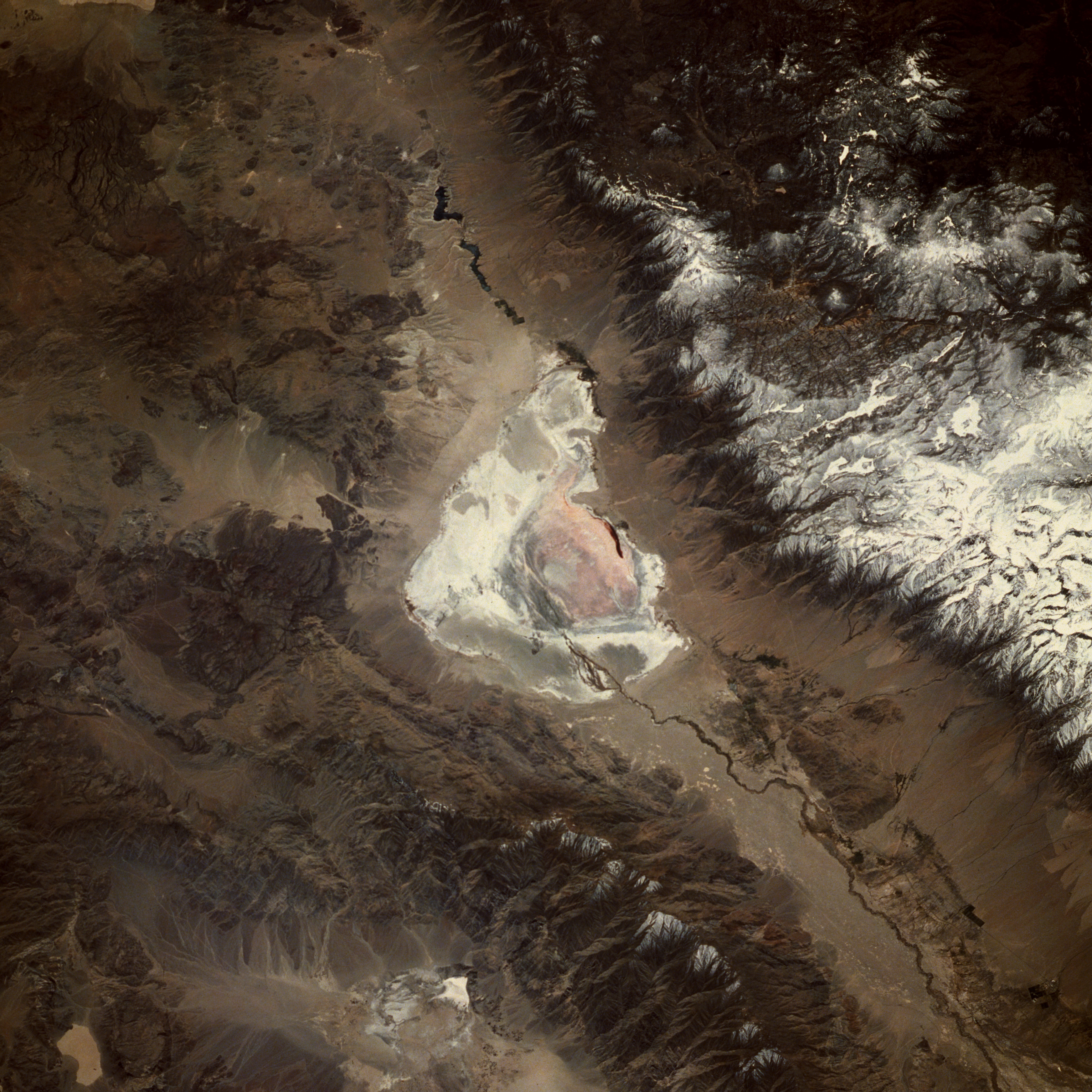
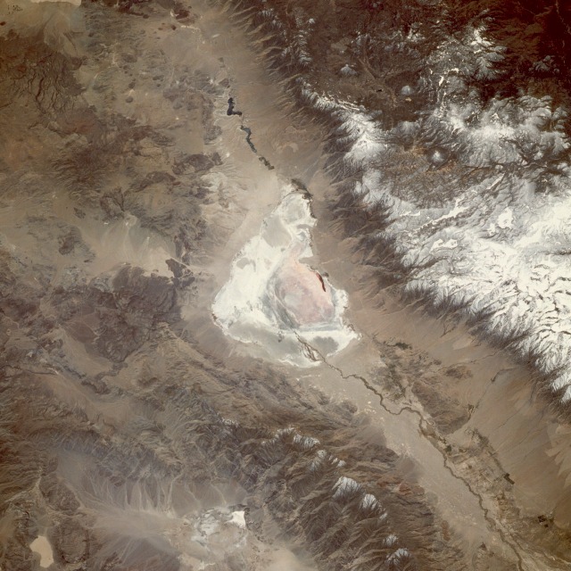
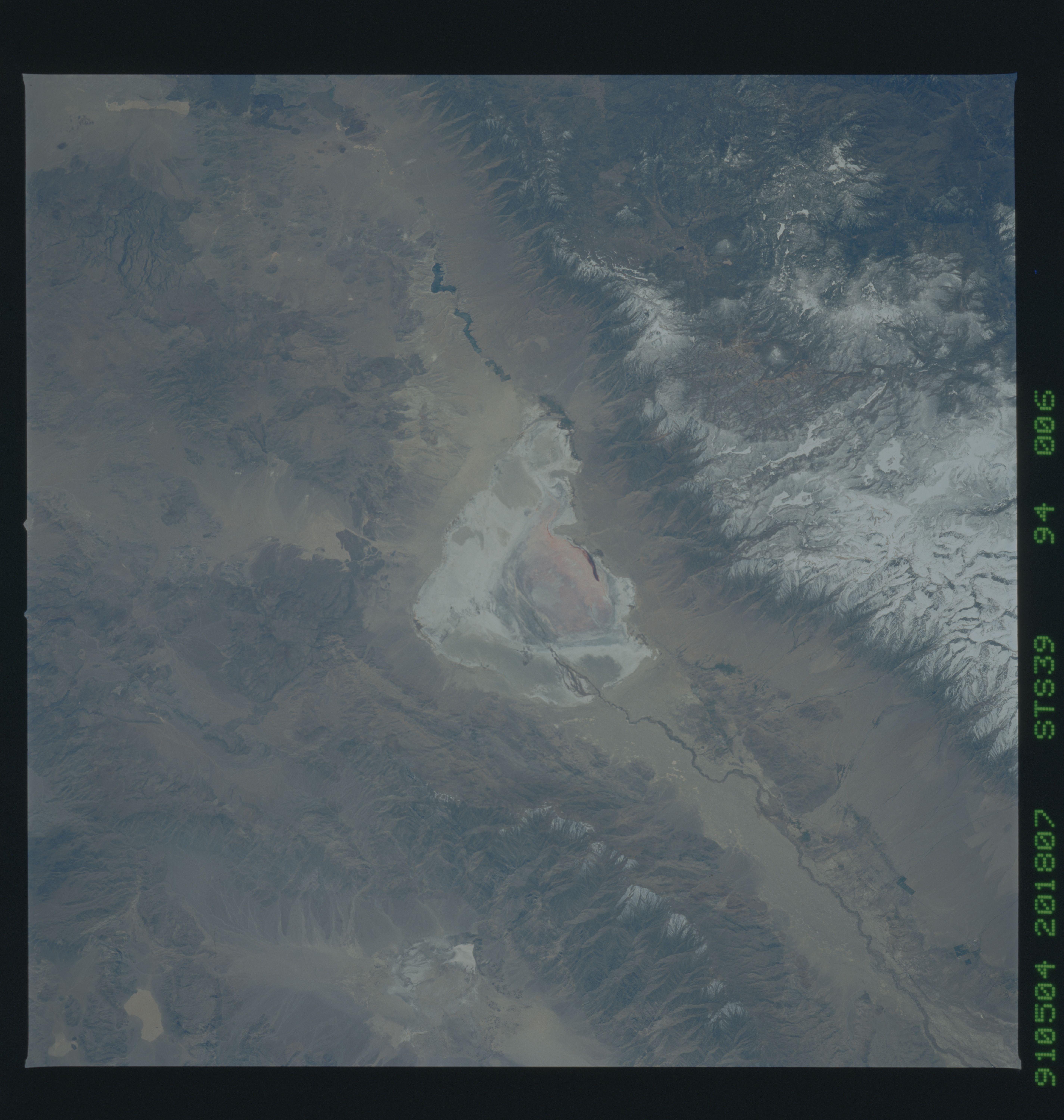
Image Caption: STS039-094-006 Owens Lake, California, U.S.A. May 1991
Before an aqueduct was built to divert water from the Owens River to the city of Los Angeles for its water needs, Owens Lake (center of the photograph) held water in a basin 18 miles (29 kilometers) long and nearly 10 miles (16 kilometers) wide. This south-southwest-looking, low-oblique photograph reveals a dry Lake Owens, north and south of which is seen the Owens River, 120 miles (195 kilometers) long, rising in the Sierra Nevada southeast of Yosemite National Park. West of Owens Lake are snow-covered peaks of the Sierra Nevada and Mount Whitney, the highest mountain in the conterminous United States at 14 494 feet (4421 meters), part of Sequoia National Park. The Inyo Mountain Range and the dark blue waters of the Haiwee Reservoir lie northeast and south, respectively, of Owens Lake.
Before an aqueduct was built to divert water from the Owens River to the city of Los Angeles for its water needs, Owens Lake (center of the photograph) held water in a basin 18 miles (29 kilometers) long and nearly 10 miles (16 kilometers) wide. This south-southwest-looking, low-oblique photograph reveals a dry Lake Owens, north and south of which is seen the Owens River, 120 miles (195 kilometers) long, rising in the Sierra Nevada southeast of Yosemite National Park. West of Owens Lake are snow-covered peaks of the Sierra Nevada and Mount Whitney, the highest mountain in the conterminous United States at 14 494 feet (4421 meters), part of Sequoia National Park. The Inyo Mountain Range and the dark blue waters of the Haiwee Reservoir lie northeast and south, respectively, of Owens Lake.
