STS039-88-54
| NASA Photo ID | STS039-88-54 |
| Focal Length | 250mm |
| Date taken | 1991.__.__ |
| Time taken | GMT |
Resolutions offered for this image:
791 x 798 pixels 5303 x 5303 pixels 640 x 640 pixels 5700 x 6000 pixels 500 x 526 pixels 640 x 480 pixels 1024 x 1024 pixels 1024 x 1024 pixels 1024 x 1024 pixels
791 x 798 pixels 5303 x 5303 pixels 640 x 640 pixels 5700 x 6000 pixels 500 x 526 pixels 640 x 480 pixels 1024 x 1024 pixels 1024 x 1024 pixels 1024 x 1024 pixels


Cloud masks available for this image:
Spacecraft nadir point:
Photo center point: 41.0° N, 74.0° W
Photo center point by machine learning:
Photo center point: 41.0° N, 74.0° W
Photo center point by machine learning:
Nadir to Photo Center:
Spacecraft Altitude: nautical miles (0km)
Country or Geographic Name: | USA-NEW YORK |
Features: | NEW YORK CITY, HUDSON R. |
| Features Found Using Machine Learning: | |
Cloud Cover Percentage: | 0 (no clouds present) |
Sun Elevation Angle: | ° |
Sun Azimuth: | ° |
Camera: | Hasselblad |
Focal Length: | 250mm |
Camera Tilt: | |
Format: | 2443: Kodak Aerochrome 2443, color IR, thin base, EA-5 process thru June 1999, E-6 process afterward |
Film Exposure: | Under Exposed |
| Additional Information | |
| Width | Height | Annotated | Cropped | Purpose | Links |
|---|---|---|---|---|---|
| 791 pixels | 798 pixels | No | No | Cities collection | Download Image |
| 5303 pixels | 5303 pixels | No | No | Earth From Space collection | Download Image |
| 640 pixels | 640 pixels | No | No | Earth From Space collection | Download Image |
| 5700 pixels | 6000 pixels | No | No | Download Image | |
| 500 pixels | 526 pixels | No | No | Download Image | |
| 640 pixels | 480 pixels | No | No | Download Image | |
| 1024 pixels | 1024 pixels | No | No | Download Image | |
| 1024 pixels | 1024 pixels | No | No | Download Image | |
| 1024 pixels | 1024 pixels | No | No | Download Image |
Download Packaged File
Download a Google Earth KML for this Image
View photo footprint information
Download a GeoTIFF for this photo
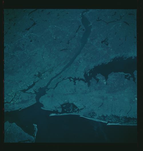
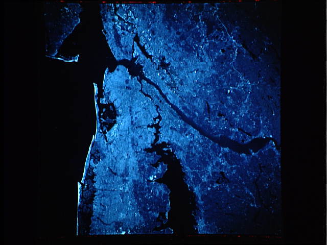
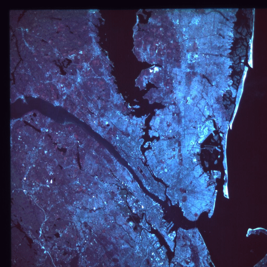
Image Caption: STS039-88-54 Metropolitan New York City Area, New York, U.S.A. May 1991
Since this color infrared photograph covers the same general area as STS058-81-38, almost all of the physical features identified and described in the caption for that photograph are applicable to this one. It is important to note that color infrared film is designed to enhance vegetation signatures. The film records reflected energy from plants and presents the information as a reddish signature. Central Park in the middle of Manhattan Island shows green trees and grass as a reddish color. Similarly, a line of rectangular parks (red blocks) can be traced eastward from the borough of Queens toward the other end of Long Island. Other features that are discernible in this photograph are three large airports--John F. Kennedy International, La Guardia, and Newark International--as well as smaller airports southeast of Brooklyn. Some segments of the extensive ground transportation network pattern (even individual thoroughfares and streets) can be identified. The recent scar created by disturbing natural vegetation (highly reflective area) is evidence that a new highway is either under construction or has just been completed through the hill and lake region northwest of the metropolitan area. It appears that this highway is part of an interstate bypass around the metropolitan area and links with Interstate Highway 287.
This color infrared photo of New York City, Hudson River, NY, (41.0N, 74.0W) shows a unique view of the dense urban development of the New York City metropolitan area in downstate New York, Long Island and New Jersey. The heavily populated city areas appear as white or gray while vegetated areas appear as shades of red. Central park clearly shows up on Manhattan Island as an illustration of the delineation between cultural and natural features.
