STS038-86-6
| NASA Photo ID | STS038-86-6 |
| Focal Length | 250mm |
| Date taken | 1990.11.18 |
| Time taken | 21:49:43 GMT |
Resolutions offered for this image:
5303 x 5303 pixels 640 x 640 pixels 5700 x 6000 pixels 500 x 526 pixels 640 x 480 pixels
5303 x 5303 pixels 640 x 640 pixels 5700 x 6000 pixels 500 x 526 pixels 640 x 480 pixels

Cloud masks available for this image:
Spacecraft nadir point: 25.2° N, 103.9° W
Photo center point: 25.5° N, 103.5° W
Photo center point by machine learning:
Photo center point: 25.5° N, 103.5° W
Photo center point by machine learning:
Nadir to Photo Center: Northeast
Spacecraft Altitude: 116 nautical miles (215km)
Country or Geographic Name: | MEXICO |
Features: | TORREON, GOMEZ PAL ACIO |
| Features Found Using Machine Learning: | |
Cloud Cover Percentage: | 0 (no clouds present) |
Sun Elevation Angle: | 26° |
Sun Azimuth: | 230° |
Camera: | Hasselblad |
Focal Length: | 250mm |
Camera Tilt: | 14 degrees |
Format: | 5017: Kodak, natural color positive, Ektachrome, X Professional, ASA 64, standard base |
Film Exposure: | Normal |
| Additional Information | |
| Width | Height | Annotated | Cropped | Purpose | Links |
|---|---|---|---|---|---|
| 5303 pixels | 5303 pixels | No | No | Earth From Space collection | Download Image |
| 640 pixels | 640 pixels | No | No | Earth From Space collection | Download Image |
| 5700 pixels | 6000 pixels | No | No | Download Image | |
| 500 pixels | 526 pixels | No | No | Download Image | |
| 640 pixels | 480 pixels | No | No | Download Image |
Download Packaged File
Download a Google Earth KML for this Image
View photo footprint information
Download a GeoTIFF for this photo
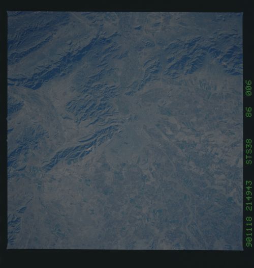
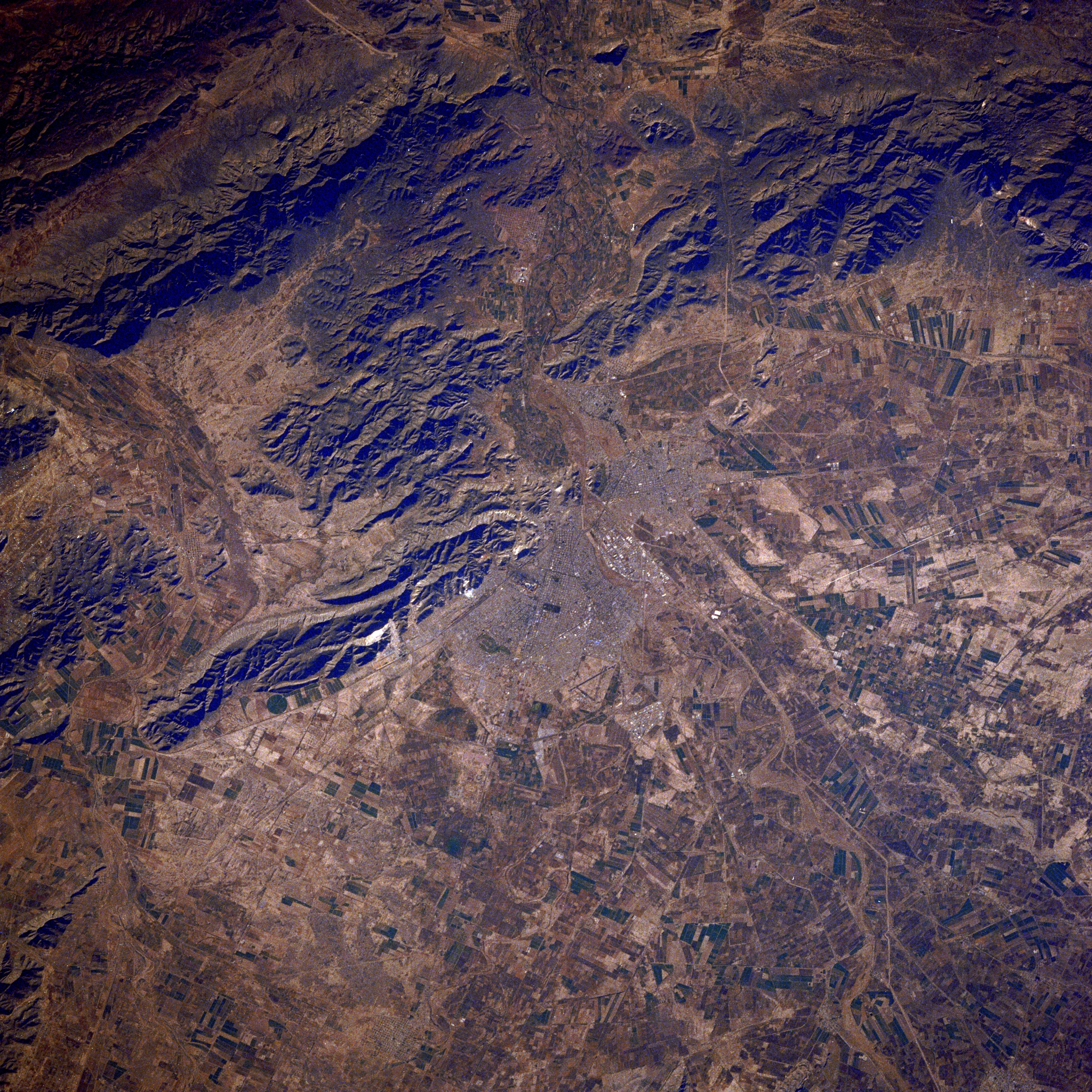
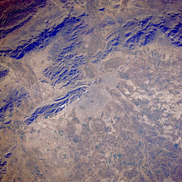
Image Caption: STS038-086-006 Torreoón, Mexico November 1990
Torreoón, with an estimated population of 250 000, is located on the arid-to-semiarid plateau of north-central Mexico approximately 150 miles (240 kilometers) west of Monterrey. The Torreoón metropolitan area includes the smaller cities of Gómez Palacio and Lerdo, which cluster at the mouth of the Nazas River, parts of which are seen northeast and southwest of the urban area. Visible are several infrastructure features--the airport northeast of Torreoón; several roads and railroads; the more highly reflective commercial and industrial section of Torreoón; and a grid street pattern. Outside the urban area, cultivated agricultural fields abound; cotton and wheat are the two main crops grown in the region. During the mid-1900s, this basin was a major cotton-growing area of Mexico. Large mechanized, irrigated farms were developed by tapping into the once-abundant deep wells for ground water; however, in recent decades, farmers have depended on more meager supplies of surface water for irrigation. This region generally receives less than 20 inches (50 centimeters) of precipitation annually. Torreoón is a major railroad center, especially for north-south traffic through Mexico.
Torreoón, with an estimated population of 250 000, is located on the arid-to-semiarid plateau of north-central Mexico approximately 150 miles (240 kilometers) west of Monterrey. The Torreoón metropolitan area includes the smaller cities of Gómez Palacio and Lerdo, which cluster at the mouth of the Nazas River, parts of which are seen northeast and southwest of the urban area. Visible are several infrastructure features--the airport northeast of Torreoón; several roads and railroads; the more highly reflective commercial and industrial section of Torreoón; and a grid street pattern. Outside the urban area, cultivated agricultural fields abound; cotton and wheat are the two main crops grown in the region. During the mid-1900s, this basin was a major cotton-growing area of Mexico. Large mechanized, irrigated farms were developed by tapping into the once-abundant deep wells for ground water; however, in recent decades, farmers have depended on more meager supplies of surface water for irrigation. This region generally receives less than 20 inches (50 centimeters) of precipitation annually. Torreoón is a major railroad center, especially for north-south traffic through Mexico.
