STS038-82-68
| NASA Photo ID | STS038-82-68 |
| Focal Length | 250mm |
| Date taken | 1990.11.18 |
| Time taken | 09:50:00 GMT |
Resolutions offered for this image:
5257 x 5257 pixels 640 x 640 pixels 5700 x 6000 pixels 500 x 526 pixels 640 x 480 pixels
5257 x 5257 pixels 640 x 640 pixels 5700 x 6000 pixels 500 x 526 pixels 640 x 480 pixels

Cloud masks available for this image:
Spacecraft nadir point: 16.9° N, 54.6° E
Photo center point: 17.0° N, 54.0° E
Photo center point by machine learning:
Photo center point: 17.0° N, 54.0° E
Photo center point by machine learning:
Nadir to Photo Center: West
Spacecraft Altitude: 119 nautical miles (220km)
Country or Geographic Name: | OMAN |
Features: | CITY OF SALALAH |
| Features Found Using Machine Learning: | |
Cloud Cover Percentage: | 0 (no clouds present) |
Sun Elevation Angle: | 46° |
Sun Azimuth: | 216° |
Camera: | Hasselblad |
Focal Length: | 250mm |
Camera Tilt: | 17 degrees |
Format: | 5017: Kodak, natural color positive, Ektachrome, X Professional, ASA 64, standard base |
Film Exposure: | Normal |
| Additional Information | |
| Width | Height | Annotated | Cropped | Purpose | Links |
|---|---|---|---|---|---|
| 5257 pixels | 5257 pixels | No | No | Earth From Space collection | Download Image |
| 640 pixels | 640 pixels | No | No | Earth From Space collection | Download Image |
| 5700 pixels | 6000 pixels | No | No | Download Image | |
| 500 pixels | 526 pixels | No | No | Download Image | |
| 640 pixels | 480 pixels | No | No | Download Image |
Download Packaged File
Download a Google Earth KML for this Image
View photo footprint information
Download a GeoTIFF for this photo
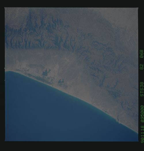
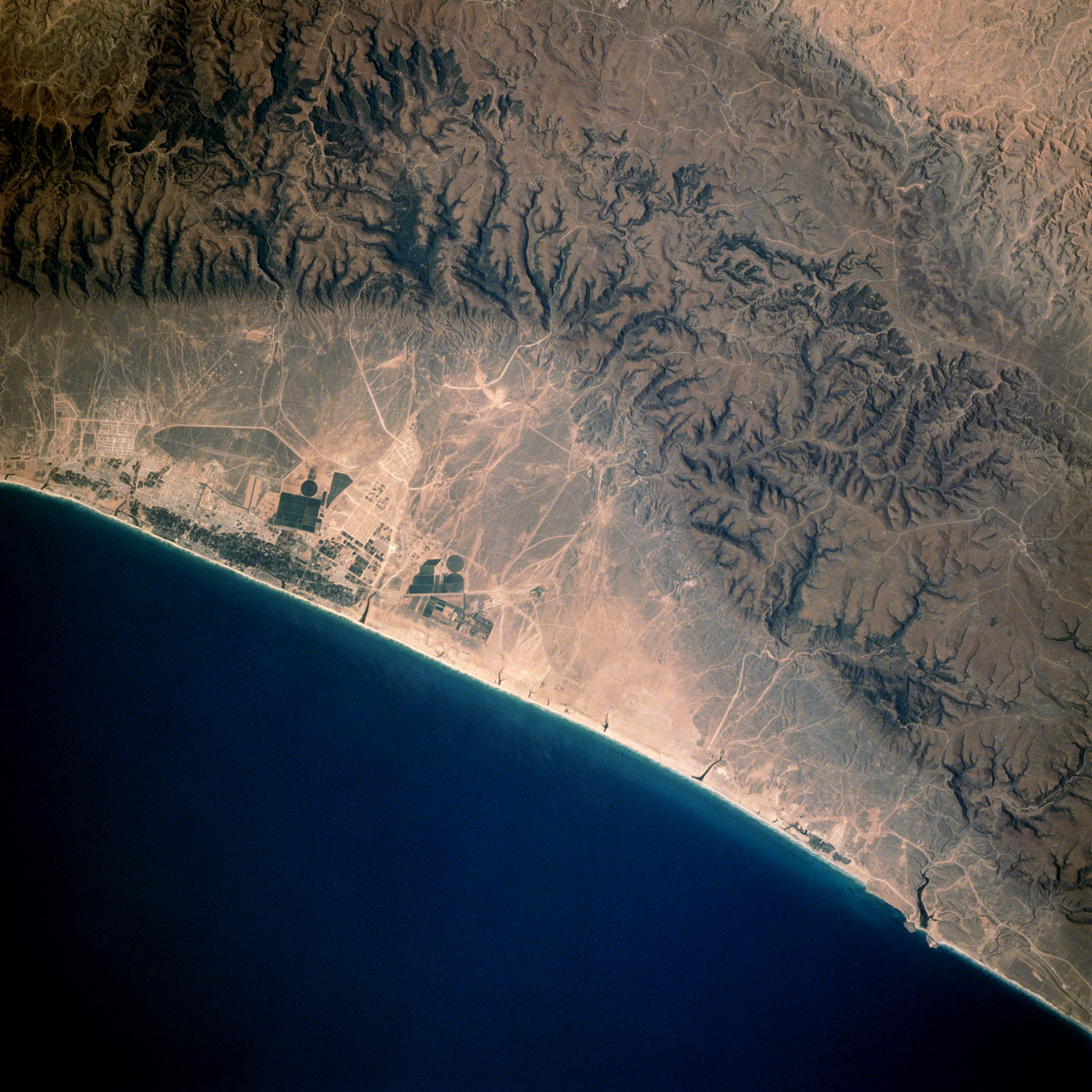
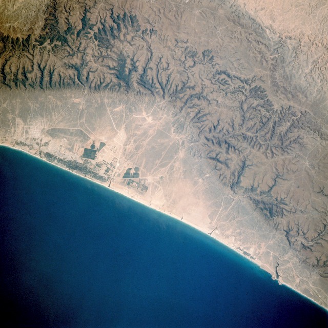
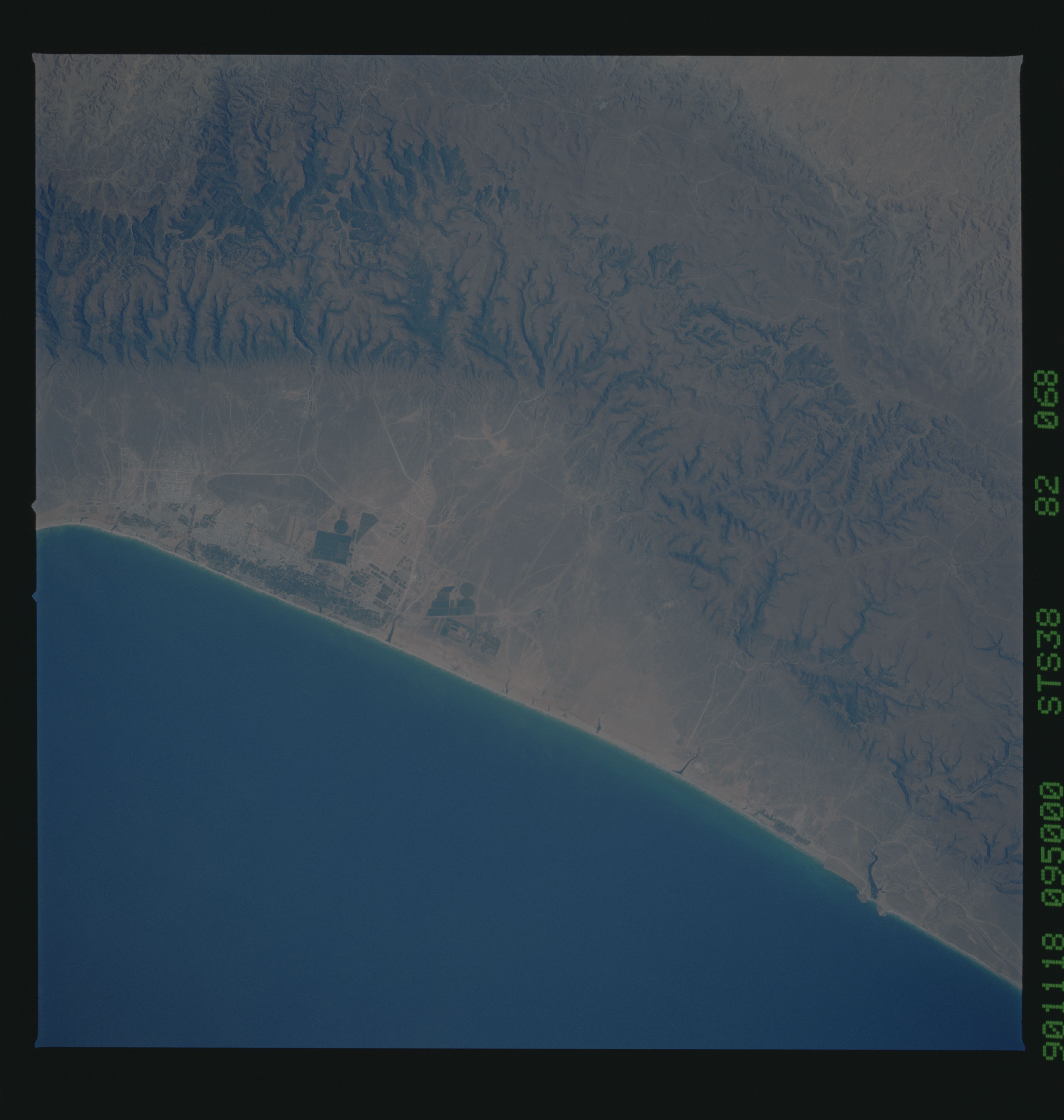
Image Caption: STS038-082-068 Salalah, Oman November 1990
Salalah, a small coastal city in southwest Oman about 80 miles (130 kilometers) from the eastern border of Yemen, is part of the arid Arabian Peninsula that is classified as a desert because it receives less than 10 inches (25 centimeters) of annual rainfall. North of Salalah, deeply dissected, low mountains that average 2500 feet (750 meters) above sea level flank the relatively narrow coastal plain. Despite arid conditions, this area of Oman offers a suitable environment for raising selected crops on a limited basis. Irrigated agriculture is necessary in this area, with most of the water provided by mountain runoff or wells. Dark green, angular field patterns indicate commercial agriculture enterprises. Some sugarcane is cultivated, and cattle are raised in this isolated, dry coastal area. Several manmade features are discernible in the photograph--three center-pivot irrigated fields; a single airport runway northwest of the largest dark field pattern; roads crossing the mountains; and some highly reflective roadways and tracks traversing the coastal plains.
Salalah, a small coastal city in southwest Oman about 80 miles (130 kilometers) from the eastern border of Yemen, is part of the arid Arabian Peninsula that is classified as a desert because it receives less than 10 inches (25 centimeters) of annual rainfall. North of Salalah, deeply dissected, low mountains that average 2500 feet (750 meters) above sea level flank the relatively narrow coastal plain. Despite arid conditions, this area of Oman offers a suitable environment for raising selected crops on a limited basis. Irrigated agriculture is necessary in this area, with most of the water provided by mountain runoff or wells. Dark green, angular field patterns indicate commercial agriculture enterprises. Some sugarcane is cultivated, and cattle are raised in this isolated, dry coastal area. Several manmade features are discernible in the photograph--three center-pivot irrigated fields; a single airport runway northwest of the largest dark field pattern; roads crossing the mountains; and some highly reflective roadways and tracks traversing the coastal plains.
