STS037-84-27

| NASA Photo ID | STS037-84-27 |
| Focal Length | 250mm |
| Date taken | 1991.04.__ |
| Time taken | GMT |
Cloud masks available for this image:
Spacecraft nadir point:
Photo center point: 21.0° N, 11.5° W
Photo center point by machine learning:
Photo center point: 21.0° N, 11.5° W
Photo center point by machine learning:
Nadir to Photo Center:
Spacecraft Altitude: nautical miles (0km)
Country or Geographic Name: | MAURITANIA |
Features: | RICHAT STRUCTURE |
| Features Found Using Machine Learning: | |
Cloud Cover Percentage: | 0 (no clouds present) |
Sun Elevation Angle: | ° |
Sun Azimuth: | ° |
Camera: | Hasselblad |
Focal Length: | 250mm |
Camera Tilt: | Near Vertical |
Format: | 5017: Kodak, natural color positive, Ektachrome, X Professional, ASA 64, standard base |
Film Exposure: | Normal |
| Additional Information | |
| Width | Height | Annotated | Cropped | Purpose | Links |
|---|---|---|---|---|---|
| 5700 pixels | 6000 pixels | No | No | Download Image | |
| 500 pixels | 526 pixels | No | No | Download Image | |
| 640 pixels | 480 pixels | No | No | Download Image |
Download Packaged File
Download a Google Earth KML for this Image
View photo footprint information
Download a GeoTIFF for this photo
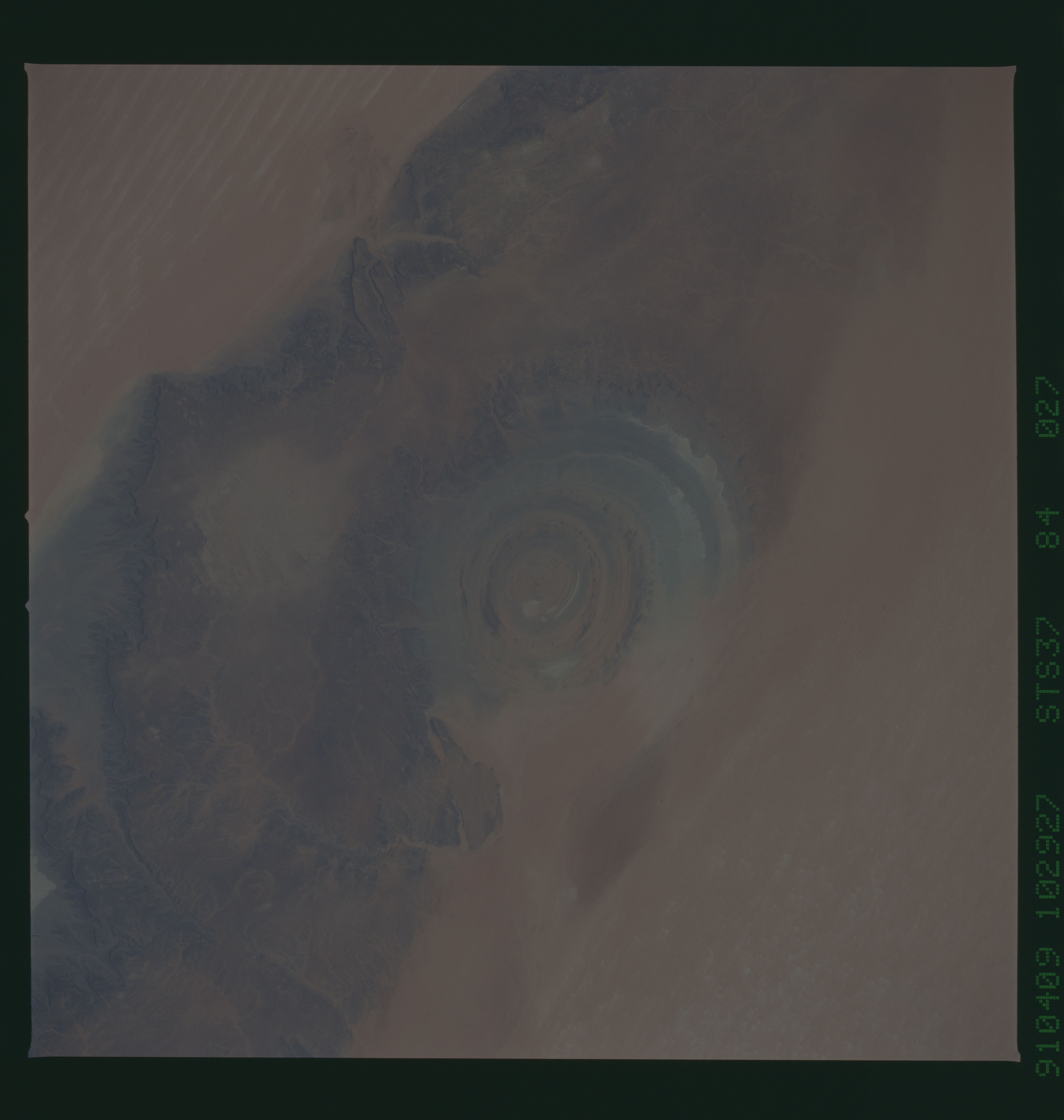
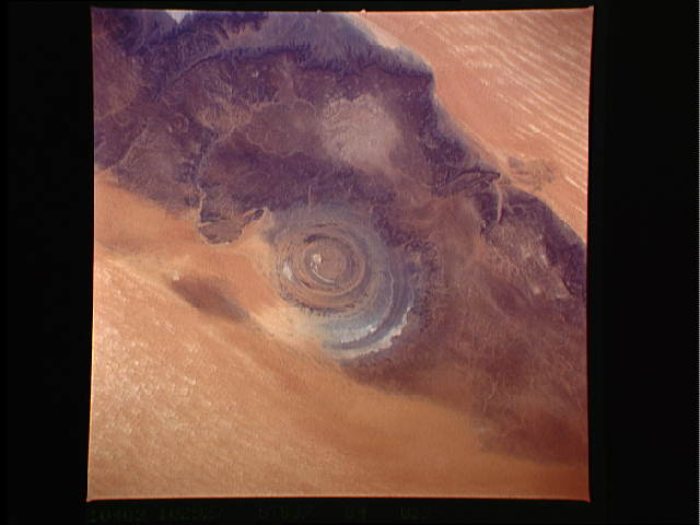
Image Caption: S37-84-27 Richat structure, Mauritania (roughly 21.5 N, 11W)
This 38-km wide structure, commonly referred to as the bull's-
eye, is in central Mauritania. It is a depression or pit about
100 m deep. The pit was made by erosion of layers of rock which
were domed upward. It was not made by impact of a meteorite.
The rock layers themselves are very old... several hundred mil-
lion years.... and their variable resistance to erosion has pro-
duced a series of concentric ridges in the structure stepping
down from the outside in.
The structure is surrounded by sand fields....sand can be seen
encroaching into the southern part of the structure. north of
the structure is the Makteir dune field.
