STS036-86-95
| NASA Photo ID | STS036-86-95 |
| Focal Length | 250mm |
| Date taken | 1990.03.03 |
| Time taken | 21:41:03 GMT |

Cloud masks available for this image:
Spacecraft nadir point: 61.6° S, 63.3° W
Photo center point:
Photo center point by machine learning:
Photo center point:
Photo center point by machine learning:
Nadir to Photo Center:
Spacecraft Altitude: 128 nautical miles (237km)
Country or Geographic Name: | ANTARCTICA |
Features: | CLOUDS |
| Features Found Using Machine Learning: | |
Cloud Cover Percentage: | 70 (51-75)% |
Sun Elevation Angle: | 11° |
Sun Azimuth: | 277° |
Camera: | Hasselblad |
Focal Length: | 250mm |
Camera Tilt: | Low Oblique |
Format: | 5036: Kodak, natural color positive, Ektachrome 5036,200 Professional, ASA 200, stand |
Film Exposure: | Normal |
| Additional Information | |
| Width | Height | Annotated | Cropped | Purpose | Links |
|---|---|---|---|---|---|
| 5700 pixels | 5900 pixels | No | No | Download Image | |
| 500 pixels | 518 pixels | No | No | Download Image | |
| 640 pixels | 480 pixels | No | No | Download Image |
Download Packaged File
Download a Google Earth KML for this Image
View photo footprint information
Download a GeoTIFF for this photo
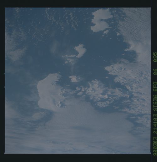
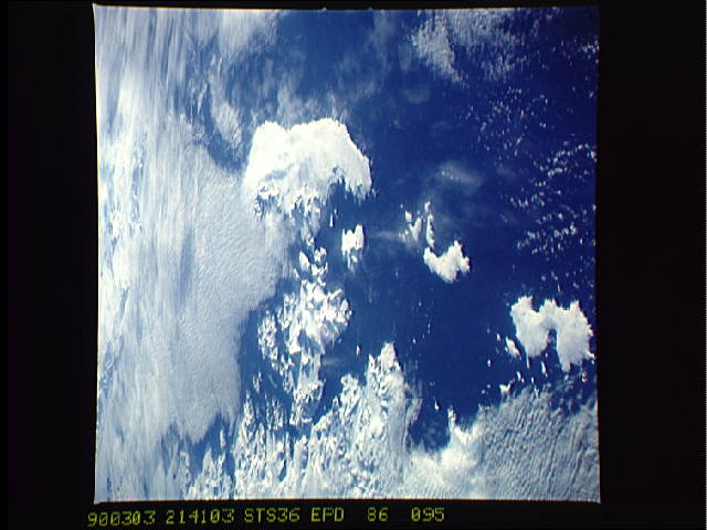
Image Caption: S36-86-095: Antarctic Peninsula A series of small islands locat-
ed just west of the Antarctic Peninsula are visible in this im-
age. Since it is late summer in the Southern Hemisphere, sea ice
is at a minimum. The region between the islands and the peninsu-
la, which is covered with ice for most of the year, is open at
this time.
ed just west of the Antarctic Peninsula are visible in this im-
age. Since it is late summer in the Southern Hemisphere, sea ice
is at a minimum. The region between the islands and the peninsu-
la, which is covered with ice for most of the year, is open at
this time.
