STS036-152-88
| NASA Photo ID | STS036-152-88 |
| Focal Length | 90mm |
| Date taken | 1990.03.03 |
| Time taken | 09:20:59 GMT |
Resolutions offered for this image:
640 x 480 pixels
640 x 480 pixels
Cloud masks available for this image:
Spacecraft nadir point: 23.2° N, 32.7° E
Photo center point: 23.5° N, 32.5° E
Photo center point by machine learning:
Photo center point: 23.5° N, 32.5° E
Photo center point by machine learning:
Nadir to Photo Center: Northwest
Spacecraft Altitude: 127 nautical miles (235km)
Camera: | Linhof |
Focal Length: | 90mm |
Camera Tilt: | 10 degrees |
Format: | QX868: Kodak, natural color positive, Ektachrome QX868(5017 emulsion), ASA 64, thin base |
Film Exposure: | Out of Focus |
| Additional Information | |
| Width | Height | Annotated | Cropped | Purpose | Links |
|---|---|---|---|---|---|
| 640 pixels | 480 pixels | No | No | ISD 1 | Download Image |
Download Packaged File
Download a Google Earth KML for this Image
View photo footprint information
Download a GeoTIFF for this photo
Image Caption:
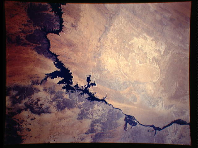
S36-152-088: Nile Delta, Suez, Sinai, Israel This points out the
Sinai, Lower Egypt and the Nile, the Suez, the center-pivot irri-
gation fields there between the Suez and the Damietta (or east)
branch of the Nile. Note also the plume of light-blue water from
the Nile heading towards Israel. In most Shuttle photography
from past missions, this plume is not present. It indicates that
a large release of water is coming downstream from Lake Nasser, a
phenomenon I have not previously seen since the building of the
Aswan Dam.
