STS036-152-202
| NASA Photo ID | STS036-152-202 |
| Focal Length | 250mm |
| Date taken | 1990.03.04 |
| Time taken | 07:28:32 GMT |
Resolutions offered for this image:
640 x 480 pixels
640 x 480 pixels
Cloud masks available for this image:
Spacecraft nadir point: 50.3° N, 29.6° E
Photo center point: 50.5° N, 29.5° E
Photo center point by machine learning:
Photo center point: 50.5° N, 29.5° E
Photo center point by machine learning:
Nadir to Photo Center: North
Spacecraft Altitude: 115 nautical miles (213km)
Country or Geographic Name: | UKRAINE |
Features: | KIEV/RES, DNIEPER RIVER, AGR. |
| Features Found Using Machine Learning: | |
Cloud Cover Percentage: | 30 (26-50)% |
Sun Elevation Angle: | 23° |
Sun Azimuth: | 135° |
Camera: | Linhof |
Focal Length: | 250mm |
Camera Tilt: | 7 degrees |
Format: | QX868: Kodak, natural color positive, Ektachrome QX868(5017 emulsion), ASA 64, thin base |
Film Exposure: | Normal |
| Additional Information | |
| Width | Height | Annotated | Cropped | Purpose | Links |
|---|---|---|---|---|---|
| 640 pixels | 480 pixels | No | No | ISD 1 | Download Image |
Download Packaged File
Download a Google Earth KML for this Image
View photo footprint information
Download a GeoTIFF for this photo
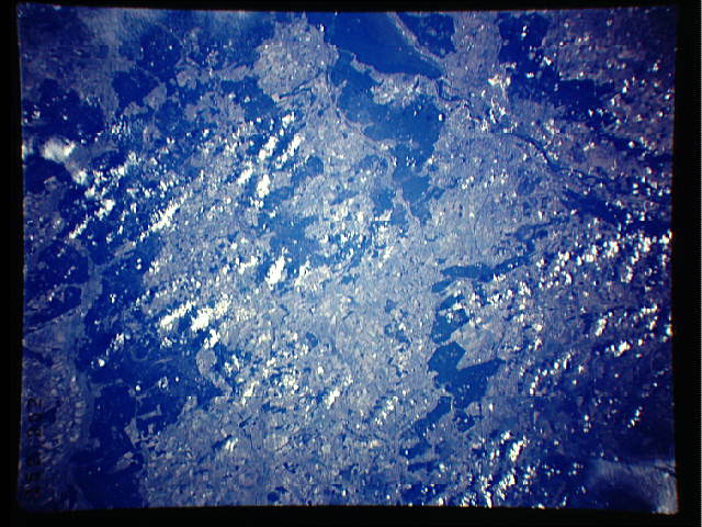
Image Caption:
S36-74-025 and S36-152-202: Kamchatka Ice patterns in water.
These possibly outline differences in water temperature and sa-
linity. Ice-free water near the coast (top center of slide) sug-
gests some coastal upwelling of warmer (slightly above freezing)
waters from depth. Where no such vertical circulation occurs (as
in the restricted bays), the water freezes. Near-shore circula-
tion entrains the warmer and colder, icy waters, forming the
spectacular patterns seen here.
