STS036-152-112
| NASA Photo ID | STS036-152-112 |
| Focal Length | 250mm |
| Date taken | 1990.03.03 |
| Time taken | 16:41:05 GMT |
Cloud masks available for this image:
Spacecraft nadir point: 41.6° N, 93.8° W
Photo center point: 42.0° N, 93.5° W
Photo center point by machine learning:
Photo center point: 42.0° N, 93.5° W
Photo center point by machine learning:
Nadir to Photo Center: Northeast
Spacecraft Altitude: 115 nautical miles (213km)
Country or Geographic Name: | USA-IOWA |
Features: | DES MOINES, AMES, AGR. |
| Features Found Using Machine Learning: | |
Cloud Cover Percentage: | 0 (no clouds present) |
Sun Elevation Angle: | 36° |
Sun Azimuth: | 147° |
Camera: | Linhof |
Focal Length: | 250mm |
Camera Tilt: | 15 degrees |
Format: | QX868: Kodak, natural color positive, Ektachrome QX868(5017 emulsion), ASA 64, thin base |
Film Exposure: | Normal |
| Additional Information | |
| Width | Height | Annotated | Cropped | Purpose | Links |
|---|---|---|---|---|---|
| 5216 pixels | 4096 pixels | No | No | Earth From Space collection | Download Image |
| 640 pixels | 502 pixels | No | No | Earth From Space collection | Download Image |
| 640 pixels | 480 pixels | No | No | ISD 1 | Download Image |
Download Packaged File
Download a Google Earth KML for this Image
View photo footprint information
Download a GeoTIFF for this photo
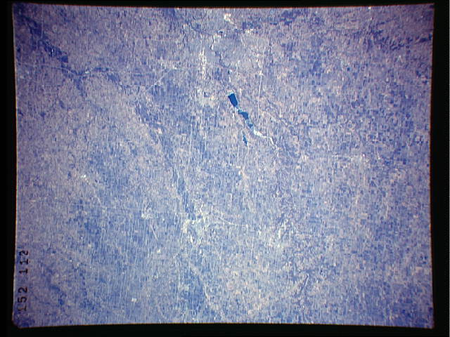
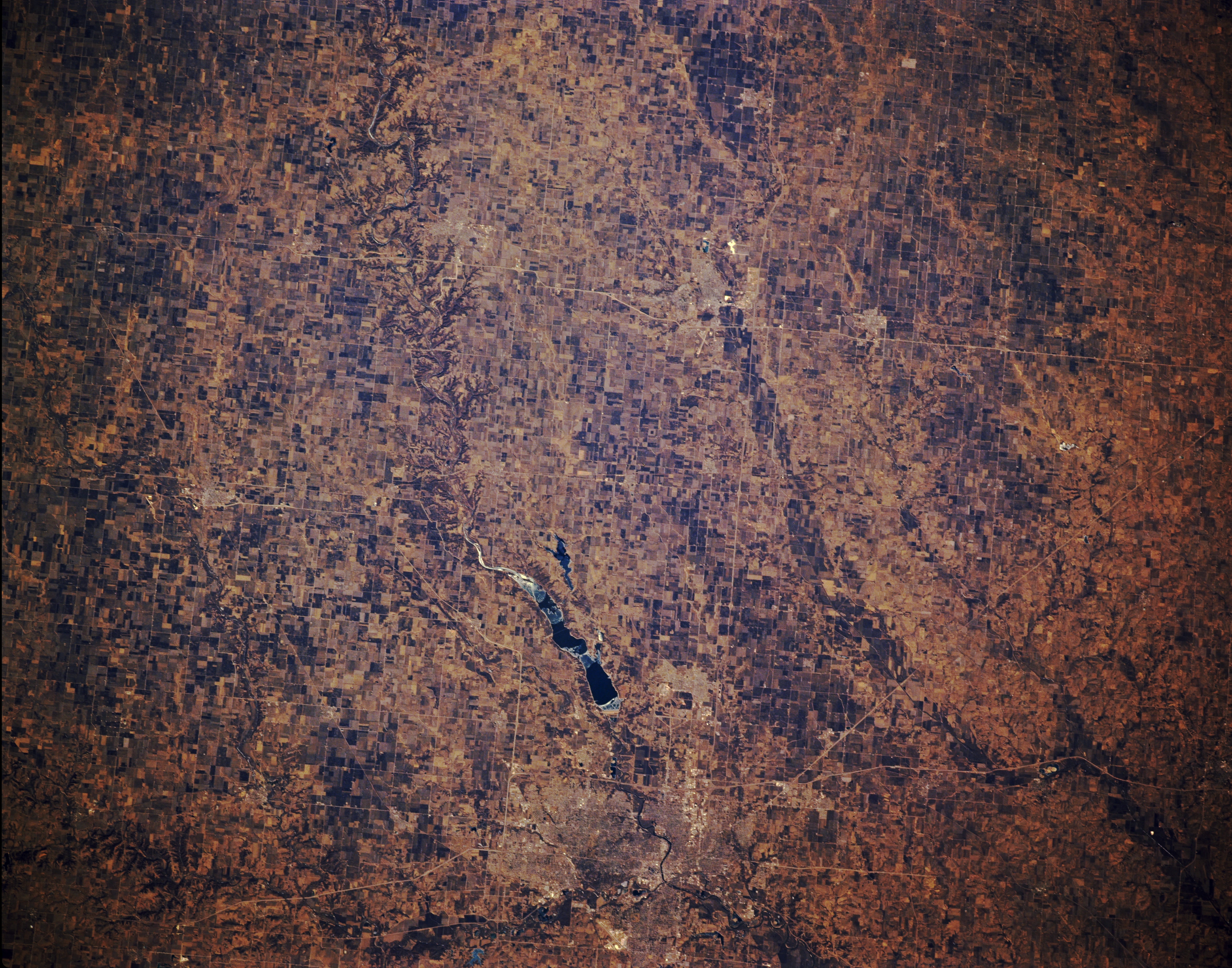
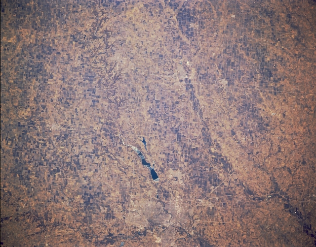
Image Caption: STS036-152-112 Des Moines and Ames, Iowa, U.S.A. March 1990
Visible in this north-looking, low-oblique photograph are partially ice-covered, blue Saylorville Reservoir north of Des Moines, the capital of Iowa, the state with 25 percent of the highest grade topsoil in the United States. With more than 90 percent of its land devoted to agriculture, Iowa, in the center of the corn belt, ranks second only to California in cash farm income. Discernible south-southwest of the city are the runways of Des Moines International Airport. To the north on the Skunk River is Ames, a major manufacturing center for electronic equipment and water analysis and treatment equipment.
Visible in this north-looking, low-oblique photograph are partially ice-covered, blue Saylorville Reservoir north of Des Moines, the capital of Iowa, the state with 25 percent of the highest grade topsoil in the United States. With more than 90 percent of its land devoted to agriculture, Iowa, in the center of the corn belt, ranks second only to California in cash farm income. Discernible south-southwest of the city are the runways of Des Moines International Airport. To the north on the Skunk River is Ames, a major manufacturing center for electronic equipment and water analysis and treatment equipment.
