STS036-151-63
| NASA Photo ID | STS036-151-63 |
| Focal Length | 250mm |
| Date taken | 1990.03.02 |
| Time taken | 06:30:46 GMT |


Cloud masks available for this image:
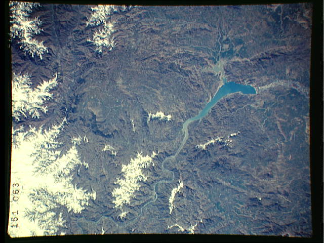
Spacecraft nadir point: 34.2° N, 73.1° E
Photo center point: 34.5° N, 73.0° E
Photo center point by machine learning:
Photo center point: 34.5° N, 73.0° E
Photo center point by machine learning:
Nadir to Photo Center: North
Spacecraft Altitude: 127 nautical miles (235km)
Country or Geographic Name: | PAKISTAN |
Features: | INDUS R, TOPI RESERVOIR |
| Features Found Using Machine Learning: | |
Cloud Cover Percentage: | 5 (1-10)% |
Sun Elevation Angle: | 47° |
Sun Azimuth: | 162° |
Camera: | Linhof |
Focal Length: | 250mm |
Camera Tilt: | 8 degrees |
Format: | QX868: Kodak, natural color positive, Ektachrome QX868(5017 emulsion), ASA 64, thin base |
Film Exposure: | Normal |
| Additional Information | |
| Width | Height | Annotated | Cropped | Purpose | Links |
|---|---|---|---|---|---|
| 640 pixels | 480 pixels | No | No | ISD 1 | Download Image |
| 1113 pixels | 1419 pixels | No | No | Download Image | |
| 8945 pixels | 11105 pixels | Download Image |
Download Packaged File
Download a Google Earth KML for this Image
View photo footprint information
Download a GeoTIFF for this photo
Image Caption: none
