STS036-151-16
| NASA Photo ID | STS036-151-16 |
| Focal Length | 250mm |
| Date taken | 1990.__.__ |
| Time taken | GMT |
Cloud masks available for this image:
Spacecraft nadir point:
Photo center point: 26.0° N, 12.5° E
Photo center point by machine learning:
Photo center point: 26.0° N, 12.5° E
Photo center point by machine learning:
Nadir to Photo Center:
Spacecraft Altitude: nautical miles (0km)
Country or Geographic Name: | LIBYA |
Features: | AWBARI, PIVOT IRRIG, SS |
| Features Found Using Machine Learning: | |
Cloud Cover Percentage: | 0 (no clouds present) |
Sun Elevation Angle: | ° |
Sun Azimuth: | ° |
Camera: | Linhof |
Focal Length: | 250mm |
Camera Tilt: | Near Vertical |
Format: | QX868: Kodak, natural color positive, Ektachrome QX868(5017 emulsion), ASA 64, thin base |
Film Exposure: | Normal |
| Additional Information | |
| Width | Height | Annotated | Cropped | Purpose | Links |
|---|---|---|---|---|---|
| 4458 pixels | 5715 pixels | No | No | Earth From Space collection | Download Image |
| 499 pixels | 640 pixels | No | No | Earth From Space collection | Download Image |
| 640 pixels | 480 pixels | No | No | ISD 1 | Download Image |
Download Packaged File
Download a Google Earth KML for this Image
View photo footprint information
Download a GeoTIFF for this photo
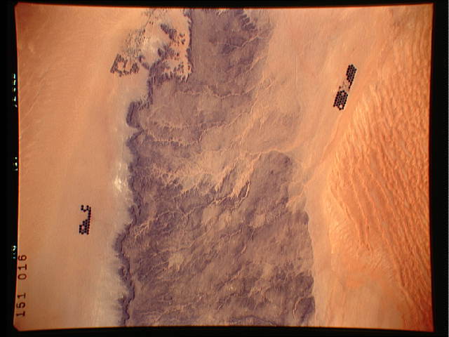
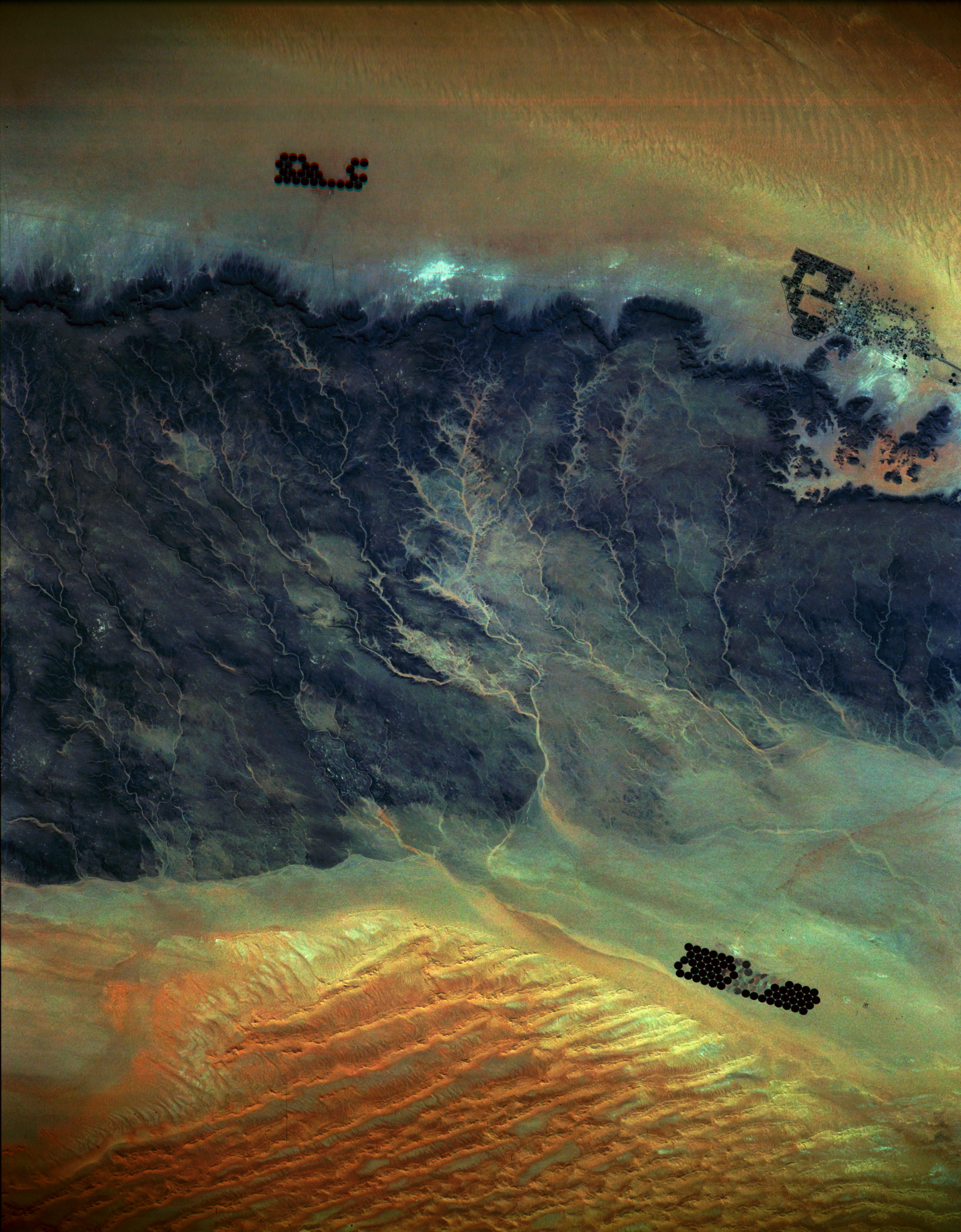
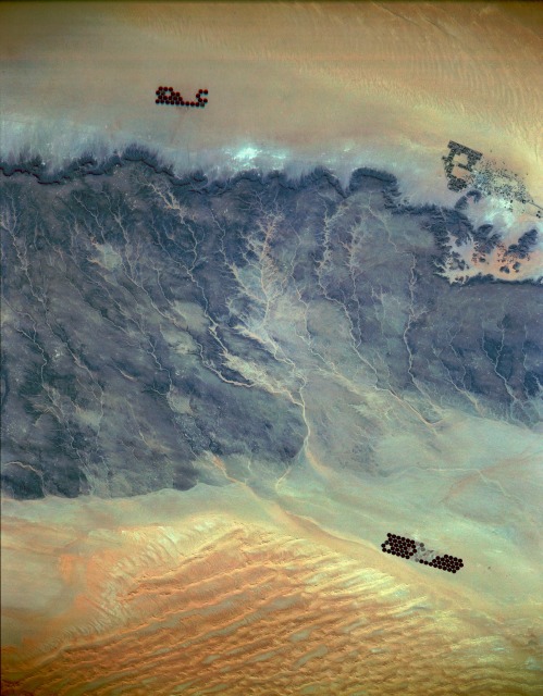
Image Caption: STS036-151-16 Southwest Libya March 1990
The desert scene in this photograph is located just west of one of the few strategic north-south trade routes through southwest Libya. The extensive oasis of Ubari (northeast part of the photograph) is located just north of the darker, eroded, rocky desert. The desert extends in a general northeast-southwest direction for approximately 45 miles (75 kilometers), from the discernible northern escarpment to the northern edge of the sandy Marzuq Desert. A well-entrenched drainage pattern indicates flows toward the south and southeast. The darker rock outcrops are slightly tilted sedimentary rocks sandwiched between the sandy Ubari and Marzuq Deserts. The vivid, dark green, circular features are center-pivot irrigated fields---usually 0.5 mile (0.8 kilometer) in diameter---where sufficient well water is available to practice farming.
The desert scene in this photograph is located just west of one of the few strategic north-south trade routes through southwest Libya. The extensive oasis of Ubari (northeast part of the photograph) is located just north of the darker, eroded, rocky desert. The desert extends in a general northeast-southwest direction for approximately 45 miles (75 kilometers), from the discernible northern escarpment to the northern edge of the sandy Marzuq Desert. A well-entrenched drainage pattern indicates flows toward the south and southeast. The darker rock outcrops are slightly tilted sedimentary rocks sandwiched between the sandy Ubari and Marzuq Deserts. The vivid, dark green, circular features are center-pivot irrigated fields---usually 0.5 mile (0.8 kilometer) in diameter---where sufficient well water is available to practice farming.
