STS035-81-103

| NASA Photo ID | STS035-81-103 |
| Focal Length | 250mm |
| Date taken | 1990.12.08 |
| Time taken | 16:18:03 GMT |
Resolutions offered for this image:
5237 x 5237 pixels 640 x 640 pixels 5700 x 6000 pixels 500 x 526 pixels 640 x 480 pixels
5237 x 5237 pixels 640 x 640 pixels 5700 x 6000 pixels 500 x 526 pixels 640 x 480 pixels

Cloud masks available for this image:
Spacecraft nadir point: 6.8° S, 15.7° W
Photo center point: 8.0° S, 14.4° W
Photo center point by machine learning:
Photo center point: 8.0° S, 14.4° W
Photo center point by machine learning:
Nadir to Photo Center: Southeast
Spacecraft Altitude: 184 nautical miles (341km)
Country or Geographic Name: | ATLANTIC OCEAN I(S). |
Features: | ASCENSION I, CEN OF FRAME |
| Features Found Using Machine Learning: | |
Cloud Cover Percentage: | 30 (26-50)% |
Sun Elevation Angle: | 38° |
Sun Azimuth: | 246° |
Camera: | Hasselblad |
Focal Length: | 250mm |
Camera Tilt: | 30 degrees |
Format: | 5017: Kodak, natural color positive, Ektachrome, X Professional, ASA 64, standard base |
Film Exposure: | Normal |
| Additional Information | |
| Width | Height | Annotated | Cropped | Purpose | Links |
|---|---|---|---|---|---|
| 5237 pixels | 5237 pixels | No | No | Earth From Space collection | Download Image |
| 640 pixels | 640 pixels | No | No | Earth From Space collection | Download Image |
| 5700 pixels | 6000 pixels | No | No | Download Image | |
| 500 pixels | 526 pixels | No | No | Download Image | |
| 640 pixels | 480 pixels | No | No | Download Image |
Download Packaged File
Download a Google Earth KML for this Image
View photo footprint information
Download a GeoTIFF for this photo
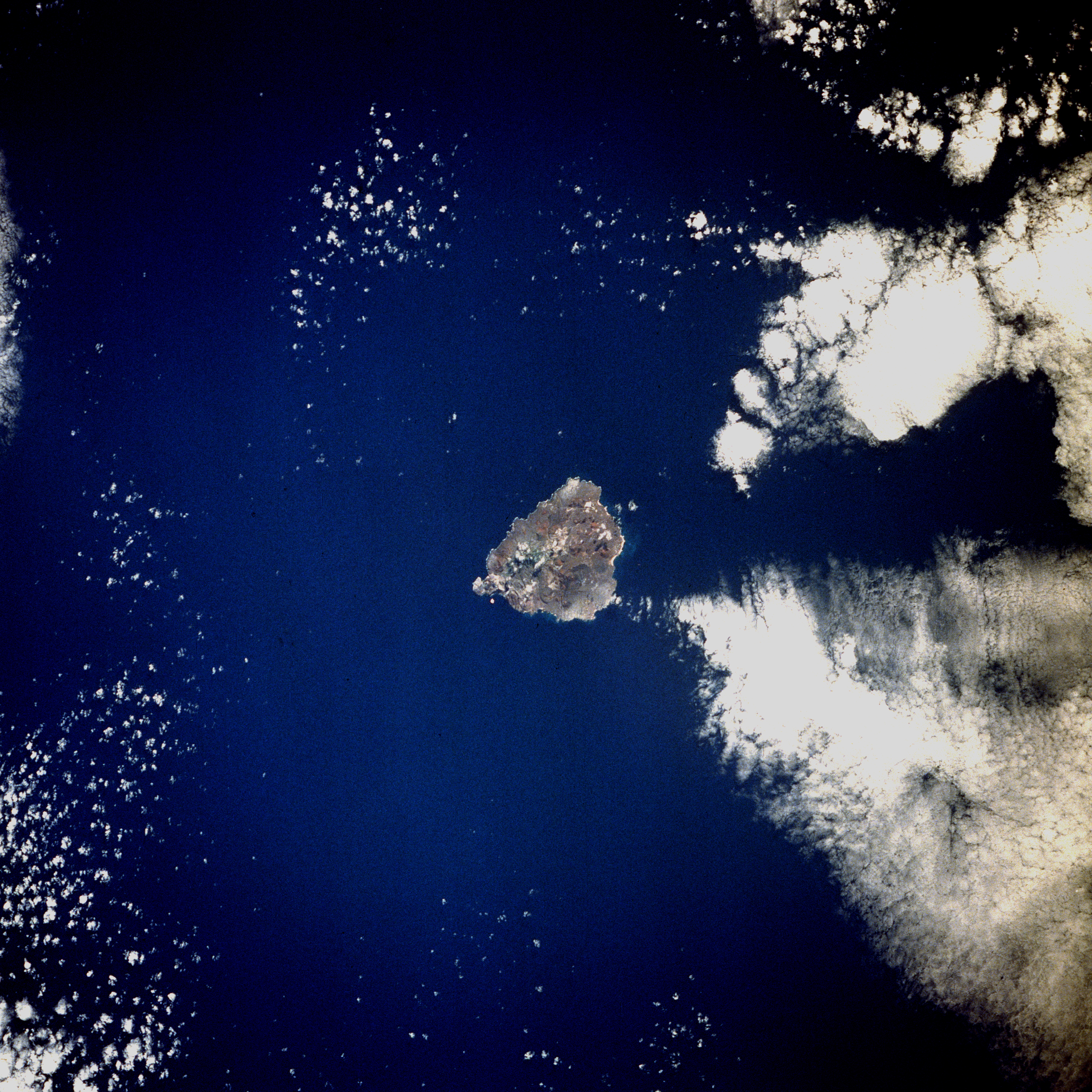
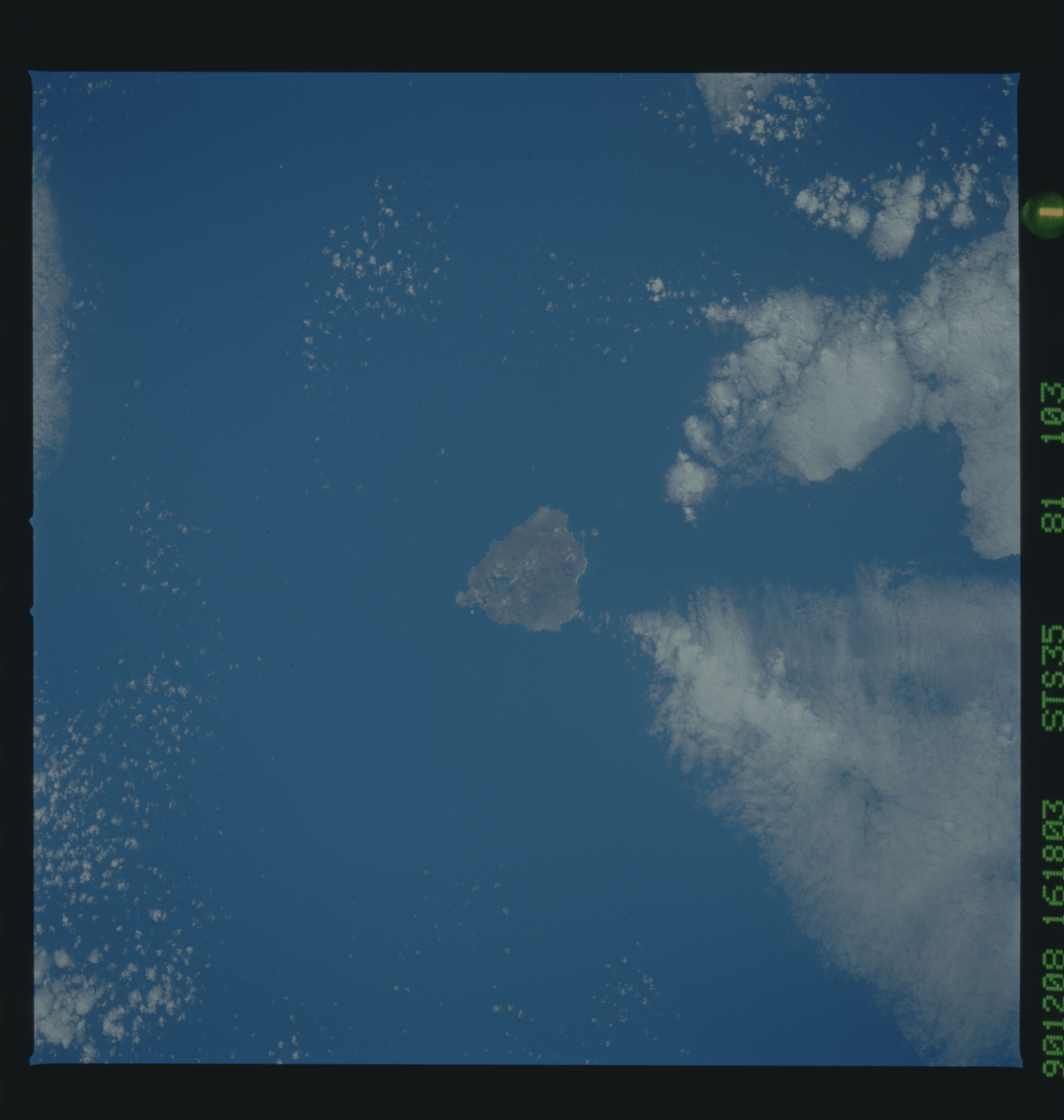
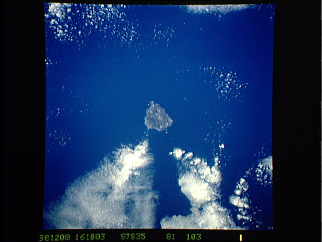
Image Caption: STS035-081-103 Ascension Island, Atlantic Ocean December 1990
Located in the middle of the south Atlantic Ocean, Ascension Island (latitude 8 degrees south) is one of the few surface manifestations of the Mid-Atlantic Ridge. A British possession populated by fewer than 1000, this small volcanic island measures approximately 9 miles (14 kilometers) in length and 6 miles (10 kilometers) in width. The highest point on the island, Green Mountain, which reaches 2817 feet (860 meters) above sea level, is an extinct volcanic crater located near the southeast coast. Georgetown, the only settlement, is on the west side of the island. Ascension was discovered by Portuguese navigator Joao da Nova on Ascension Day 1501, thereby providing the island its name. American engineers constructed an airfield on the island's southwest side during World War II, and the facility was used as a refueling base for selected transatlantic flights.
Located in the middle of the south Atlantic Ocean, Ascension Island (latitude 8 degrees south) is one of the few surface manifestations of the Mid-Atlantic Ridge. A British possession populated by fewer than 1000, this small volcanic island measures approximately 9 miles (14 kilometers) in length and 6 miles (10 kilometers) in width. The highest point on the island, Green Mountain, which reaches 2817 feet (860 meters) above sea level, is an extinct volcanic crater located near the southeast coast. Georgetown, the only settlement, is on the west side of the island. Ascension was discovered by Portuguese navigator Joao da Nova on Ascension Day 1501, thereby providing the island its name. American engineers constructed an airfield on the island's southwest side during World War II, and the facility was used as a refueling base for selected transatlantic flights.
