STS035-76-62
| NASA Photo ID | STS035-76-62 |
| Focal Length | 250mm |
| Date taken | 1990.12.08 |
| Time taken | 05:31:17 GMT |
Resolutions offered for this image:
3840 x 3904 pixels 629 x 639 pixels 5700 x 6000 pixels 500 x 526 pixels 640 x 480 pixels
3840 x 3904 pixels 629 x 639 pixels 5700 x 6000 pixels 500 x 526 pixels 640 x 480 pixels
Cloud masks available for this image:
Spacecraft nadir point: 19.0° S, 123.1° E
Photo center point: 19.5° S, 121.0° E
Photo center point by machine learning:
Photo center point: 19.5° S, 121.0° E
Photo center point by machine learning:
Nadir to Photo Center: West
Spacecraft Altitude: 187 nautical miles (346km)
Country or Geographic Name: | AUSTRALIA-WA |
Features: | COAST-EIGHTY MILE BEACH |
| Features Found Using Machine Learning: | |
Cloud Cover Percentage: | 1 (1-10)% |
Sun Elevation Angle: | 63° |
Sun Azimuth: | 256° |
Camera: | Hasselblad |
Focal Length: | 250mm |
Camera Tilt: | 35 degrees |
Format: | 5017: Kodak, natural color positive, Ektachrome, X Professional, ASA 64, standard base |
Film Exposure: | Normal |
| Additional Information | |
| Width | Height | Annotated | Cropped | Purpose | Links |
|---|---|---|---|---|---|
| 3840 pixels | 3904 pixels | No | No | Earth From Space collection | Download Image |
| 629 pixels | 639 pixels | No | No | Earth From Space collection | Download Image |
| 5700 pixels | 6000 pixels | No | No | Download Image | |
| 500 pixels | 526 pixels | No | No | Download Image | |
| 640 pixels | 480 pixels | No | No | Download Image |
Download Packaged File
Download a Google Earth KML for this Image
View photo footprint information
Download a GeoTIFF for this photo
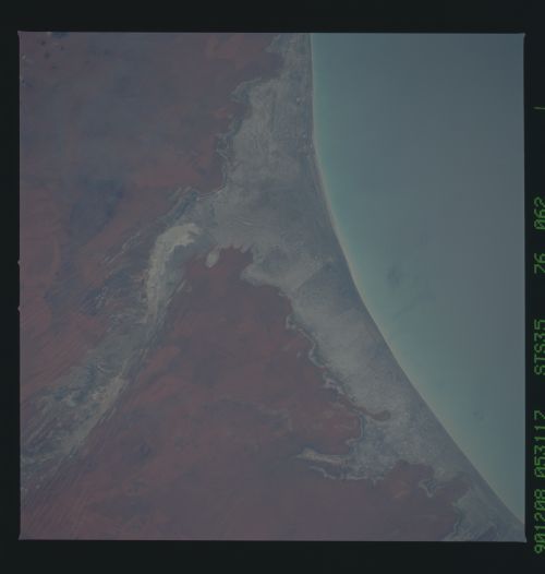
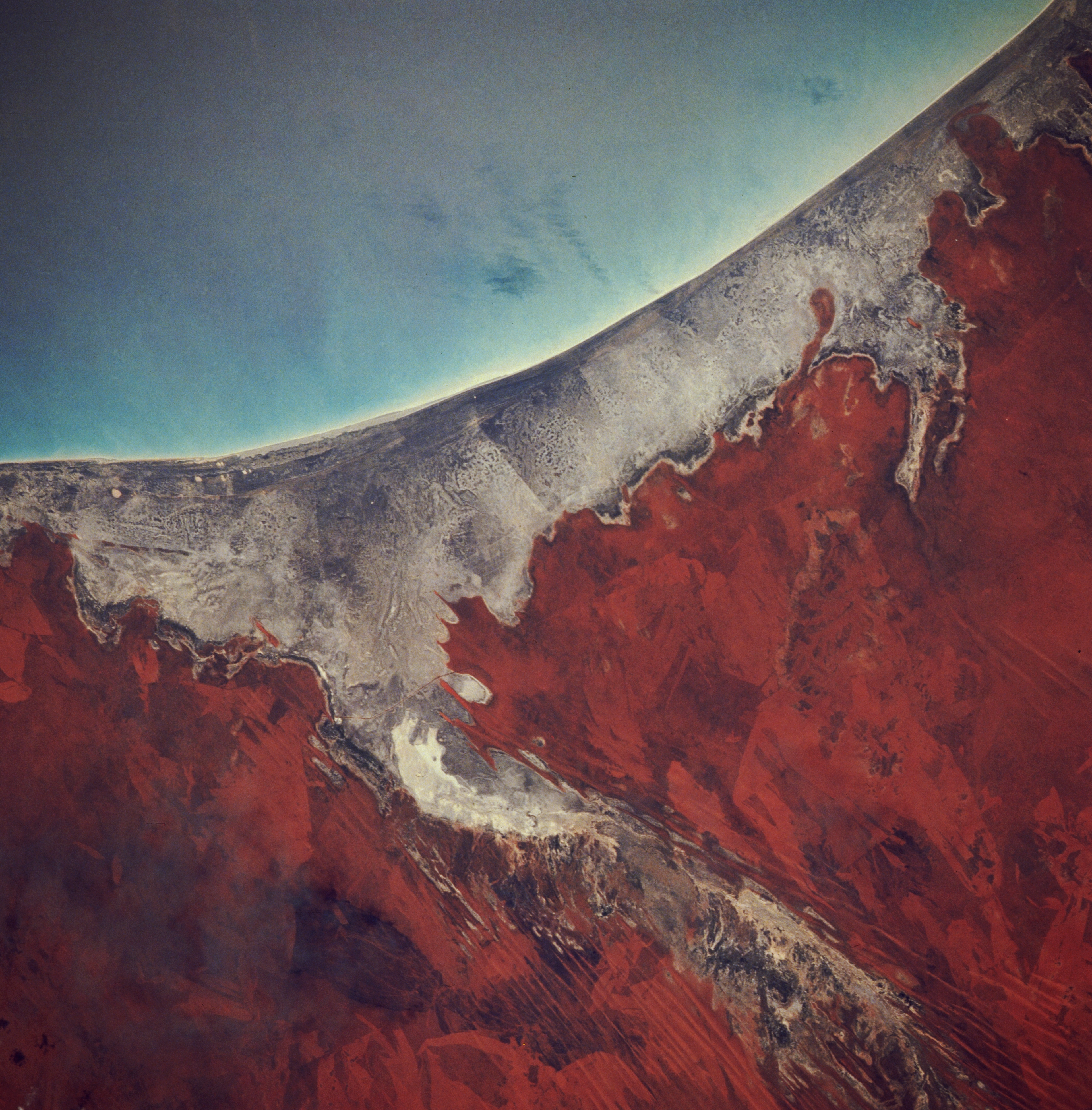
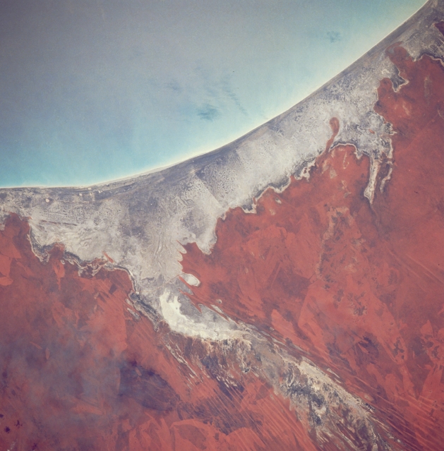
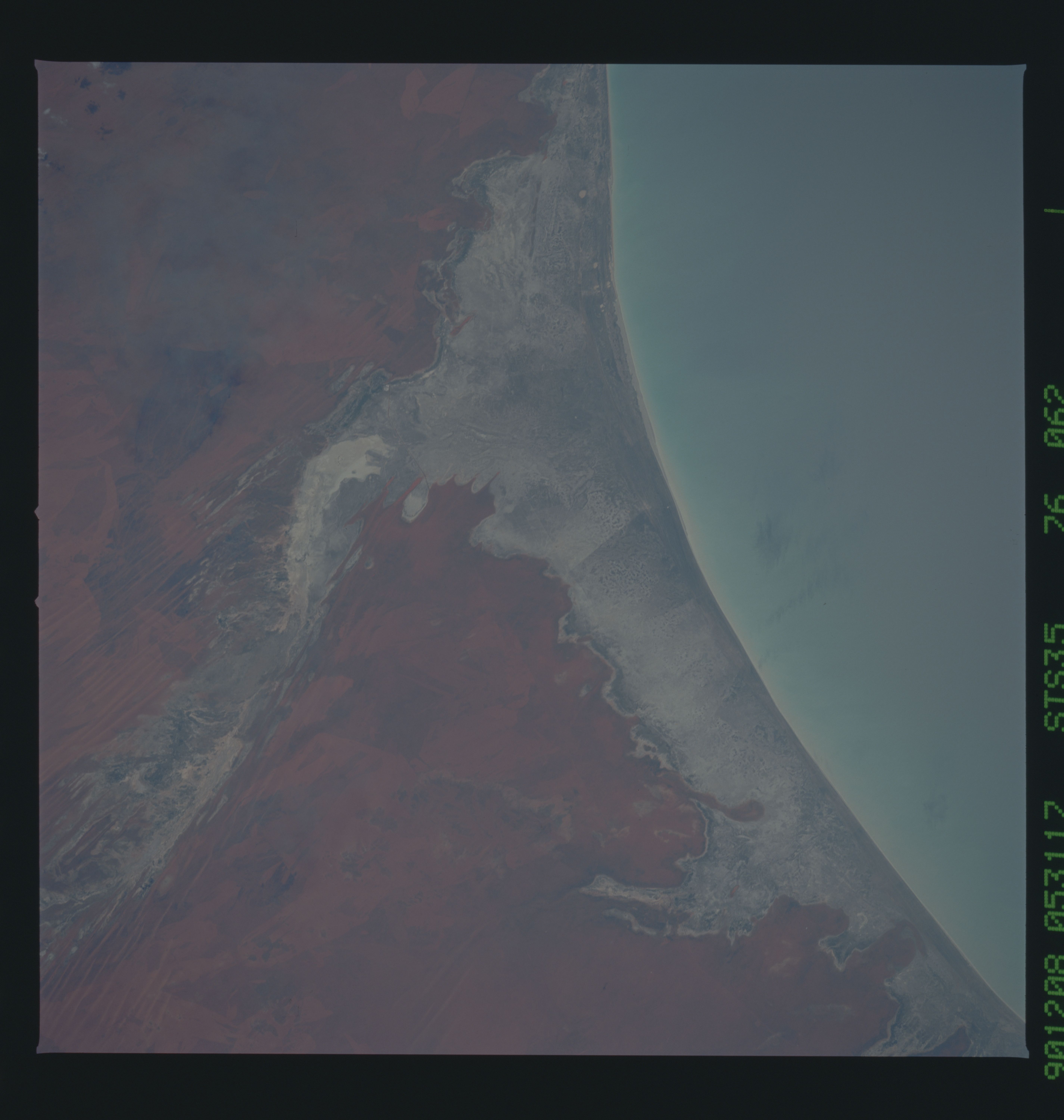
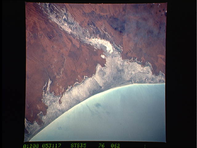
Image Caption: STS035-076-062 Eighty Mile Beach, Western Australia, Australia December 1990
The coastal region in this image is the central part of Eighty Mile Beach. The beach and the surrounding mudflats and marshes are one of the most important migratory stop-over areas for shorebirds in East Asia and Australia and is included in the list of RAMSAR sites. The unpolluted waters off the beach host some of the world's richest pearl beds. The actual beach width averages about 328 feet (100 meters), with a tidal range of about 20 feet (6 meters). Inland from the coast the sandy plains and ridges (parallel bands of alternating light and dark streaks) are covered by an assortment of grasses.
The coastal region in this image is the central part of Eighty Mile Beach. The beach and the surrounding mudflats and marshes are one of the most important migratory stop-over areas for shorebirds in East Asia and Australia and is included in the list of RAMSAR sites. The unpolluted waters off the beach host some of the world's richest pearl beds. The actual beach width averages about 328 feet (100 meters), with a tidal range of about 20 feet (6 meters). Inland from the coast the sandy plains and ridges (parallel bands of alternating light and dark streaks) are covered by an assortment of grasses.
