STS035-76-54
| NASA Photo ID | STS035-76-54 |
| Focal Length | 250mm |
| Date taken | 1990.12.08 |
| Time taken | 05:30:28 GMT |
Resolutions offered for this image:
3936 x 3904 pixels 639 x 634 pixels 5700 x 6000 pixels 500 x 526 pixels 640 x 480 pixels
3936 x 3904 pixels 639 x 634 pixels 5700 x 6000 pixels 500 x 526 pixels 640 x 480 pixels
Cloud masks available for this image:
Spacecraft nadir point: 20.1° S, 120.1° E
Photo center point: 20.5° S, 118.5° E
Photo center point by machine learning:
Photo center point: 20.5° S, 118.5° E
Photo center point by machine learning:
Nadir to Photo Center: West
Spacecraft Altitude: 187 nautical miles (346km)
Country or Geographic Name: | AUSTRALIA-WA |
Features: | COAST-TURNER RIVER |
| Features Found Using Machine Learning: | |
Cloud Cover Percentage: | 0 (no clouds present) |
Sun Elevation Angle: | 66° |
Sun Azimuth: | 259° |
Camera: | Hasselblad |
Focal Length: | 250mm |
Camera Tilt: | 28 degrees |
Format: | 5017: Kodak, natural color positive, Ektachrome, X Professional, ASA 64, standard base |
Film Exposure: | Normal |
| Additional Information | |
| Width | Height | Annotated | Cropped | Purpose | Links |
|---|---|---|---|---|---|
| 3936 pixels | 3904 pixels | No | No | Earth From Space collection | Download Image |
| 639 pixels | 634 pixels | No | No | Earth From Space collection | Download Image |
| 5700 pixels | 6000 pixels | No | No | Download Image | |
| 500 pixels | 526 pixels | No | No | Download Image | |
| 640 pixels | 480 pixels | No | No | Download Image |
Download Packaged File
Download a Google Earth KML for this Image
View photo footprint information
Download a GeoTIFF for this photo
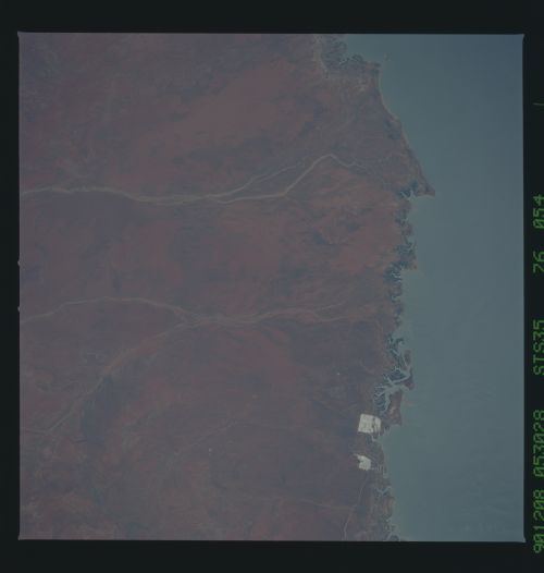
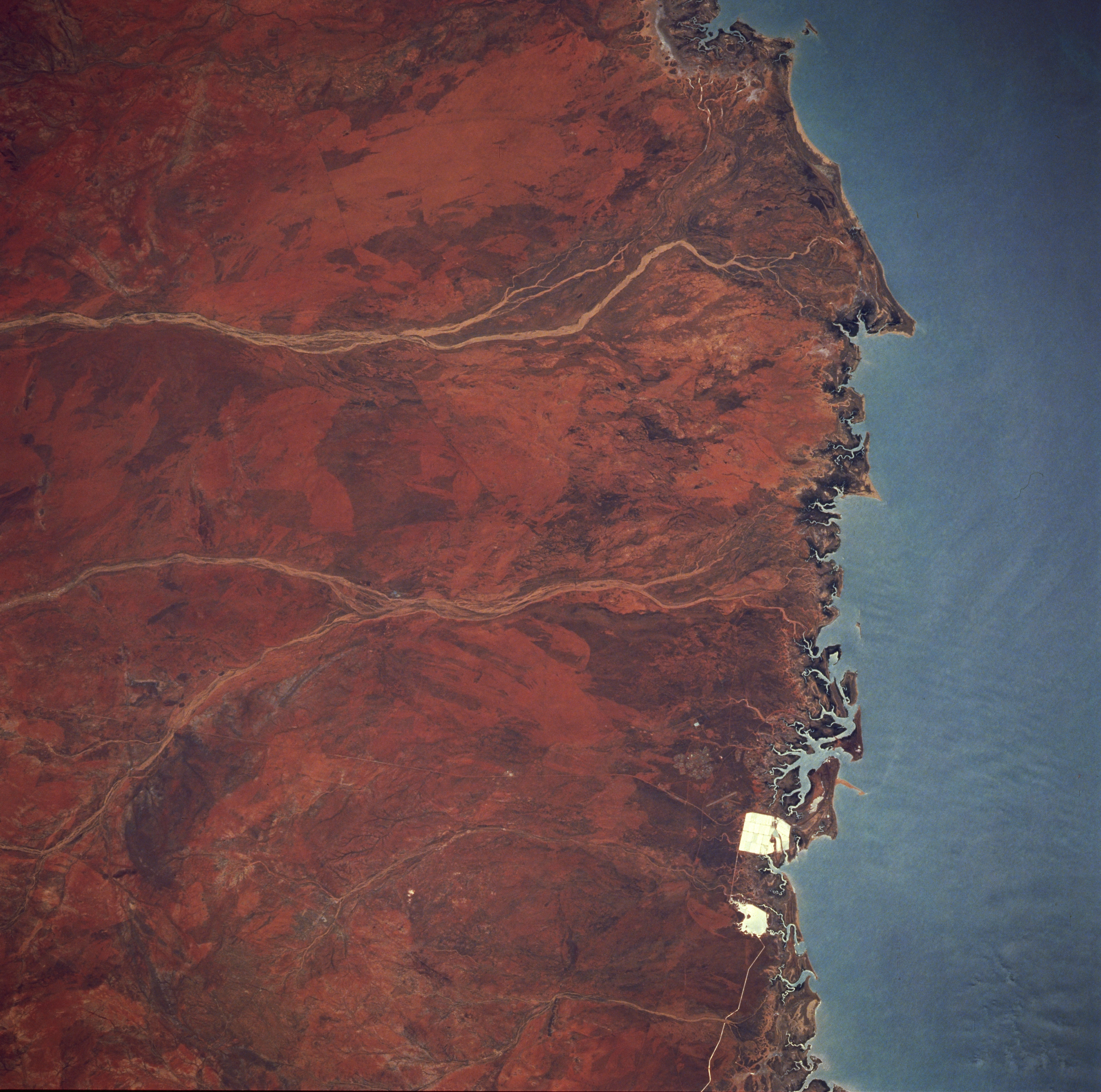
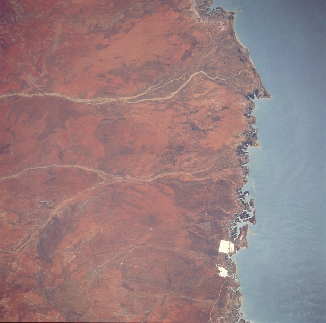
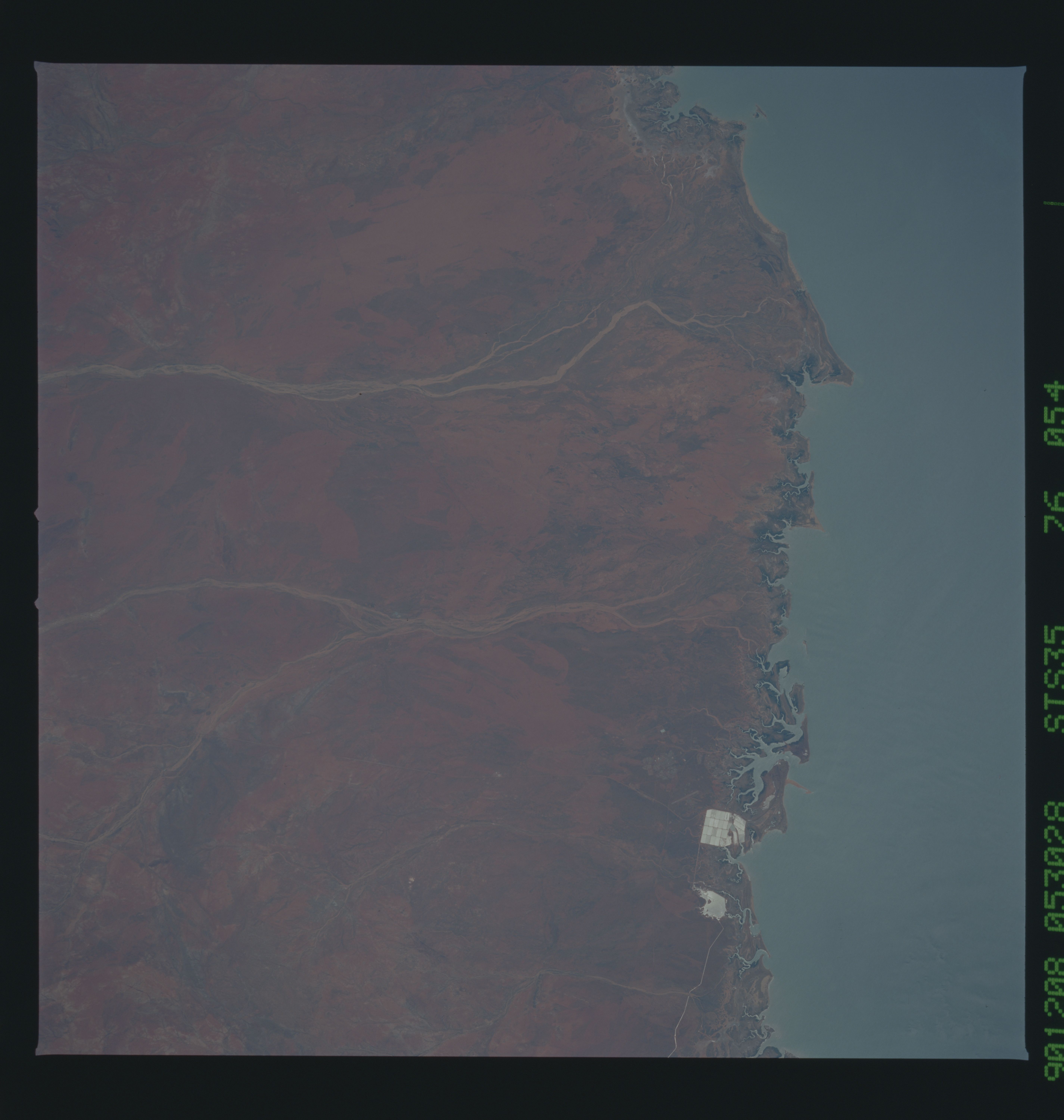
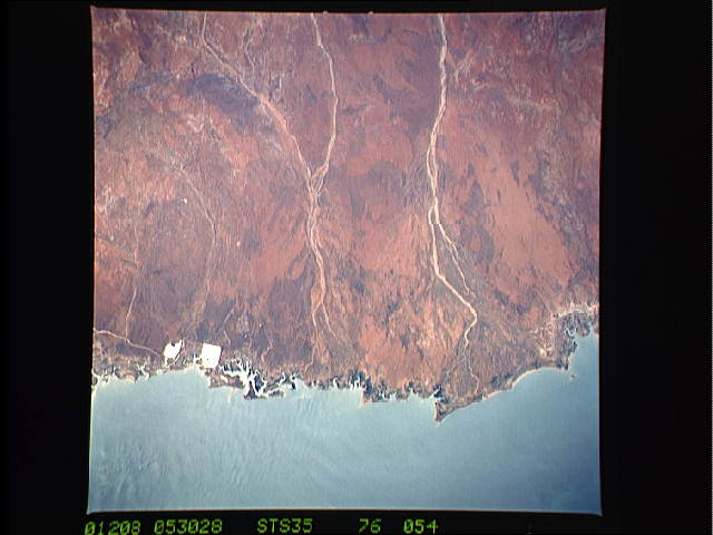
Image Caption: STS035-076-054 Port Hedland Area, Western Australia, Australia December 1990
The two highly reflective features are part of a flourishing salt mining operation (salt evaporation-pans) along the shoreline in northern Western Australia. The two north flowing river systems (flow is to the right) are the Turner and the Yule River (most westerly). Although these rivers flow only intermittently through the arid region, the tropical rains that do fall during the summer months have sufficient flow to build sizable deltas (slightly darker, more vegetated landscape) along the coast. There is also a narrow band of mangrove forest (darker areas) along the coast.
The two highly reflective features are part of a flourishing salt mining operation (salt evaporation-pans) along the shoreline in northern Western Australia. The two north flowing river systems (flow is to the right) are the Turner and the Yule River (most westerly). Although these rivers flow only intermittently through the arid region, the tropical rains that do fall during the summer months have sufficient flow to build sizable deltas (slightly darker, more vegetated landscape) along the coast. There is also a narrow band of mangrove forest (darker areas) along the coast.
