STS035-76-50
| NASA Photo ID | STS035-76-50 |
| Focal Length | 250mm |
| Date taken | 1990.12.08 |
| Time taken | 05:30:11 GMT |
Resolutions offered for this image:
3936 x 3872 pixels 639 x 629 pixels 5700 x 6000 pixels 500 x 526 pixels 640 x 480 pixels
3936 x 3872 pixels 639 x 629 pixels 5700 x 6000 pixels 500 x 526 pixels 640 x 480 pixels
Cloud masks available for this image:
Spacecraft nadir point: 20.5° S, 119.1° E
Photo center point: 21.0° S, 117.0° E
Photo center point by machine learning:
Photo center point: 21.0° S, 117.0° E
Photo center point by machine learning:
Nadir to Photo Center: West
Spacecraft Altitude: 188 nautical miles (348km)
Country or Geographic Name: | AUSTRALIA-WA |
Features: | COAST-MERMAID SOUND |
| Features Found Using Machine Learning: | |
Cloud Cover Percentage: | 15 (11-25)% |
Sun Elevation Angle: | 67° |
Sun Azimuth: | 259° |
Camera: | Hasselblad |
Focal Length: | 250mm |
Camera Tilt: | 35 degrees |
Format: | 5017: Kodak, natural color positive, Ektachrome, X Professional, ASA 64, standard base |
Film Exposure: | Normal |
| Additional Information | |
| Width | Height | Annotated | Cropped | Purpose | Links |
|---|---|---|---|---|---|
| 3936 pixels | 3872 pixels | No | No | Earth From Space collection | Download Image |
| 639 pixels | 629 pixels | No | No | Earth From Space collection | Download Image |
| 5700 pixels | 6000 pixels | No | No | Download Image | |
| 500 pixels | 526 pixels | No | No | Download Image | |
| 640 pixels | 480 pixels | No | No | Download Image |
Download Packaged File
Download a Google Earth KML for this Image
View photo footprint information
Download a GeoTIFF for this photo
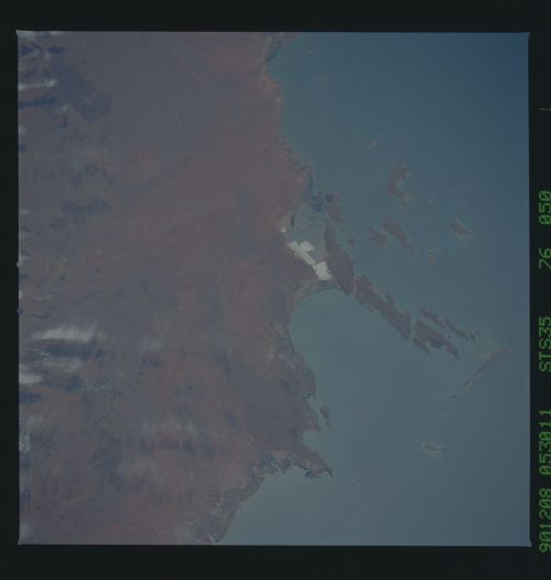
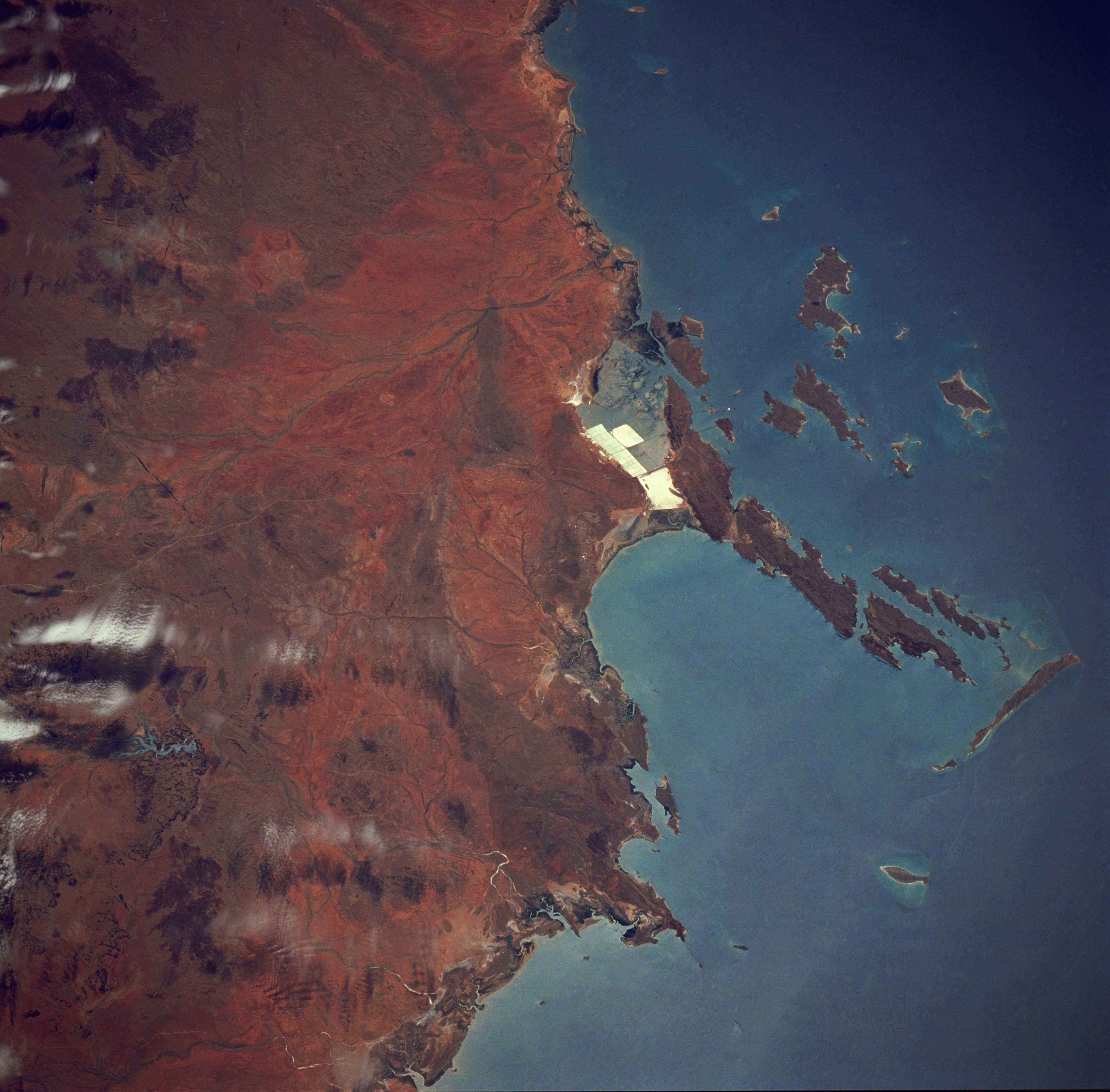
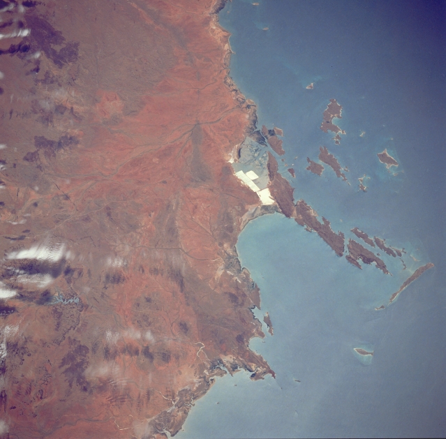
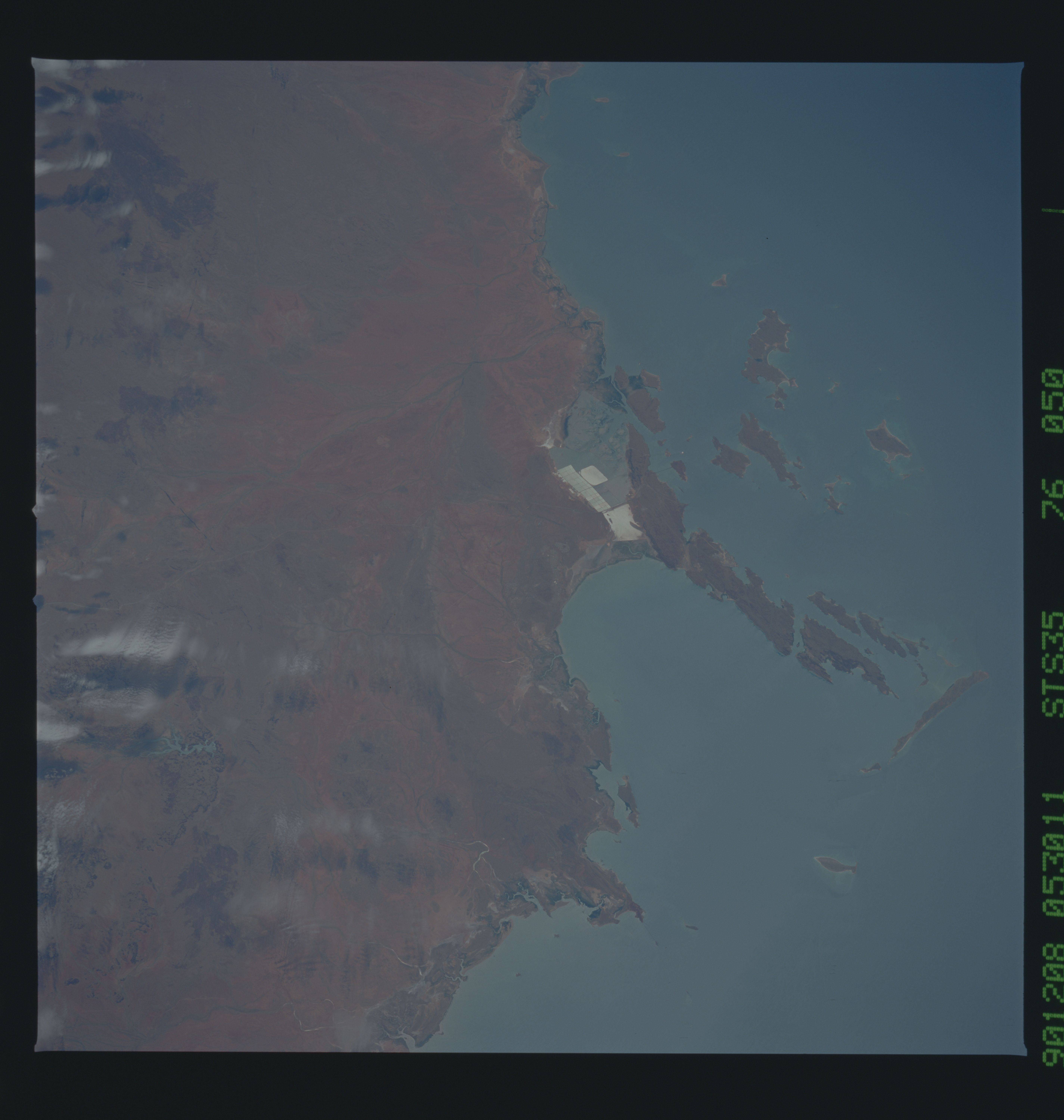
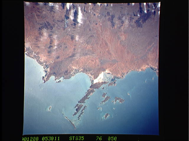
Image Caption: STS035-076-050 Dampier Area, Western Australia, Australia December 1990
The highly reflective surfaces near the middle of the photograph show the location of evaporative pans where salt is being mined on the northwest coast of Western Australia. The Burrup Peninsula, the large peninsula pointing northward (right) has an abundance of prehistoric rock engravings. Part of the extensive Dampier Archipelago is visible along the coastline. This archipelago consists of 42 islands. The islands were formed approximately 7000 years ago when rising water from the melting glaciers (last Ice Age) flooded the coastal valleys.
The highly reflective surfaces near the middle of the photograph show the location of evaporative pans where salt is being mined on the northwest coast of Western Australia. The Burrup Peninsula, the large peninsula pointing northward (right) has an abundance of prehistoric rock engravings. Part of the extensive Dampier Archipelago is visible along the coastline. This archipelago consists of 42 islands. The islands were formed approximately 7000 years ago when rising water from the melting glaciers (last Ice Age) flooded the coastal valleys.
