STS035-76-44

| NASA Photo ID | STS035-76-44 |
| Focal Length | 250mm |
| Date taken | 1990.12.08 |
| Time taken | 05:29:33 GMT |
Resolutions offered for this image:
3936 x 3840 pixels 639 x 624 pixels 5700 x 6000 pixels 500 x 526 pixels 640 x 480 pixels 3996 x 3988 pixels 909 x 1772 pixels 3996 x 3988 pixels 540 x 1053 pixels
3936 x 3840 pixels 639 x 624 pixels 5700 x 6000 pixels 500 x 526 pixels 640 x 480 pixels 3996 x 3988 pixels 909 x 1772 pixels 3996 x 3988 pixels 540 x 1053 pixels


Cloud masks available for this image:
Spacecraft nadir point: 21.4° S, 116.7° E
Photo center point: 22.0° S, 114.0° E
Photo center point by machine learning:
Photo center point: 22.0° S, 114.0° E
Photo center point by machine learning:
Nadir to Photo Center: West
Spacecraft Altitude: 188 nautical miles (348km)
Country or Geographic Name: | AUSTRALIA-WA |
Features: | COAST-NINGALOO REEF |
| Features Found Using Machine Learning: | |
Cloud Cover Percentage: | 5 (1-10)% |
Sun Elevation Angle: | 70° |
Sun Azimuth: | 261° |
Camera: | Hasselblad |
Focal Length: | 250mm |
Camera Tilt: | 41 degrees |
Format: | 5017: Kodak, natural color positive, Ektachrome, X Professional, ASA 64, standard base |
Film Exposure: | Normal |
| Additional Information | |
| Width | Height | Annotated | Cropped | Purpose | Links |
|---|---|---|---|---|---|
| 3936 pixels | 3840 pixels | No | No | Earth From Space collection | Download Image |
| 639 pixels | 624 pixels | No | No | Earth From Space collection | Download Image |
| 5700 pixels | 6000 pixels | No | No | Download Image | |
| 500 pixels | 526 pixels | No | No | Download Image | |
| 640 pixels | 480 pixels | No | No | Download Image | |
| 3996 pixels | 3988 pixels | No | No | Coral Reef Atlas Publication | Download Image |
| 909 pixels | 1772 pixels | Yes | Yes | Publisher Request | Download Image |
| 3996 pixels | 3988 pixels | No | No | Download Image | |
| 540 pixels | 1053 pixels | Yes | Yes | Publisher Request | Download Image |
Download Packaged File
Download a Google Earth KML for this Image
View photo footprint information
Download a GeoTIFF for this photo
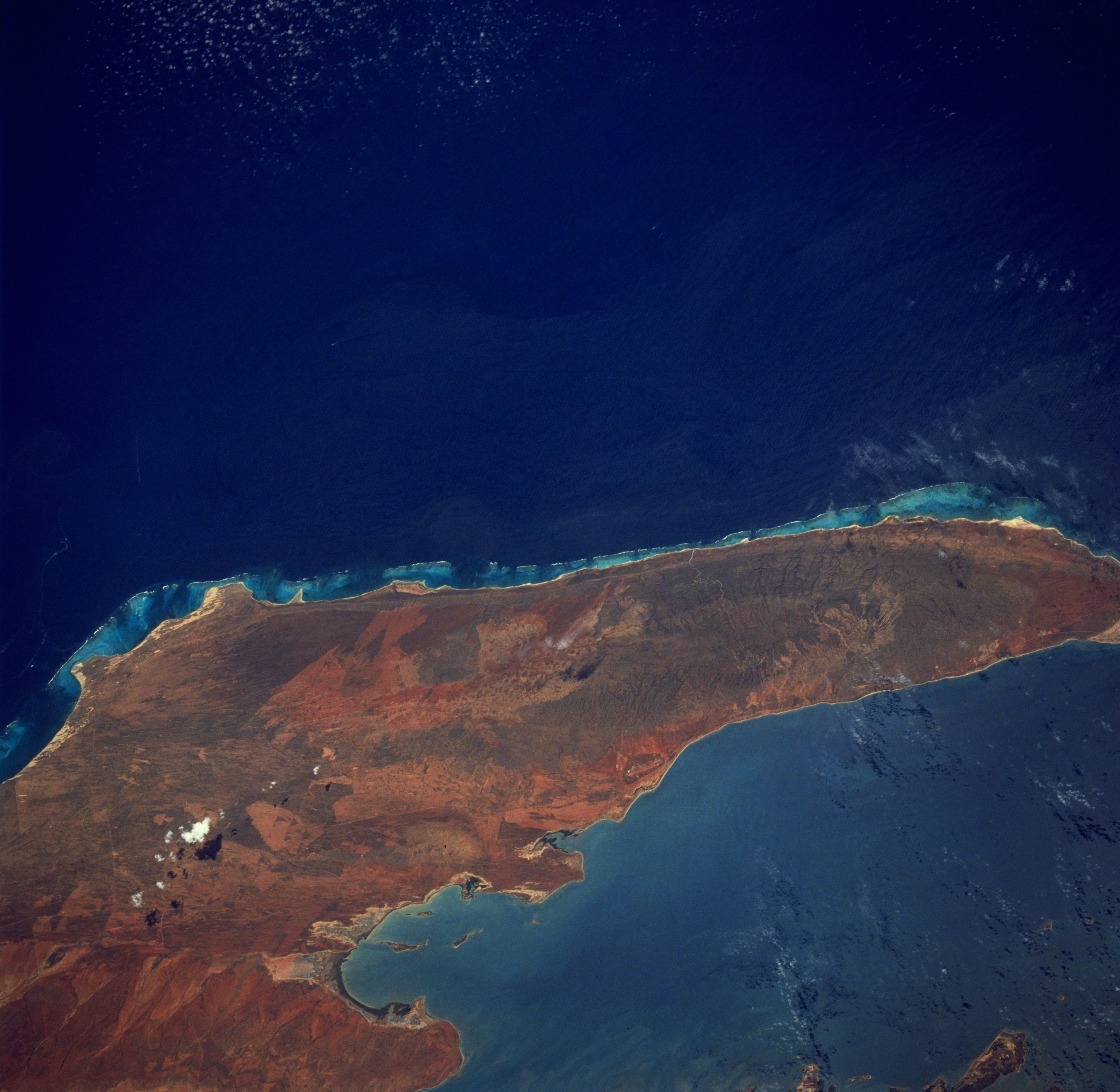
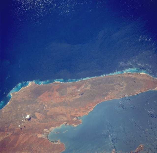
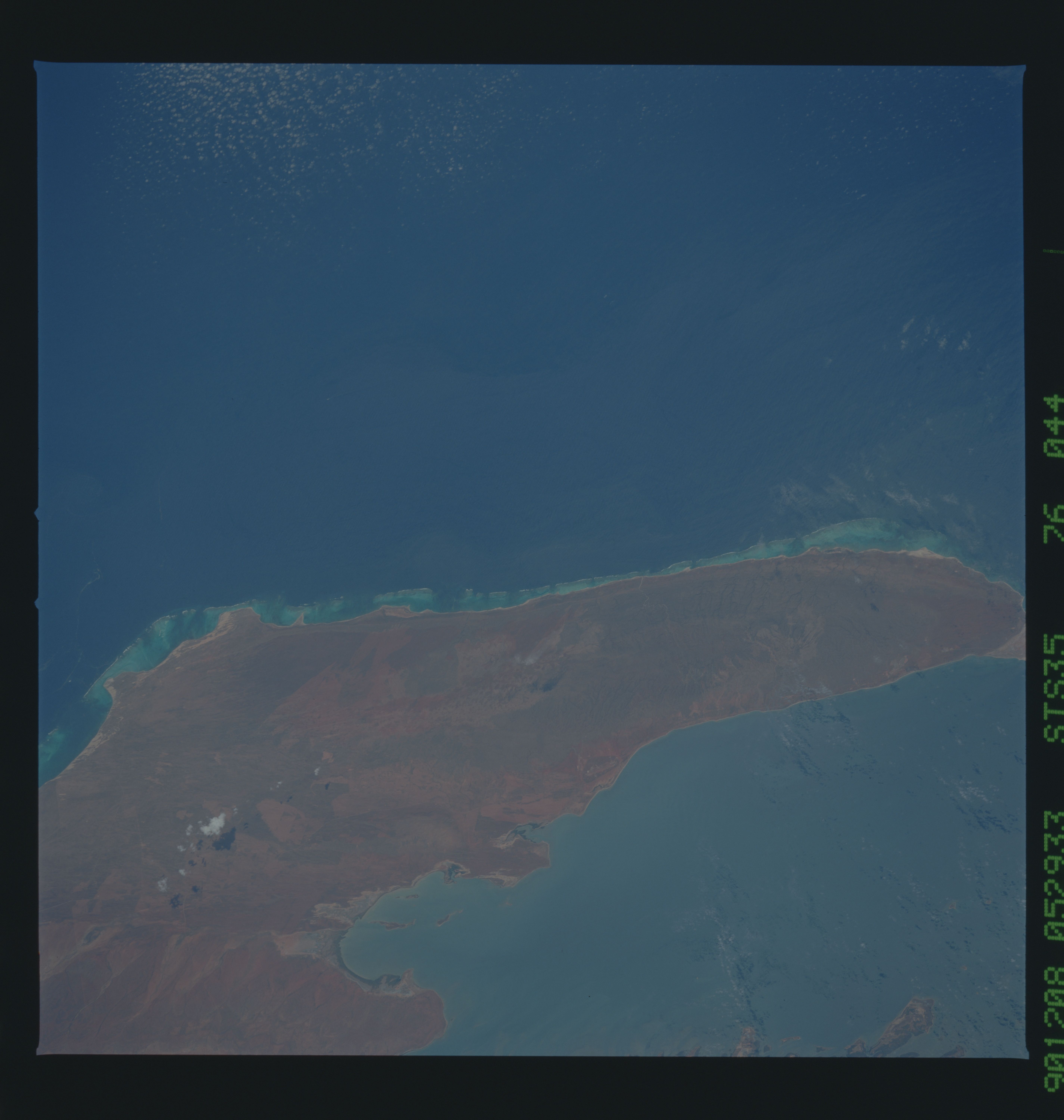
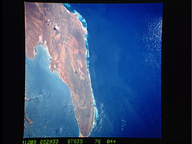
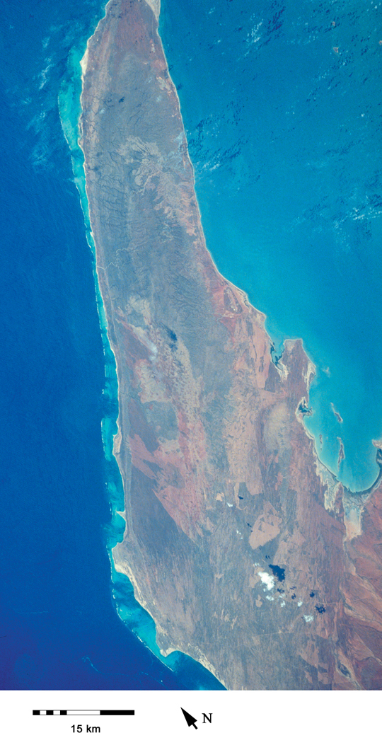
Image Caption: STS035-76-44 North West Cape, Western Australia, Australia December 1990
This sizable peninsula forms the western border for the Exmouth Gulf of northwest Western Australia. A line of low mountains, known as the Cape Range, extends along the spine or north-south axis of the peninsula. Maximum elevation in these low mountains is 1099 feet (335 meters) above sea level. Some of the lighter colored, angular-looking designs indicate that the vegetative cover, mainly grasslands, has been modified by fires. The clearly defined Ningaloo Reef system borders the west coast of the peninsula.
This sizable peninsula forms the western border for the Exmouth Gulf of northwest Western Australia. A line of low mountains, known as the Cape Range, extends along the spine or north-south axis of the peninsula. Maximum elevation in these low mountains is 1099 feet (335 meters) above sea level. Some of the lighter colored, angular-looking designs indicate that the vegetative cover, mainly grasslands, has been modified by fires. The clearly defined Ningaloo Reef system borders the west coast of the peninsula.
