STS035-76-40
| NASA Photo ID | STS035-76-40 |
| Focal Length | 250mm |
| Date taken | 1990.12.08 |
| Time taken | 05:28:56 GMT |
Resolutions offered for this image:
3872 x 3936 pixels 629 x 639 pixels 5700 x 6000 pixels 500 x 526 pixels 640 x 480 pixels
3872 x 3936 pixels 629 x 639 pixels 5700 x 6000 pixels 500 x 526 pixels 640 x 480 pixels

Cloud masks available for this image:
Spacecraft nadir point: 22.2° S, 114.4° E
Photo center point: 24.0° S, 113.5° E
Photo center point by machine learning:
Photo center point: 24.0° S, 113.5° E
Photo center point by machine learning:
Nadir to Photo Center: South
Spacecraft Altitude: 188 nautical miles (348km)
Country or Geographic Name: | AUSTRALIA-WA |
Features: | COAST-LAKE MCLEOD |
| Features Found Using Machine Learning: | |
Cloud Cover Percentage: | 0 (no clouds present) |
Sun Elevation Angle: | 72° |
Sun Azimuth: | 264° |
Camera: | Hasselblad |
Focal Length: | 250mm |
Camera Tilt: | 33 degrees |
Format: | 5017: Kodak, natural color positive, Ektachrome, X Professional, ASA 64, standard base |
Film Exposure: | Normal |
| Additional Information | |
| Width | Height | Annotated | Cropped | Purpose | Links |
|---|---|---|---|---|---|
| 3872 pixels | 3936 pixels | No | No | Earth From Space collection | Download Image |
| 629 pixels | 639 pixels | No | No | Earth From Space collection | Download Image |
| 5700 pixels | 6000 pixels | No | No | Download Image | |
| 500 pixels | 526 pixels | No | No | Download Image | |
| 640 pixels | 480 pixels | No | No | Download Image |
Download Packaged File
Download a Google Earth KML for this Image
View photo footprint information
Download a GeoTIFF for this photo
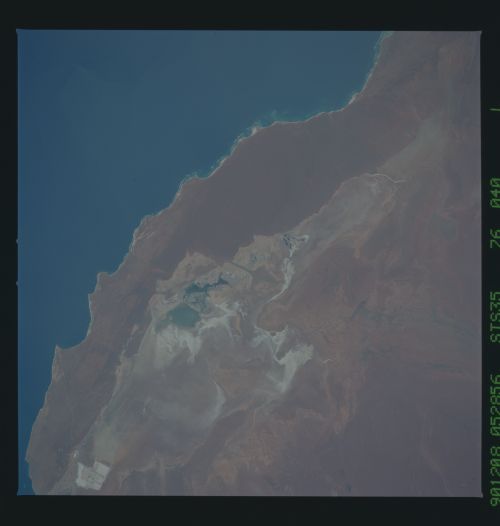
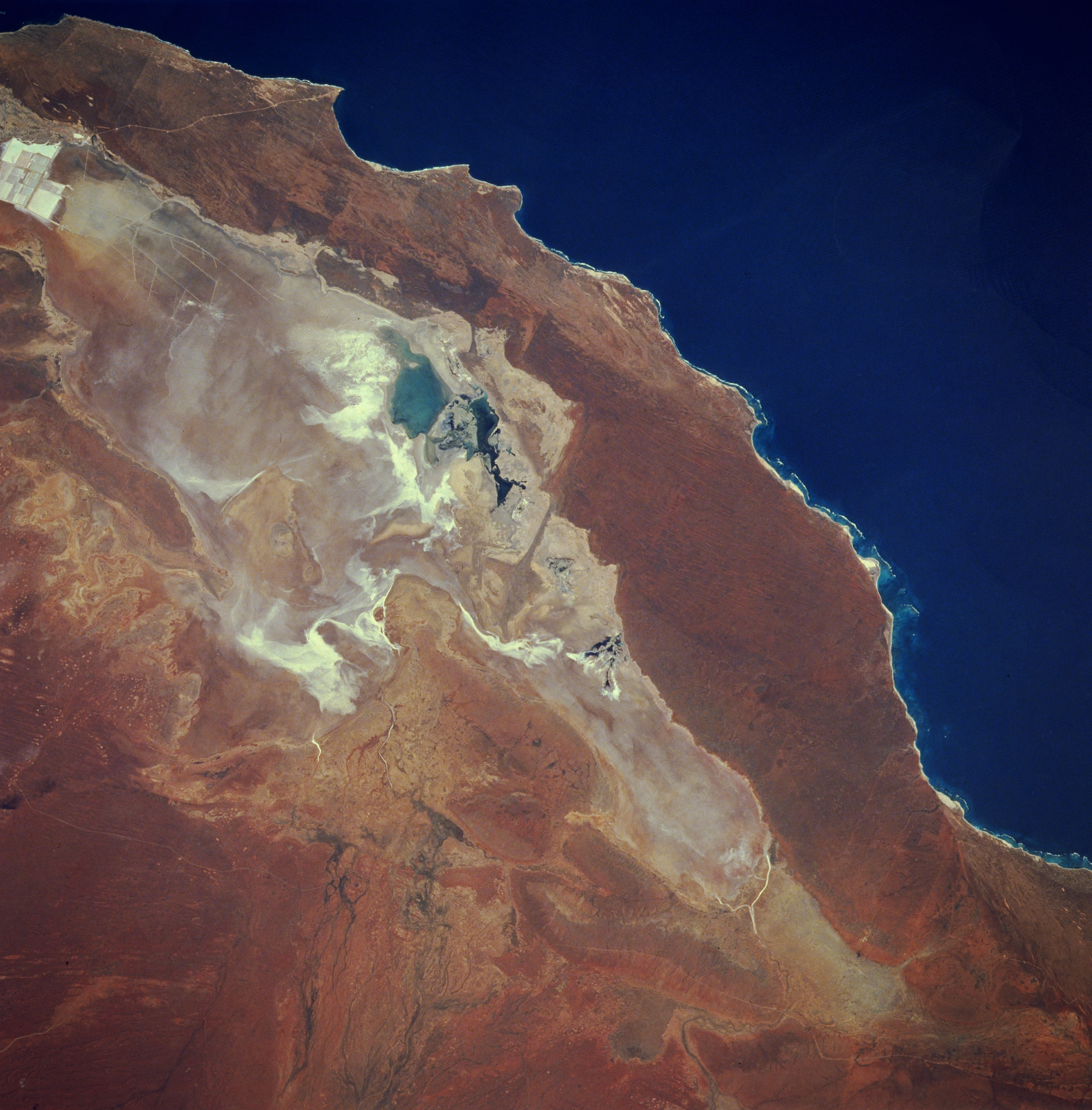
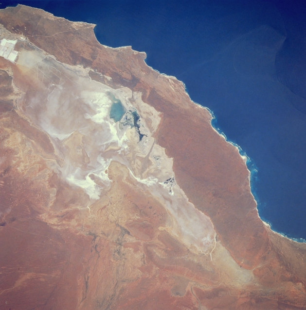
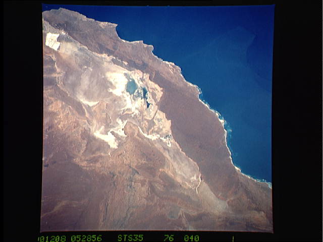
Image Caption: STS035-076-040 Lake Macleod, West Australia, Australia December 1990
Lake Macleod, located approximately 43 miles (70 kilometers) north of the small town of Carnarvon, is normally a dry lake. At the time this photograph was taken there appears to be standing water in Lake Macleod (darker features near center of the image). Overall, the dry lake bed is a mosaic of saline alluvial plains with some shrublands and an assortment of sandy ridges, clay flats, and grasslands on and between red sand dunes. The light colored rectangular patterns (bottom left) are areas where salt mining operations are in progress. The southern end of Lake Macleod has been producing various quantities of salt since 1969. Much of the mined salt is exported to Pacific Rim countries.
Lake Macleod, located approximately 43 miles (70 kilometers) north of the small town of Carnarvon, is normally a dry lake. At the time this photograph was taken there appears to be standing water in Lake Macleod (darker features near center of the image). Overall, the dry lake bed is a mosaic of saline alluvial plains with some shrublands and an assortment of sandy ridges, clay flats, and grasslands on and between red sand dunes. The light colored rectangular patterns (bottom left) are areas where salt mining operations are in progress. The southern end of Lake Macleod has been producing various quantities of salt since 1969. Much of the mined salt is exported to Pacific Rim countries.
