STS035-74-37
| NASA Photo ID | STS035-74-37 |
| Focal Length | 250mm |
| Date taken | 1990.12.03 |
| Time taken | 15:53:04 GMT |

Cloud masks available for this image:
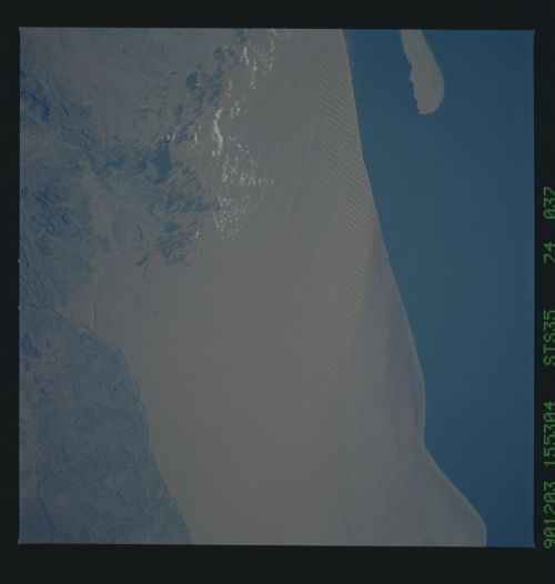
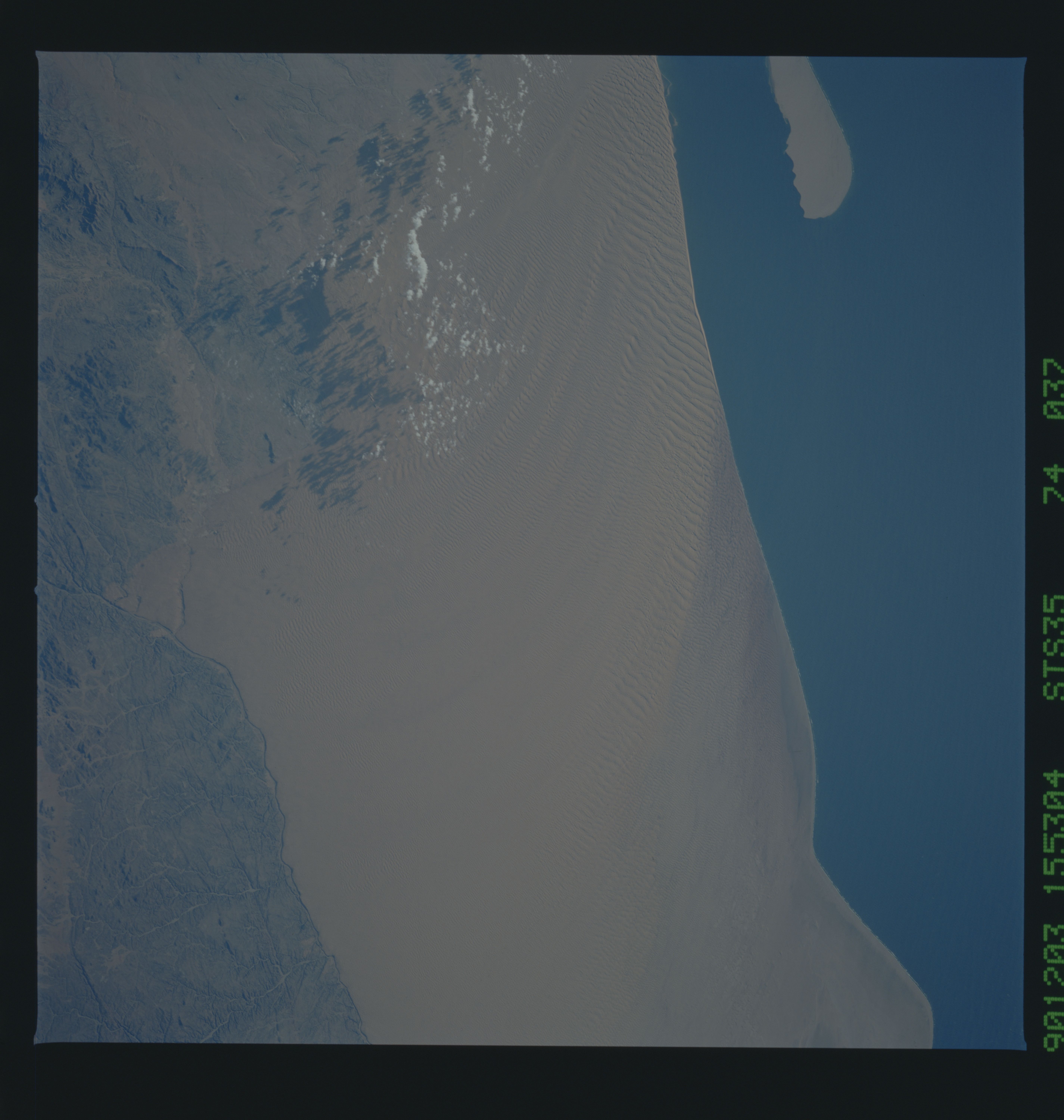
Spacecraft nadir point: 15.8° S, 13.0° E
Photo center point: 16.0° S, 12.0° E
Photo center point by machine learning:
Photo center point: 16.0° S, 12.0° E
Photo center point by machine learning:
Nadir to Photo Center: West
Spacecraft Altitude: 188 nautical miles (348km)
Country or Geographic Name: | ANGOLA |
Features: | MOCAMEDES DESERT-COAST |
| Features Found Using Machine Learning: | |
Cloud Cover Percentage: | 5 (1-10)% |
Sun Elevation Angle: | 20° |
Sun Azimuth: | 251° |
Camera: | Hasselblad |
Focal Length: | 250mm |
Camera Tilt: | 18 degrees |
Format: | 5017: Kodak, natural color positive, Ektachrome, X Professional, ASA 64, standard base |
Film Exposure: | Normal |
| Additional Information | |
| Width | Height | Annotated | Cropped | Purpose | Links |
|---|---|---|---|---|---|
| 5700 pixels | 6000 pixels | No | No | Download Image | |
| 500 pixels | 526 pixels | No | No | Download Image | |
| 640 pixels | 480 pixels | No | No | Download Image |
Download Packaged File
Download a Google Earth KML for this Image
View photo footprint information
Download a GeoTIFF for this photo
Image Caption: These lines of sand dunes in the Mocamedes Desert, Angola, Africa (16.0S, 12.0E), make a festoon pattern as they curve inland from the coast. Beach sand is blown inland by very strong southerly winds giving rise to lines of dunes, the crests of which have a ribbed appearance. The reason for the inland curve of the winds is not known but the effect can bve observed at the mouths of most of the major valleys along the Namib coast to the south.
