STS035-73-39

| NASA Photo ID | STS035-73-39 |
| Focal Length | 100mm |
| Date taken | 1990.12.03 |
| Time taken | 17:11:26 GMT |
Resolutions offered for this image:
5275 x 5275 pixels 639 x 639 pixels 5700 x 6000 pixels 500 x 526 pixels 640 x 480 pixels 1296 x 1284 pixels
5275 x 5275 pixels 639 x 639 pixels 5700 x 6000 pixels 500 x 526 pixels 640 x 480 pixels 1296 x 1284 pixels


Cloud masks available for this image:
Spacecraft nadir point: 28.5° S, 61.2° W
Photo center point: 33.5° S, 59.0° W
Photo center point by machine learning:
Photo center point: 33.5° S, 59.0° W
Photo center point by machine learning:
Nadir to Photo Center: South
Spacecraft Altitude: 190 nautical miles (352km)
Country or Geographic Name: | ARGENTINA |
Features: | DE LA PLATA RIVER |
| Features Found Using Machine Learning: | |
Cloud Cover Percentage: | 15 (11-25)% |
Sun Elevation Angle: | 71° |
Sun Azimuth: | 285° |
Camera: | Hasselblad |
Focal Length: | 100mm |
Camera Tilt: | High Oblique |
Format: | 5017: Kodak, natural color positive, Ektachrome, X Professional, ASA 64, standard base |
Film Exposure: | Normal |
| Additional Information | |
| Width | Height | Annotated | Cropped | Purpose | Links |
|---|---|---|---|---|---|
| 5275 pixels | 5275 pixels | No | No | Earth From Space collection | Download Image |
| 639 pixels | 639 pixels | No | No | Earth From Space collection | Download Image |
| 5700 pixels | 6000 pixels | No | No | Download Image | |
| 500 pixels | 526 pixels | No | No | Download Image | |
| 640 pixels | 480 pixels | No | No | Download Image | |
| 1296 pixels | 1284 pixels | No | No | Download Image |
Download Packaged File
Download a Google Earth KML for this Image
View photo footprint information
Download a GeoTIFF for this photo
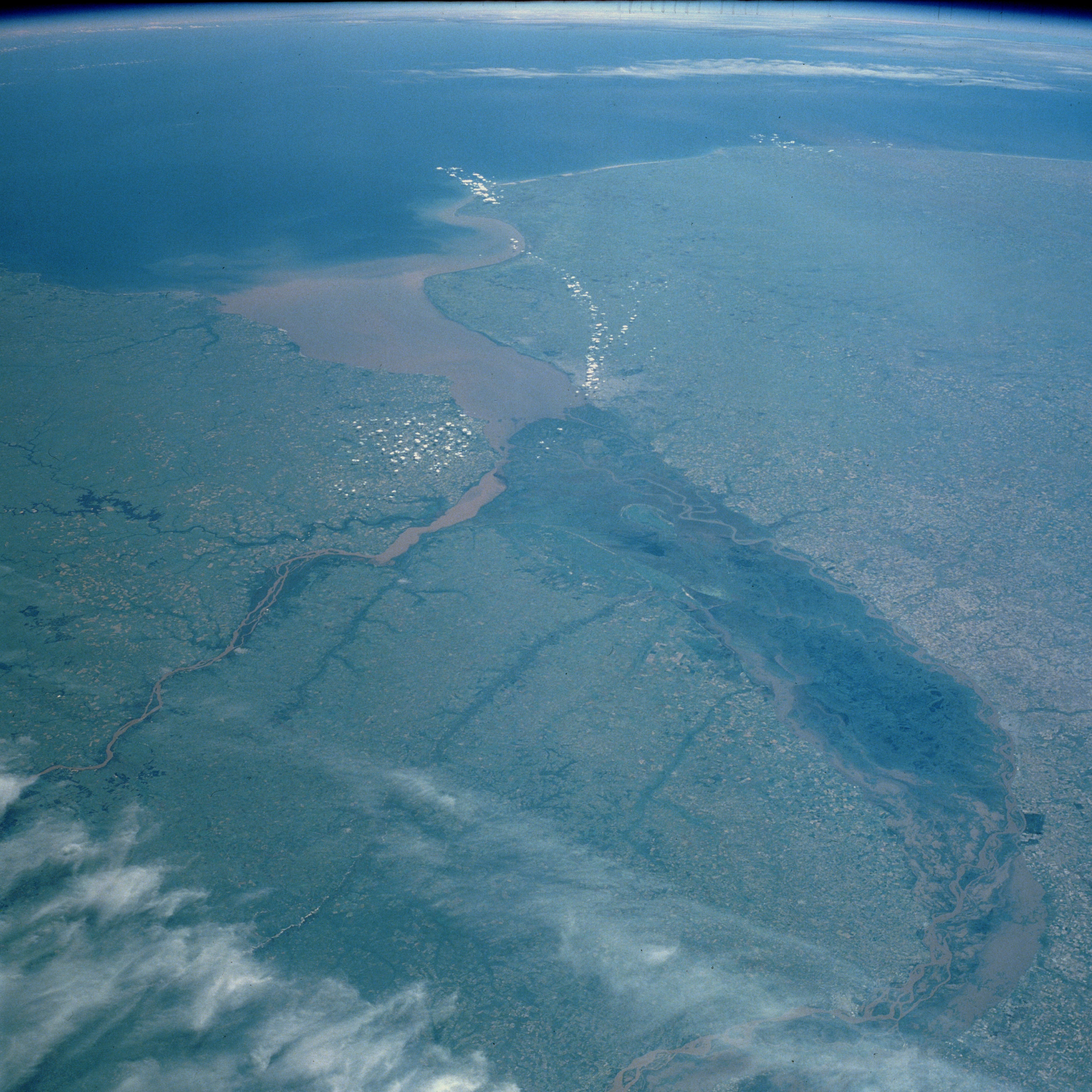
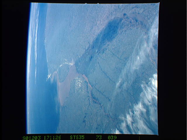
Image Caption: STS035-073-039 Rio de la Plata, Argentina December 1990
In addition to the Atlantic Ocean (eastern horizon), three important water features of Argentina's central east coast are apparent in this high-oblique, southeast-looking photograph--the Paraná River (South America's second largest drainage basin), the southward-flowing Uruguay River, and the muddy Rio de la Plata. Paraná's delta, measuring more than 175 miles (275 kilometers) in length and averaging 30 miles (50 kilometers) in width, appears dark green in this northwest-southeast orientation. The delta is composed of numerous meandering and interbraided streams and channels that make it subject to occasional severe flooding. The silt-laden main watercourse is observable at various points within this flood prone area. The southward-flowing Uruguay River, which has a very high level of sediment, passes east of the mouth of the Paraná River delta. The merging of these two rivers with their high levels of silt almost always produces an extremely muddy Rio de la Plata. The interfluvial area of the Paraná and Uruguay Rivers, known as the Mesopotamia of South America, is composed of floodplain and gently rolling, well-drained land. Montevideo, capital of Uruguay near the northeast limit of the Rio de la Plata, and Buenos Aires, capital of Argentina at the southern end of the Paraná River delta, are not identifiable on this scale.
In addition to the Atlantic Ocean (eastern horizon), three important water features of Argentina's central east coast are apparent in this high-oblique, southeast-looking photograph--the Paraná River (South America's second largest drainage basin), the southward-flowing Uruguay River, and the muddy Rio de la Plata. Paraná's delta, measuring more than 175 miles (275 kilometers) in length and averaging 30 miles (50 kilometers) in width, appears dark green in this northwest-southeast orientation. The delta is composed of numerous meandering and interbraided streams and channels that make it subject to occasional severe flooding. The silt-laden main watercourse is observable at various points within this flood prone area. The southward-flowing Uruguay River, which has a very high level of sediment, passes east of the mouth of the Paraná River delta. The merging of these two rivers with their high levels of silt almost always produces an extremely muddy Rio de la Plata. The interfluvial area of the Paraná and Uruguay Rivers, known as the Mesopotamia of South America, is composed of floodplain and gently rolling, well-drained land. Montevideo, capital of Uruguay near the northeast limit of the Rio de la Plata, and Buenos Aires, capital of Argentina at the southern end of the Paraná River delta, are not identifiable on this scale.
