STS035-502-2
| NASA Photo ID | STS035-502-2 |
| Focal Length | mm |
| Date taken | 1990.12.__ |
| Time taken | GMT |
Resolutions offered for this image:
3904 x 3904 pixels 639 x 639 pixels 5829 x 5820 pixels 500 x 499 pixels
3904 x 3904 pixels 639 x 639 pixels 5829 x 5820 pixels 500 x 499 pixels

Cloud masks available for this image:
Spacecraft nadir point:
Photo center point:
Photo center point by machine learning:
Photo center point:
Photo center point by machine learning:
Nadir to Photo Center:
Spacecraft Altitude: nautical miles (0km)
Country or Geographic Name: | AUSTRALIA-NT |
Features: | MACDONNELL RA, L AMADEUS |
| Features Found Using Machine Learning: | |
Cloud Cover Percentage: | |
Sun Elevation Angle: | ° |
Sun Azimuth: | ° |
Camera: | |
Focal Length: | mm |
Camera Tilt: | |
Format: | |
Film Exposure: | |
| Additional Information | |
| Width | Height | Annotated | Cropped | Purpose | Links |
|---|---|---|---|---|---|
| 3904 pixels | 3904 pixels | No | No | Earth From Space collection | Download Image |
| 639 pixels | 639 pixels | No | No | Earth From Space collection | Download Image |
| 5829 pixels | 5820 pixels | No | No | Download Image | |
| 500 pixels | 499 pixels | No | No | Download Image |
Download Packaged File
Download a Google Earth KML for this Image
View photo footprint information
Download a GeoTIFF for this photo
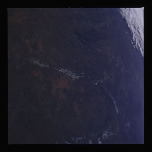
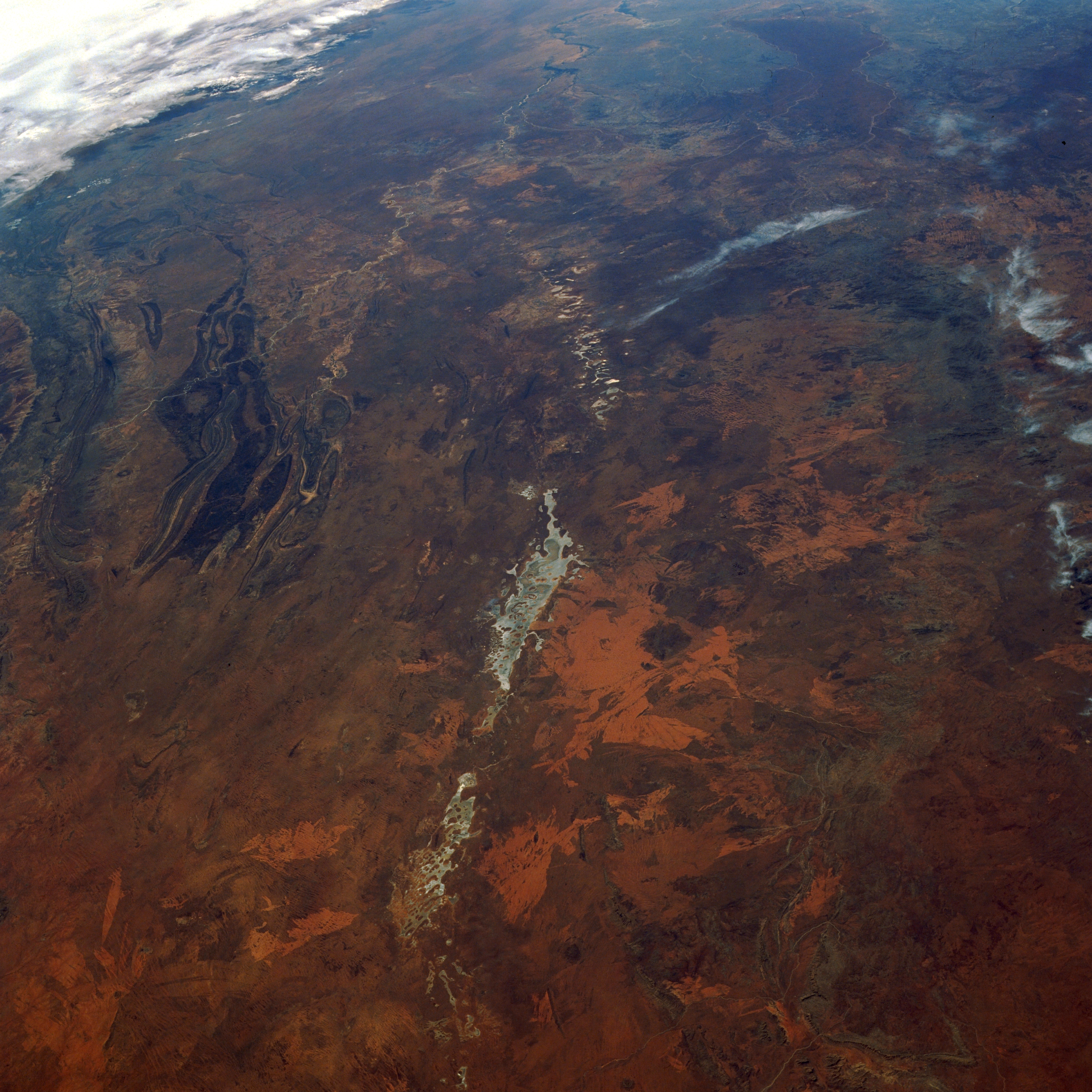
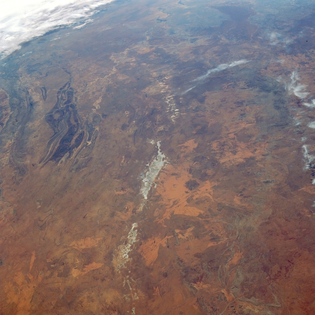
Image Caption: STS035-502-002 Lake Amadeus, Northern Territory, Australia December 1990
This east-looking oblique view includes a large section of southwest Northern Territory. The distance stretches north-south from the MacDonnell Ranges (darker parallel stripes of mountains--left middle) to the faintly identifiable outline of the Musgrave Ranges near the right edge of the image. The string of lighter colored (appearing whitish-gray) features that extend generally east-west (vertically on the screen) are a series of shallow, dry lakes that include Lake Neale (most westerly) and Lake Amadeus (larger lake towards center of scene). If the viewer knows exactly where to look south of Lake Amadeus, the location of Ayer's Rock and the more extensive Olgas can be established (in the bright orange area just to the right of the lake). These isolated and unique sandstone monoliths are major tourist attractions in this desert region southwest of Alice Springs. This eastward view also enables the viewer to trace the ephemeral lakes that reveal the watercourse that flowed from west to east.
This east-looking oblique view includes a large section of southwest Northern Territory. The distance stretches north-south from the MacDonnell Ranges (darker parallel stripes of mountains--left middle) to the faintly identifiable outline of the Musgrave Ranges near the right edge of the image. The string of lighter colored (appearing whitish-gray) features that extend generally east-west (vertically on the screen) are a series of shallow, dry lakes that include Lake Neale (most westerly) and Lake Amadeus (larger lake towards center of scene). If the viewer knows exactly where to look south of Lake Amadeus, the location of Ayer's Rock and the more extensive Olgas can be established (in the bright orange area just to the right of the lake). These isolated and unique sandstone monoliths are major tourist attractions in this desert region southwest of Alice Springs. This eastward view also enables the viewer to trace the ephemeral lakes that reveal the watercourse that flowed from west to east.
