STS034-88-8
| NASA Photo ID | STS034-88-8 |
| Focal Length | 250mm |
| Date taken | 1989.10.20 |
| Time taken | 14:09:20 GMT |
Resolutions offered for this image:
3932 x 3962 pixels 635 x 639 pixels 5700 x 5900 pixels 500 x 518 pixels 640 x 480 pixels
3932 x 3962 pixels 635 x 639 pixels 5700 x 5900 pixels 500 x 518 pixels 640 x 480 pixels


Cloud masks available for this image:
Spacecraft nadir point: 13.6° N, 85.1° W
Photo center point: 12.0° N, 86.5° W
Photo center point by machine learning:
Photo center point: 12.0° N, 86.5° W
Photo center point by machine learning:
Nadir to Photo Center: Southwest
Spacecraft Altitude: 179 nautical miles (332km)
Country or Geographic Name: | NICARAGUA |
Features: | MANAGUA |
| Features Found Using Machine Learning: | |
Cloud Cover Percentage: | 5 (1-10)% |
Sun Elevation Angle: | 35° |
Sun Azimuth: | 113° |
Camera: | Hasselblad |
Focal Length: | 250mm |
Camera Tilt: | Near Vertical |
Format: | 2443: Kodak Aerochrome 2443, color IR, thin base, EA-5 process thru June 1999, E-6 process afterward |
Film Exposure: | Normal |
| Additional Information | |
| Width | Height | Annotated | Cropped | Purpose | Links |
|---|---|---|---|---|---|
| 3932 pixels | 3962 pixels | No | No | Earth From Space collection | Download Image |
| 635 pixels | 639 pixels | No | No | Earth From Space collection | Download Image |
| 5700 pixels | 5900 pixels | No | No | Download Image | |
| 500 pixels | 518 pixels | No | No | Download Image | |
| 640 pixels | 480 pixels | No | No | Download Image |
Download Packaged File
Download a Google Earth KML for this Image
View photo footprint information
Download a GeoTIFF for this photo
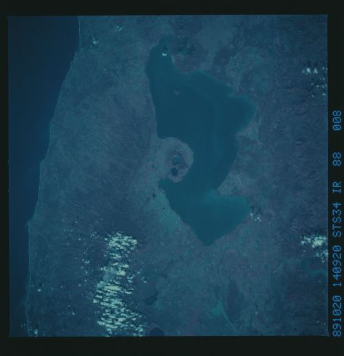
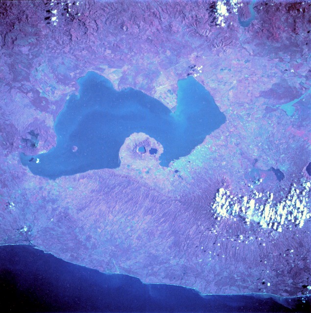
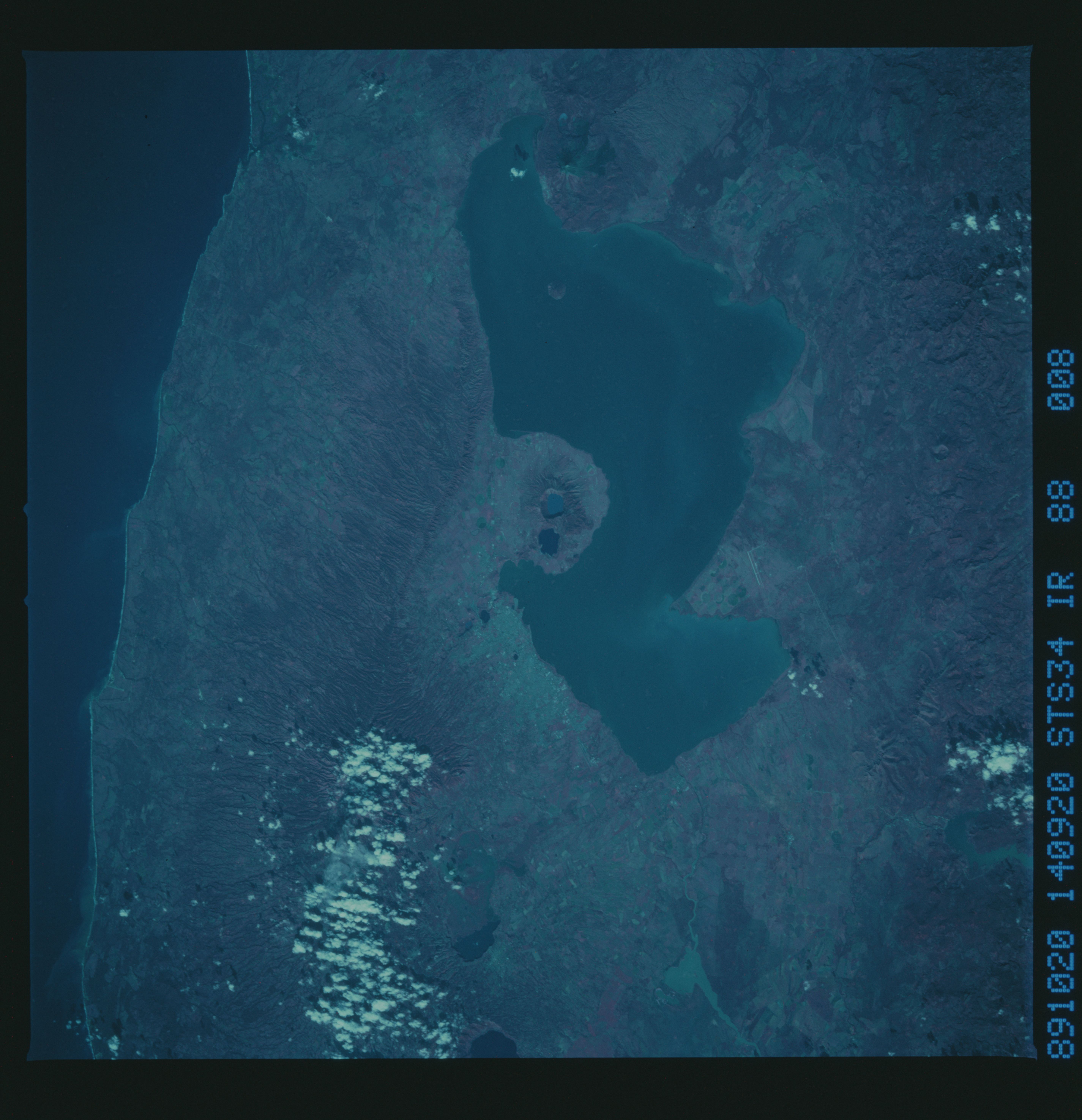
Image Caption: STS034-88-8 Lake Managua, Nicaragua October 1989
Lake Managua, a large freshwater lake approximately 40 miles (65 kilometers) long and 15 miles (25 kilometers) wide, is the centerpiece of this near-vertical, color infrared photograph. The color infrared film allows differentiation of forested and nonforested areas and highlights various cultural features. The lake empties via the Tipitapa River into much larger Lake Nicaragua (not part of this photograph) to the southeast. The capital city of Managua, with a population of more than 500 000, is located along the southern shore of Lake Managua, the area with the highest population density in Nicaragua. The key to understanding the physical setting of Lake Managua is to note the numerous volcanic features aligned in a northwest-southeast axis. Momotombo, a stratovolcano, is located on the northwest end of the lake, and two water-filled calderas (Apoyegue and Jiloa volcanoes) are easily discernible on the Chiltepe Peninsula, which protrudes into Lake Managua. Two major earthquakes (1931 and 1972) devastated the Managua area. In addition to occasional volcanic activity, a crustal fracture (structural rift valley) has created a long, narrow depression east of the volcanic zone and west of the main body of mountains. This very active, unstable geologic area is the result of the subduction of the Cocos Plate by the Caribbean Plate.
Lake Managua, a large freshwater lake approximately 40 miles (65 kilometers) long and 15 miles (25 kilometers) wide, is the centerpiece of this near-vertical, color infrared photograph. The color infrared film allows differentiation of forested and nonforested areas and highlights various cultural features. The lake empties via the Tipitapa River into much larger Lake Nicaragua (not part of this photograph) to the southeast. The capital city of Managua, with a population of more than 500 000, is located along the southern shore of Lake Managua, the area with the highest population density in Nicaragua. The key to understanding the physical setting of Lake Managua is to note the numerous volcanic features aligned in a northwest-southeast axis. Momotombo, a stratovolcano, is located on the northwest end of the lake, and two water-filled calderas (Apoyegue and Jiloa volcanoes) are easily discernible on the Chiltepe Peninsula, which protrudes into Lake Managua. Two major earthquakes (1931 and 1972) devastated the Managua area. In addition to occasional volcanic activity, a crustal fracture (structural rift valley) has created a long, narrow depression east of the volcanic zone and west of the main body of mountains. This very active, unstable geologic area is the result of the subduction of the Cocos Plate by the Caribbean Plate.
