STS034-88-22

| NASA Photo ID | STS034-88-22 |
| Focal Length | 250mm |
| Date taken | 1989.10.20 |
| Time taken | 15:47:39 GMT |
Resolutions offered for this image:
3904 x 3868 pixels 639 x 634 pixels 5700 x 5900 pixels 500 x 518 pixels 640 x 480 pixels
3904 x 3868 pixels 639 x 634 pixels 5700 x 5900 pixels 500 x 518 pixels 640 x 480 pixels
Cloud masks available for this image:
Spacecraft nadir point: 27.5° N, 81.5° W
Photo center point: 26.5° N, 80.5° W
Photo center point by machine learning:
Photo center point: 26.5° N, 80.5° W
Photo center point by machine learning:
Nadir to Photo Center: Southeast
Spacecraft Altitude: 179 nautical miles (332km)
Country or Geographic Name: | USA-FLORIDA |
Features: | LAKE OKEECHOBEE |
| Features Found Using Machine Learning: | |
Cloud Cover Percentage: | 0 (no clouds present) |
Sun Elevation Angle: | 47° |
Sun Azimuth: | 149° |
Camera: | Hasselblad |
Focal Length: | 250mm |
Camera Tilt: | 25 degrees |
Format: | 2443: Kodak Aerochrome 2443, color IR, thin base, EA-5 process thru June 1999, E-6 process afterward |
Film Exposure: | Normal |
| Additional Information | |
| Width | Height | Annotated | Cropped | Purpose | Links |
|---|---|---|---|---|---|
| 3904 pixels | 3868 pixels | No | No | Earth From Space collection | Download Image |
| 639 pixels | 634 pixels | No | No | Earth From Space collection | Download Image |
| 5700 pixels | 5900 pixels | No | No | Download Image | |
| 500 pixels | 518 pixels | No | No | Download Image | |
| 640 pixels | 480 pixels | No | No | Download Image |
Download Packaged File
Download a Google Earth KML for this Image
View photo footprint information
Download a GeoTIFF for this photo
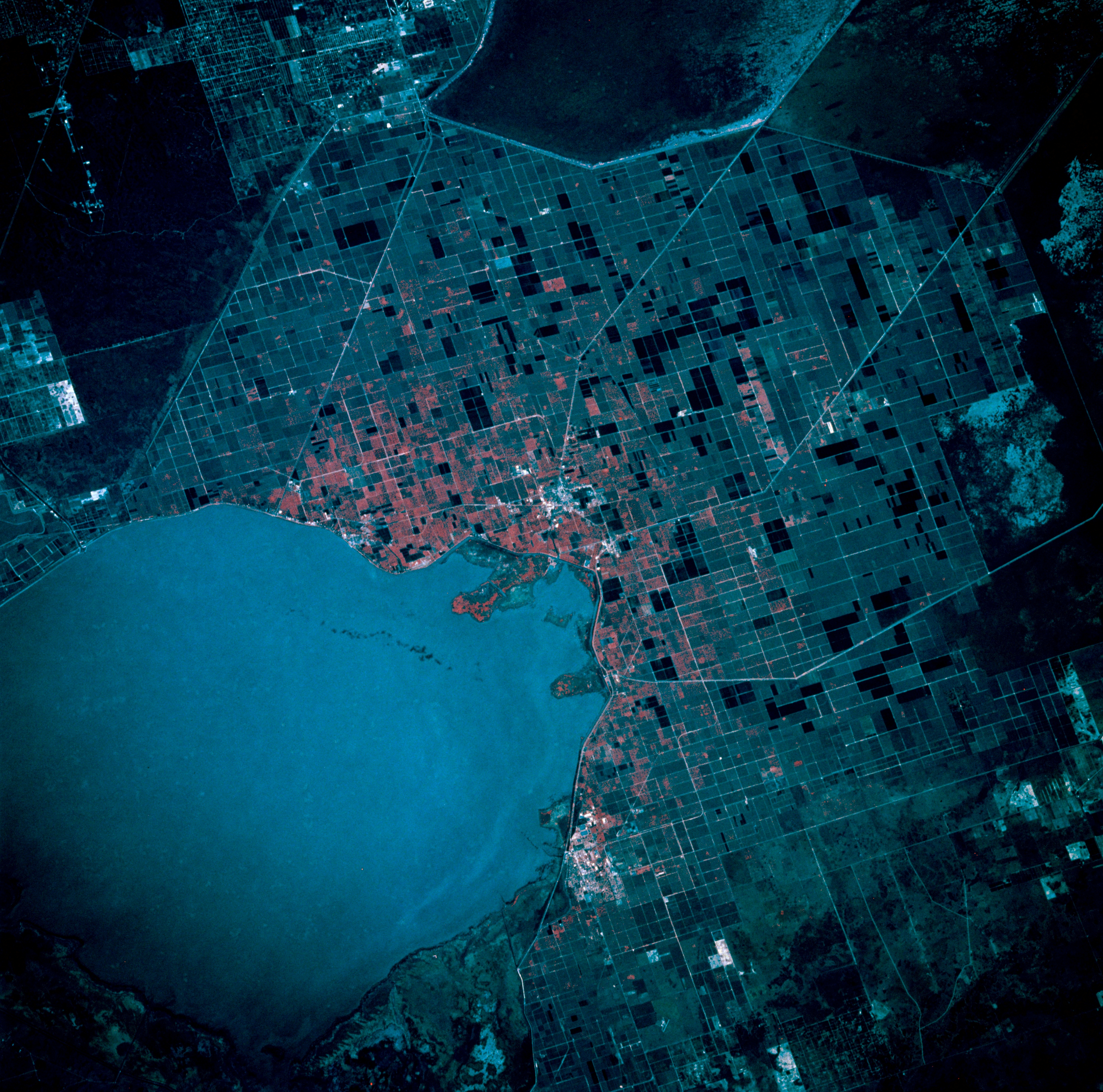
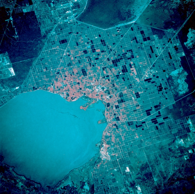
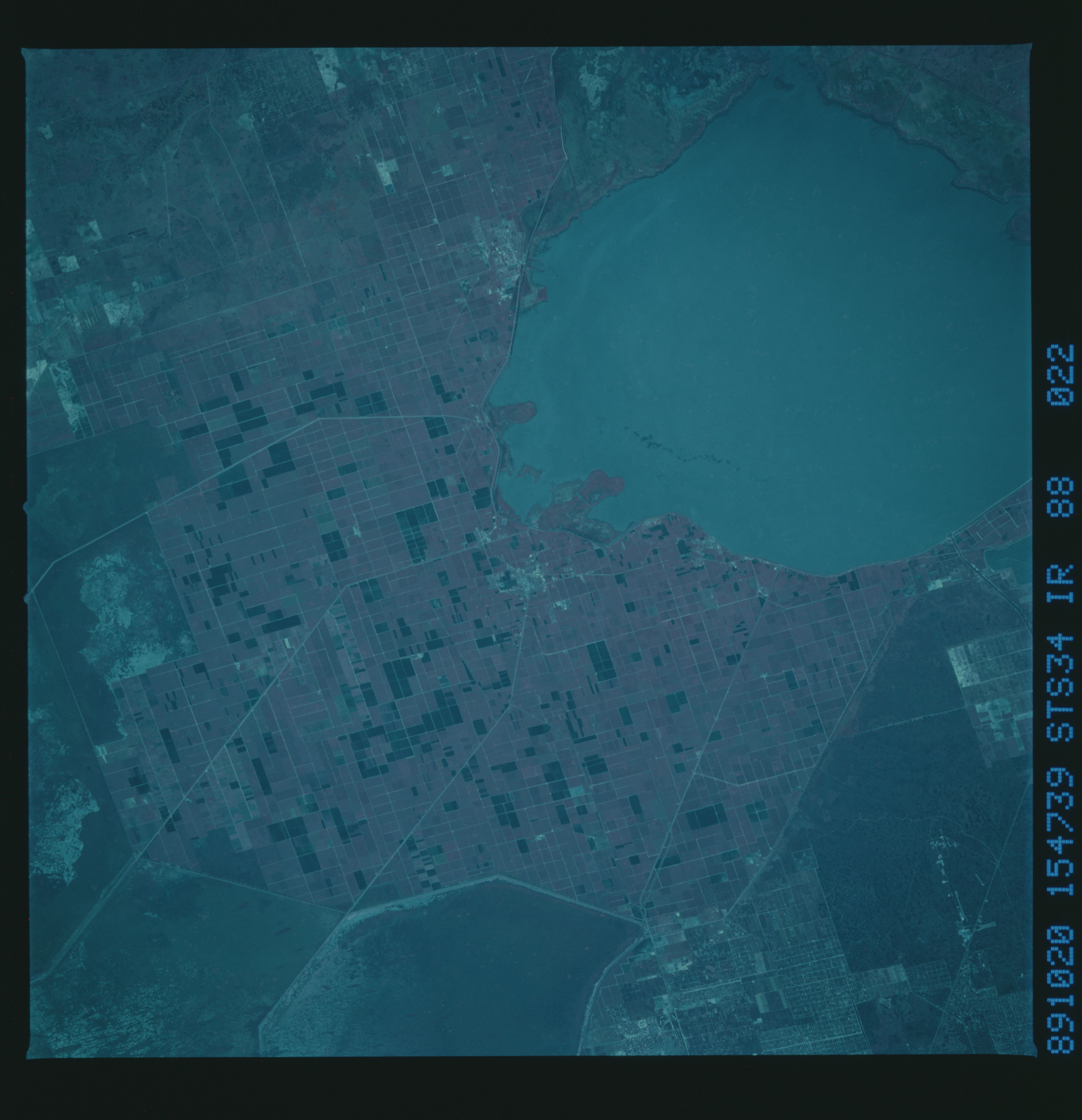
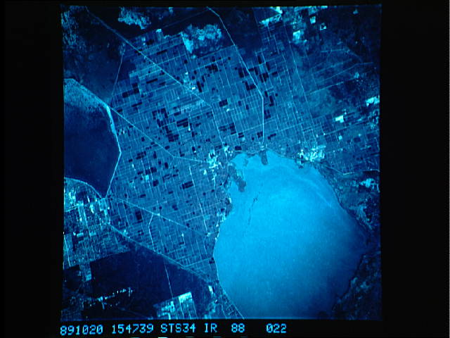
Image Caption: STS034-088-022 Lake Okeechobee Basin, Florida, U.S.A. October 1989
Large cultivated sugarcane fields (rectangular patterns) are easily discriminated south and southeast of Lake Okeechobee. These flatlands in south-central Florida were part of Lake Okeechobee when it was much larger and produced an abundance of vegetation. As the shoreline receded to its present size, the decaying plants left a rich soil with a high humus content. Light, linear features extending south and southeast from the lake are part of a network of dikes and canals built by the U.S. Army Corps of Engineers to transport water to the east coast. Part of the Arthur R. Marshall-Loxahatchee National Wildlife Refuge is visible (right edge).
Large cultivated sugarcane fields (rectangular patterns) are easily discriminated south and southeast of Lake Okeechobee. These flatlands in south-central Florida were part of Lake Okeechobee when it was much larger and produced an abundance of vegetation. As the shoreline receded to its present size, the decaying plants left a rich soil with a high humus content. Light, linear features extending south and southeast from the lake are part of a network of dikes and canals built by the U.S. Army Corps of Engineers to transport water to the east coast. Part of the Arthur R. Marshall-Loxahatchee National Wildlife Refuge is visible (right edge).
