STS033-84-91
| NASA Photo ID | STS033-84-91 |
| Focal Length | 250mm |
| Date taken | 1989.11.25 |
| Time taken | 10:35:34 GMT |
Resolutions offered for this image:
5700 x 5900 pixels 500 x 518 pixels 640 x 480 pixels 2683 x 2683 pixels 2619 x 2595 pixels
5700 x 5900 pixels 500 x 518 pixels 640 x 480 pixels 2683 x 2683 pixels 2619 x 2595 pixels

Cloud masks available for this image:
Spacecraft nadir point: 22.8° N, 69.6° E
Photo center point: 22.5° N, 69.0° E
Photo center point by machine learning:
Photo center point: 22.5° N, 69.0° E
Photo center point by machine learning:
Nadir to Photo Center: Southwest
Spacecraft Altitude: 129 nautical miles (239km)
Country or Geographic Name: | INDIA |
Features: | GULF OF KUTCH |
| Features Found Using Machine Learning: | |
Cloud Cover Percentage: | 0 (no clouds present) |
Sun Elevation Angle: | 23° |
Sun Azimuth: | 233° |
Camera: | Hasselblad |
Focal Length: | 250mm |
Camera Tilt: | 17 degrees |
Format: | 5017: Kodak, natural color positive, Ektachrome, X Professional, ASA 64, standard base |
Film Exposure: | Normal |
| Additional Information | |
| Width | Height | Annotated | Cropped | Purpose | Links |
|---|---|---|---|---|---|
| 5700 pixels | 5900 pixels | No | No | Download Image | |
| 500 pixels | 518 pixels | No | No | Download Image | |
| 640 pixels | 480 pixels | No | No | Download Image | |
| 2683 pixels | 2683 pixels | No | ReefBase 1 | Download Image | |
| 2619 pixels | 2595 pixels | No | Yes | ReefBase 1 | Download Image |
Download Packaged File
Download a Google Earth KML for this Image
View photo footprint information
Download a GeoTIFF for this photo
Image Caption:
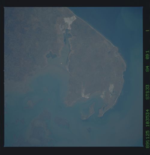
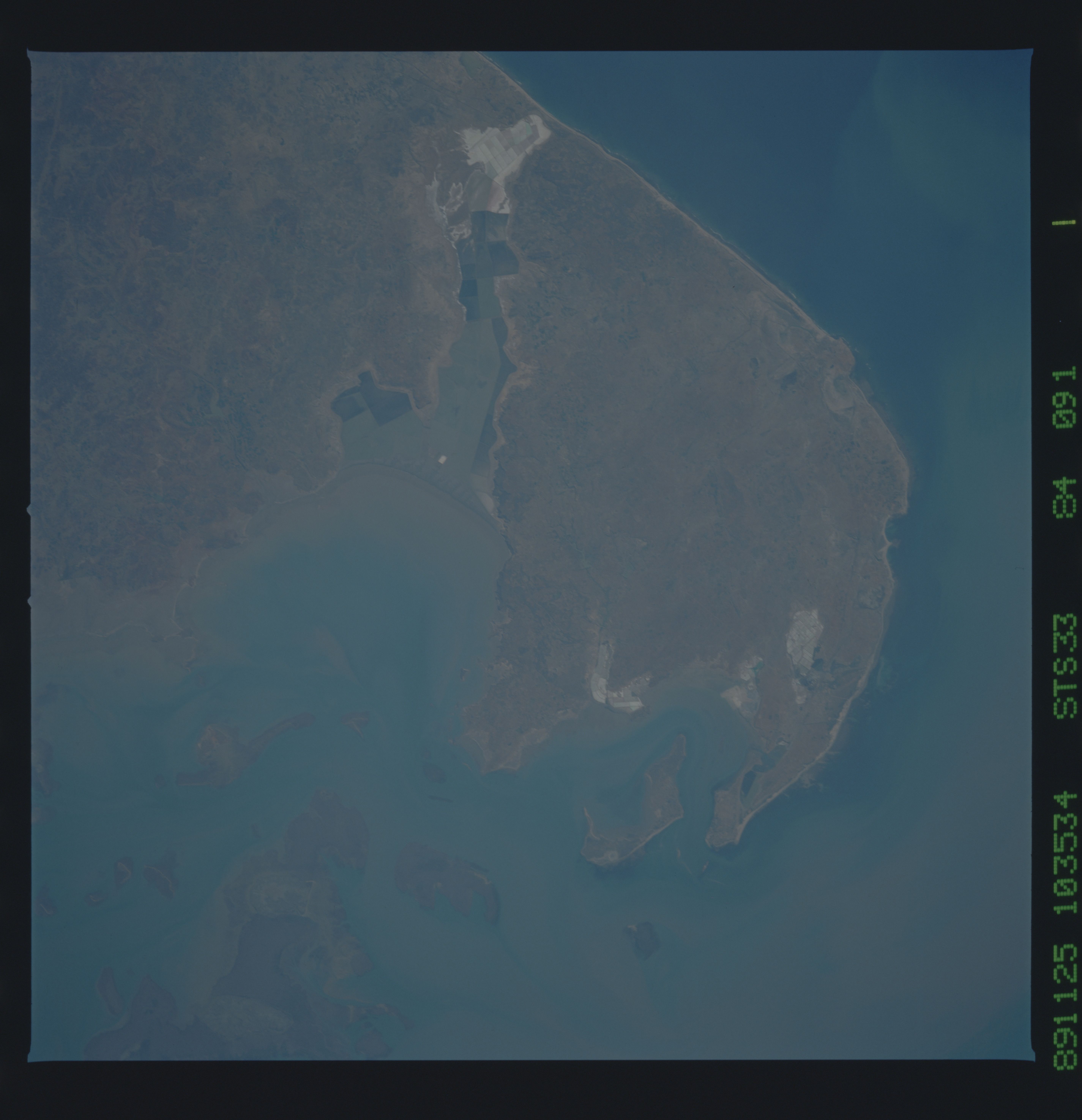
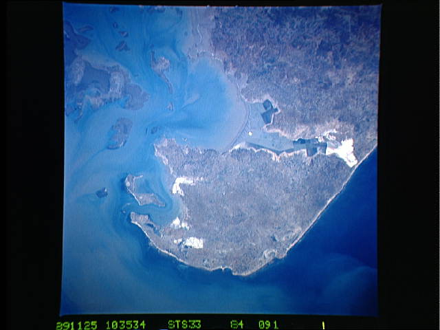
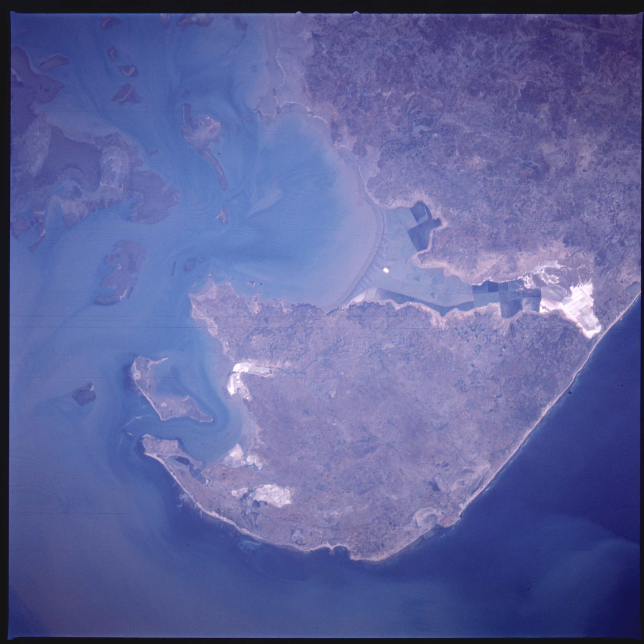
Near-vertical view of the tip of the Dwarka Peninsula, south
shore of the Gulf of Kutch. Mudbanks and current patterns are
evident. The resolution of the near-vertical view also brings out
details of salt evaporation ponds and vegetation patterns on
land. S33-84-091.
Near-vertical view of the tip of the Dwarka Peninsula, south
shore of the Gulf of Kutch. Mudbanks and current patterns are
evident. The resolution of the near-vertical view also brings out
details of salt evaporation ponds and vegetation patterns on
land. S33-84-091.
