STS033-82-71
| NASA Photo ID | STS033-82-71 |
| Focal Length | 40mm |
| Date taken | 1989.11.25 |
| Time taken | 02:35:30 GMT |
Resolutions offered for this image:
5194 x 5194 pixels 640 x 640 pixels 5700 x 5900 pixels 500 x 518 pixels 640 x 480 pixels
5194 x 5194 pixels 640 x 640 pixels 5700 x 5900 pixels 500 x 518 pixels 640 x 480 pixels

Cloud masks available for this image:
Spacecraft nadir point: 9.3° S, 124.3° E
Photo center point: 9.0° S, 125.0° E
Photo center point by machine learning:
Photo center point: 9.0° S, 125.0° E
Photo center point by machine learning:
Nadir to Photo Center: East
Spacecraft Altitude: 209 nautical miles (387km)
Country or Geographic Name: | INDONESIA |
Features: | TIMOR |
| Features Found Using Machine Learning: | |
Cloud Cover Percentage: | 25 (11-25)% |
Sun Elevation Angle: | 73° |
Sun Azimuth: | 133° |
Camera: | Hasselblad |
Focal Length: | 40mm |
Camera Tilt: | 12 degrees |
Format: | 5017: Kodak, natural color positive, Ektachrome, X Professional, ASA 64, standard base |
Film Exposure: | Normal |
| Additional Information | |
| Width | Height | Annotated | Cropped | Purpose | Links |
|---|---|---|---|---|---|
| 5194 pixels | 5194 pixels | No | No | Earth From Space collection | Download Image |
| 640 pixels | 640 pixels | No | No | Earth From Space collection | Download Image |
| 5700 pixels | 5900 pixels | No | No | Download Image | |
| 500 pixels | 518 pixels | No | No | Download Image | |
| 640 pixels | 480 pixels | No | No | Download Image |
Download Packaged File
Download a Google Earth KML for this Image
View photo footprint information
Download a GeoTIFF for this photo
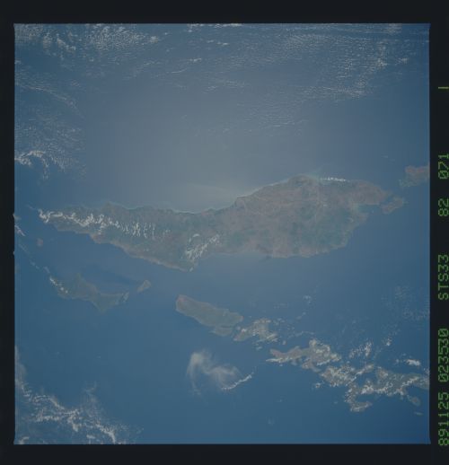
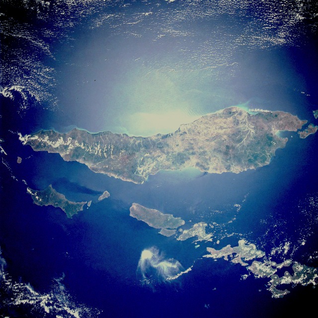
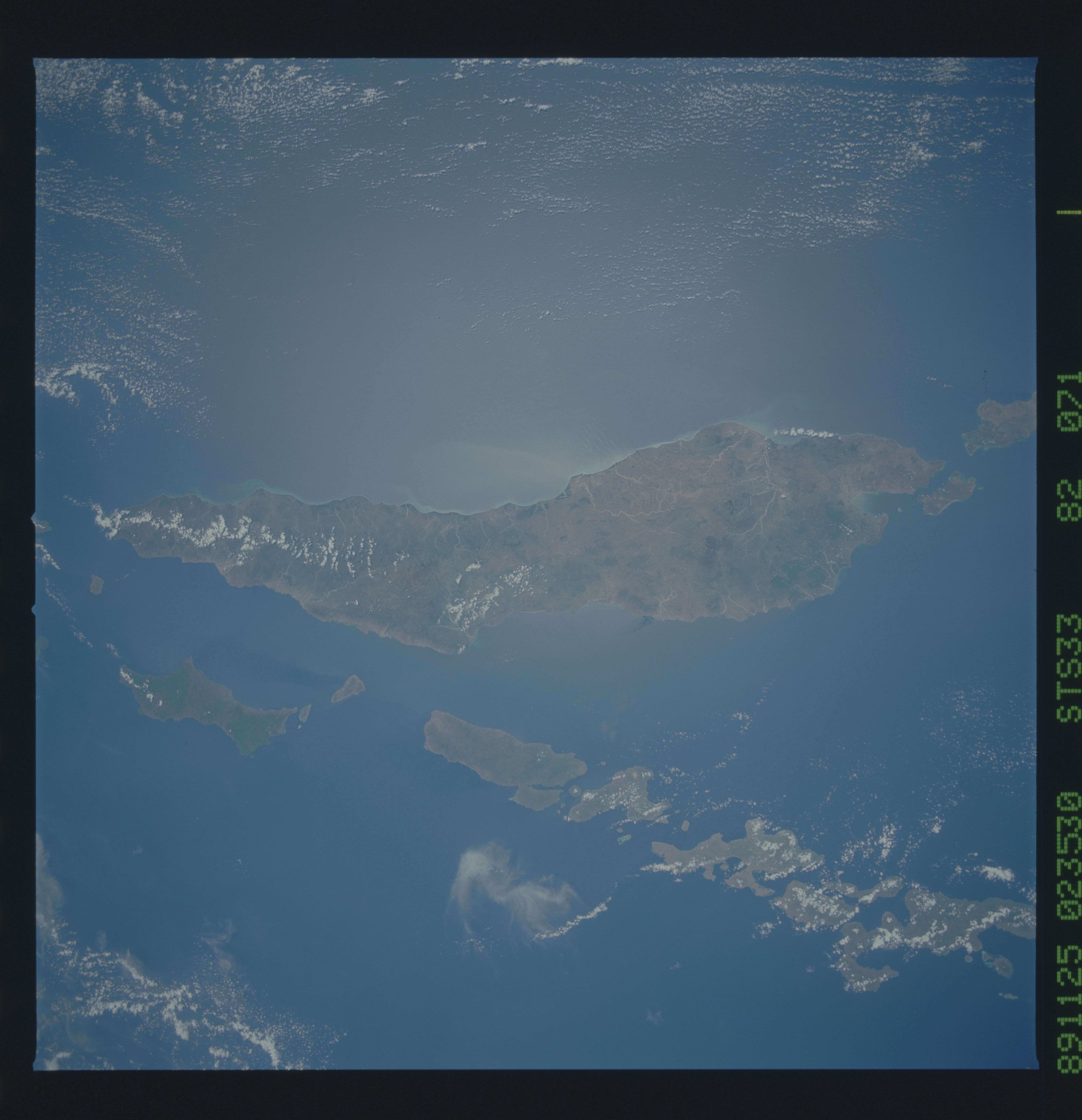
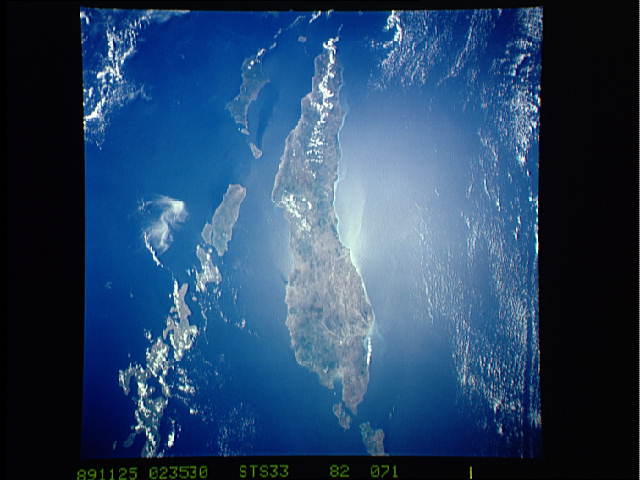
Image Caption: STS033-082-071 Timor Island, Indonesia November 1989
Timor Island, one of the larger islands of the Lesser Sunda Islands, is located between the Savu Sea to the northwest and the Timor Sea to the southeast. The western half of the island, under Dutch control until 1949, and the eastern half, a Portuguese province until 1975, are now united as a province of Indonesia. Timor Island is approximately 300 miles (480 kilometers) long and 10 to 65 miles (16 to 105 kilometers) wide. Timor and the north-northwest arc of islands around the eastern end of the Banda Sea, all volcanic in origin, are in an unstable region of the world because of the intersection of three major tectonic plates northeast near Irian Jaya, Indonesia. Although it is located in the tropics, Timor Island has a definite dry season during the winter. Large forested volcanic mountains exist; however, much of the landscape lacks dense stands of tropical forest or jungle. Major cash crops include coffee, sandalwood, and copra.
This almost totally cloud free, photo of the island of Timor, Indonesia (9.0S, 125.0E) illustrates the volcanic origin of the over 1500 islands of Indonesia. Close examination of the photo reveals several eroded volcanoes on the Island of Timor and several of the adjacent islands. The linear alignment of the volcanoes, as seen from space, indicates the edges of the tectonic plates of the Earth's crust where volcanic activity is most common.
