STS033-81-1
| NASA Photo ID | STS033-81-1 |
| Focal Length | 250mm |
| Date taken | 1989.11.25 |
| Time taken | 22:24:00 GMT |
Resolutions offered for this image:
3904 x 3904 pixels 639 x 639 pixels 5700 x 5900 pixels 500 x 518 pixels 640 x 480 pixels
3904 x 3904 pixels 639 x 639 pixels 5700 x 5900 pixels 500 x 518 pixels 640 x 480 pixels
Cloud masks available for this image:
Spacecraft nadir point: 25.9° S, 135.3° E
Photo center point: 27.0° S, 136.0° E
Photo center point by machine learning:
Photo center point: 27.0° S, 136.0° E
Photo center point by machine learning:
Nadir to Photo Center: Southeast
Spacecraft Altitude: 285 nautical miles (528km)
Country or Geographic Name: | AUSTRALIA-NT |
Features: | THE ALBERGA R. |
| Features Found Using Machine Learning: | |
Cloud Cover Percentage: | 5 (1-10)% |
Sun Elevation Angle: | 30° |
Sun Azimuth: | 100° |
Camera: | Hasselblad |
Focal Length: | 250mm |
Camera Tilt: | 15 degrees |
Format: | 5017: Kodak, natural color positive, Ektachrome, X Professional, ASA 64, standard base |
Film Exposure: | Normal |
| Additional Information | |
| Width | Height | Annotated | Cropped | Purpose | Links |
|---|---|---|---|---|---|
| 3904 pixels | 3904 pixels | No | No | Earth From Space collection | Download Image |
| 639 pixels | 639 pixels | No | No | Earth From Space collection | Download Image |
| 5700 pixels | 5900 pixels | No | No | Download Image | |
| 500 pixels | 518 pixels | No | No | Download Image | |
| 640 pixels | 480 pixels | No | No | Download Image |
Download Packaged File
Download a Google Earth KML for this Image
View photo footprint information
Download a GeoTIFF for this photo
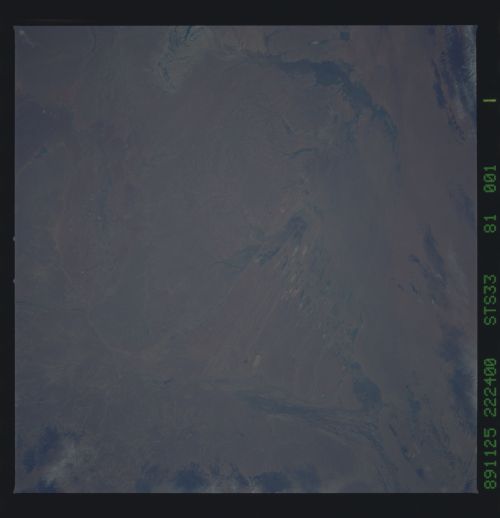
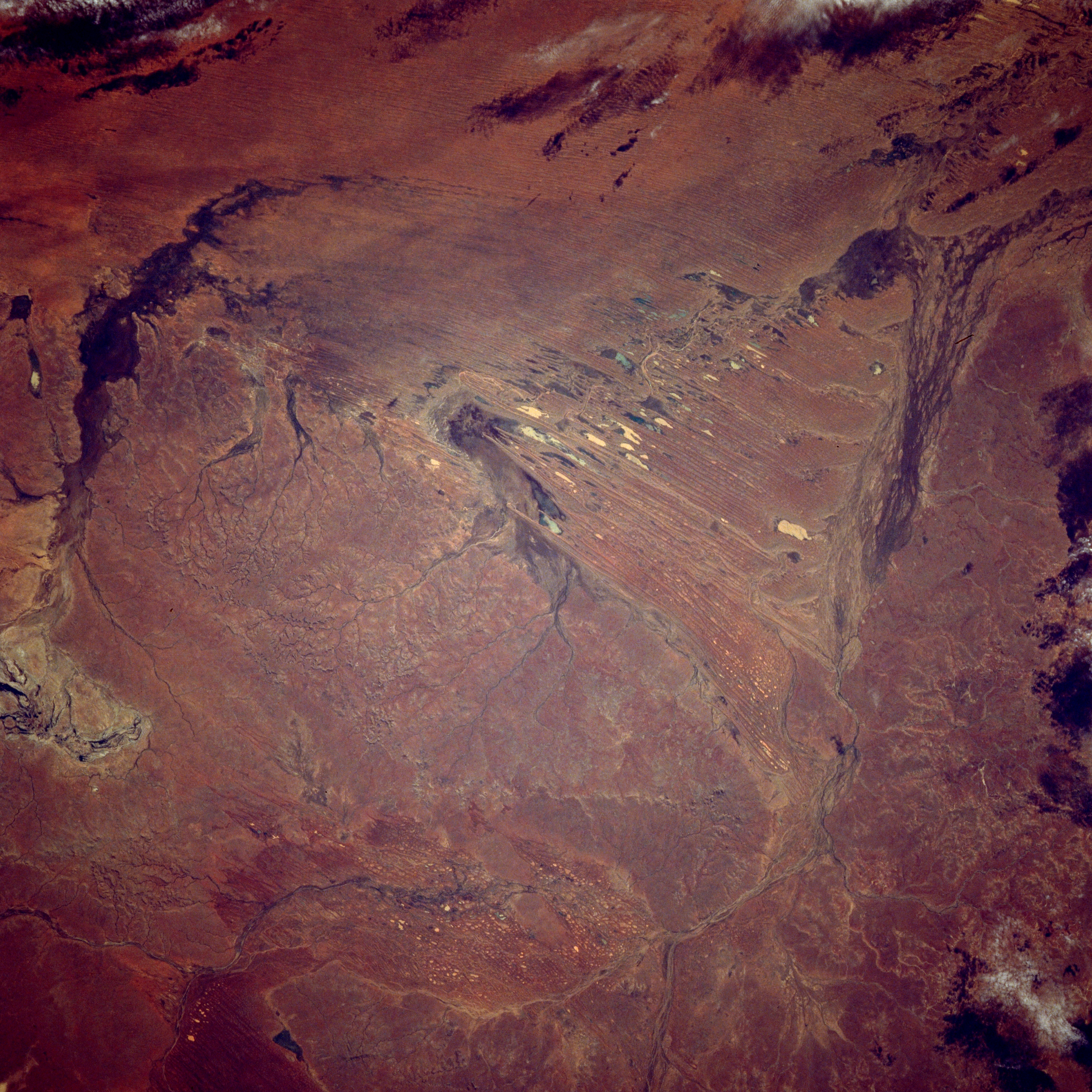
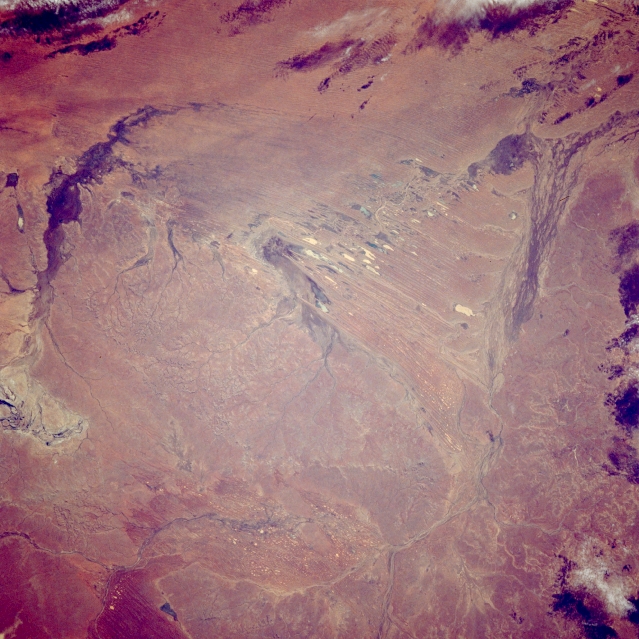
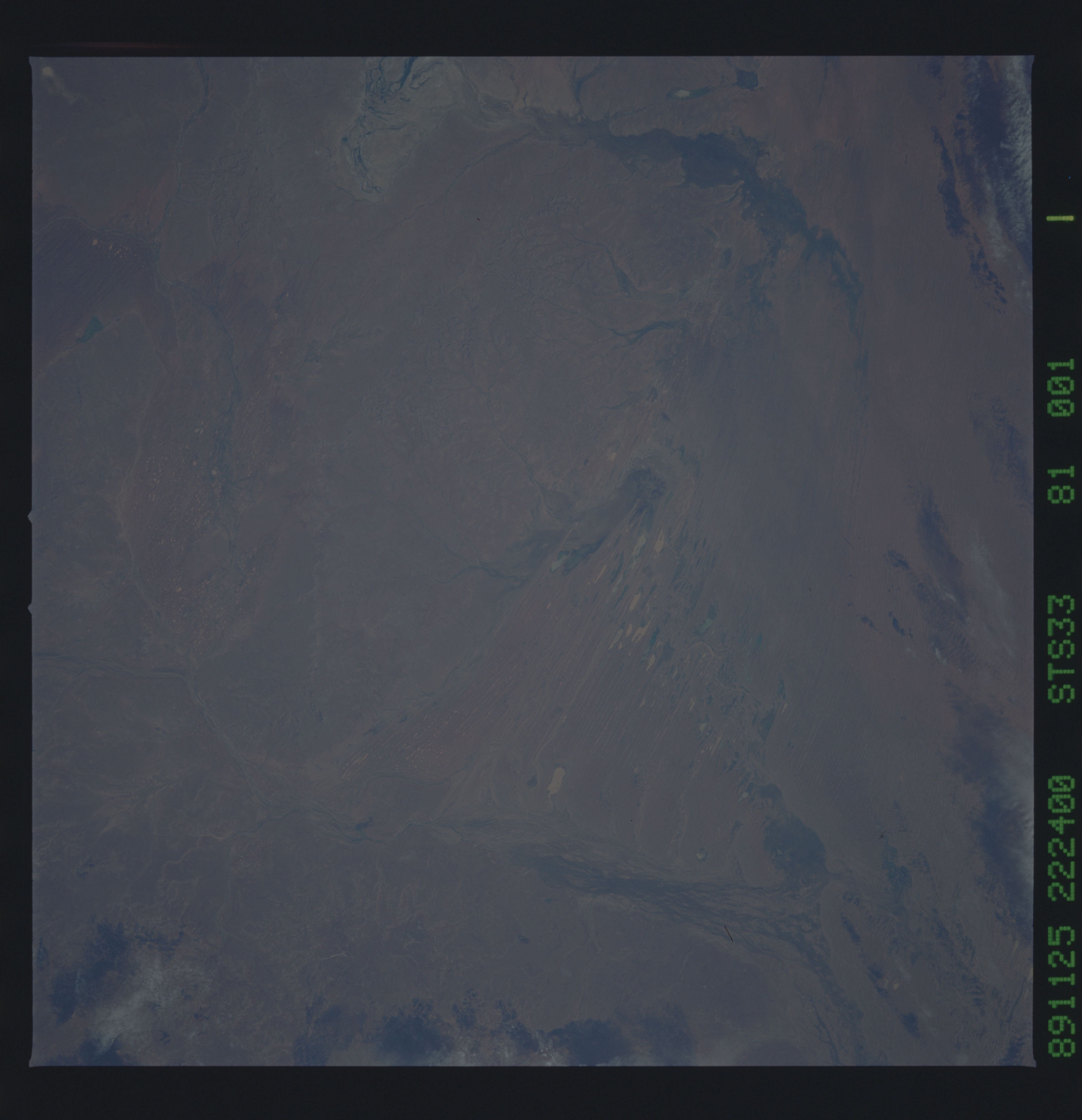
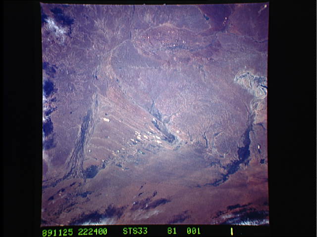
Image Caption: STS033-081-001 Alberga Creek, South Australia, Australia November 1989
Located in the southeast corner of the Simpson Desert in central Australia, the Alberga Creek distributary channels are visible as dark lines that fan out near the right upper edge of the image. These streams have their headwater areas as well as their final distributary channels in the desert. This creek can be considered part of the much larger Lake Eyre drainage basin, although it is doubtful if any water ever makes it from Alberga Creek to Lake Eyre. Alberga Creek is one of literally hundreds of stream channels that criss-cross the expansive interior basin of Australia. The north-south oriented, lighter features near center of the picture are small dry lake beds which have formed between linear dunes. The darker arcing feature along the left side of the picture is another stream channel where some type of plant life exists. The subtle dendritic drainage patterns west of the linear dry lake beds are generated by water from rare rains flowing off of the slightly elevated terrain.
Located in the southeast corner of the Simpson Desert in central Australia, the Alberga Creek distributary channels are visible as dark lines that fan out near the right upper edge of the image. These streams have their headwater areas as well as their final distributary channels in the desert. This creek can be considered part of the much larger Lake Eyre drainage basin, although it is doubtful if any water ever makes it from Alberga Creek to Lake Eyre. Alberga Creek is one of literally hundreds of stream channels that criss-cross the expansive interior basin of Australia. The north-south oriented, lighter features near center of the picture are small dry lake beds which have formed between linear dunes. The darker arcing feature along the left side of the picture is another stream channel where some type of plant life exists. The subtle dendritic drainage patterns west of the linear dry lake beds are generated by water from rare rains flowing off of the slightly elevated terrain.
